Trenches, Tales, and the Turning Point of the Civil War: Vicksburg National Military Park

Photo by S. Resendez

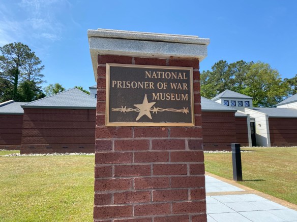
Created by Congress in 1899 and later managed by the National Park Service, Vicksburg National Military Park was designed to preserve one of the most decisive campaigns of the American Civil War. We’ll explore why this battlefield was considered so significant that it became one of the earliest preserved military parks in the United States and how its mission has evolved from battlefield preservation to broader cultural interpretation. This space wasn’t just saved for its military importance, it was saved because what happened here reshaped a nation.

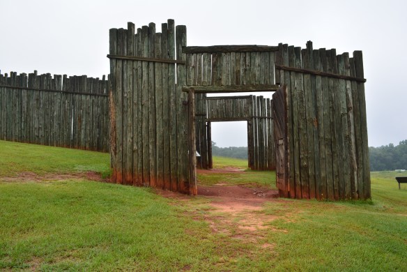
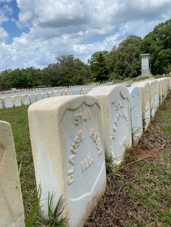
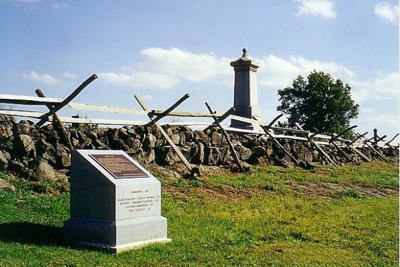
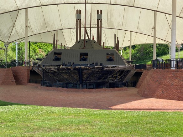
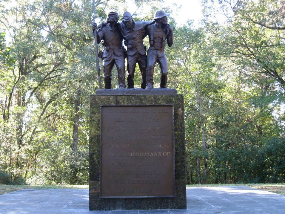
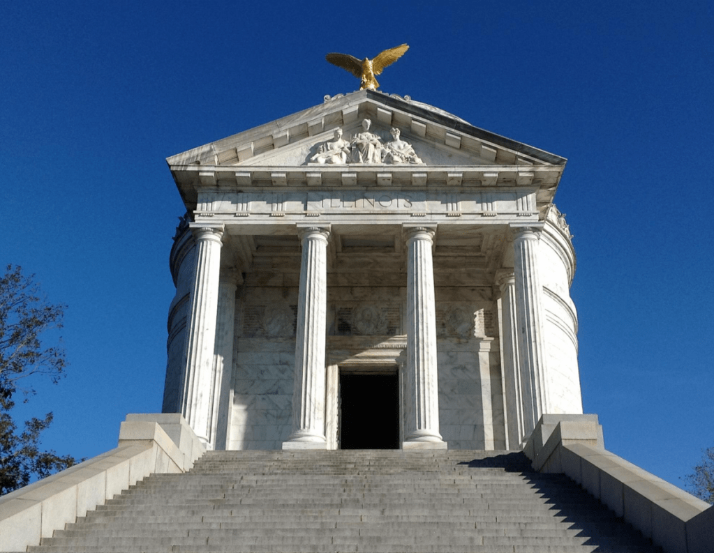
Vicksburg was the site of a siege that lasted 47 days in the summer heat of 1863. Ulysses S. Grant orchestrated a bold campaign that ultimately split the Confederacy in two. It is up to us, as visitors, to imagine life during war and what siege warfare meant…the exhaustion, the hunger, the civilians sheltering in caves carved into clay hillsides. This wasn’t just strategy. It was survival for all involved. It was a test of endurance, strategy, and survival. Vicksburg National Military Park has preserved earthworks, reconstructed forts, and more than 1,300 monuments honoring both Union and Confederate soldiers. These monuments include the restored ironclad gunboat USS Cairo, the first U.S. warship sunk by a torpedo and later recovered from the Yazoo River giving visitors a rare glimpse of Civil War naval warfare. In the park, Vicksburg National Cemetery is the final resting place of over 17,000 Union soldiers, making it one of the largest national cemeteries in the country.

Photo by S. Resendez

The Park District Visitor Center is open 8:30 am to 4:30 pm Wednesday through Sunday. Tour road is open from 8:30 am to 5 pm daily with last vehicle entry at 4:40 pm. Public restrooms are open at the Visitor Center and USS Cairo 7 days a week. Park grounds are open sunrise to sunset daily. They are closed Thanksgiving, Christmas Day, and New Year’s Day. The USS Cairo outdoor exhibit area including the ironclad itself is open 8:30 AM to 4:30 PM daily. The USS Cairo Museum is open 7 days a week from 8:30AM till 4:30PM. Make sure to check the website for closures and other updates. This park offers Living History programs and Ranger programs. Check the website’s calendar for further information on these programs.

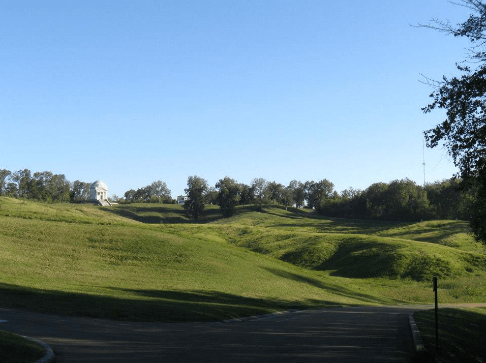
It’s easy to get caught up in the views, the monuments and the beautiful scenery, but think about what you don’t see. Walking here isn’t just a hike—it’s stepping through layers of survival, resilience, and stories that never really left.

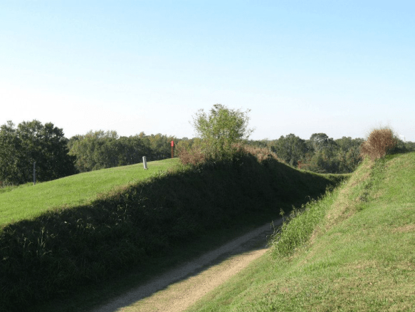
MILE MARKER: Civilians dug hundreds of caves into the hills to survive constant bombardment…entire families lived in them for weeks. It’s one thing to walk the trails but it’s another to imagine living beneath them.

HIKE IT!: While there are no traditional hiking trails (the one hiking trail, Al Scheller Hiking Trail, is currently closed as of this publication), Tour Road is a walkable, pedestrian-friendly, way to create walking loops that range in length from 3 miles to 16 miles. Along the left side of the road, there is dedicated lane for non-motorized transportation. Pets are welcome on this road, but must be kept on a 6 ft or less leash at all times, and owners are responsible for picking up after their pets.


Everything’s Bigger in Texas… Even the Fossils!: Waco Mammoth National Monument

Imagine…you’re minding your own business, wandering around by the Bosque River, searching for fossils and arrowheads, when you come upon something sticking out of the ground and it looks like…a bone?!

This is what happened back in 1978 to Paul Barron and Eddie Bufkin. Lucky for us that these two guys had a pretty good idea of what they had found and had the presence of mind to excavate it and take it over to Baylor University’s Strecker Museum for further examination. Museum staff identified the object as a femur bone from a Columbian Mammoth and quickly went about organizing a team to begin excavating. Between 1978 and 1990, the dig unearthed the remains of 16 Columbian mammoths. They also found what appeared to be a nursery herd that may have died together in a single natural event. Between 1990 and 1997, six additional mammoths were excavated as well as the remains of a Western camel, an alligator, a dwarf antelope, and a giant tortoise, among other animals.

Photo by S. Resendez

There is conjecture on how these animals died and even though it remains a mystery, there are theories that allude to several successive floods which may have trapped and eventually drowned the animals in rapidly rising flood waters.

Photo by S. Resendez

In 2015, President Barack Obama signed the executive order that established Waco Mammoth National Monument, making it a part of the National Park System. The public is welcome anytime during regular operating hours, 9:00 am to 5:00 pm Central Time. Start your visit at the Welcome Center located at 6220 Steinbeck Bend Drive. Guided tours are conducted every 30 minutes, so just show up and join the fun, no reservation needed! Tours last from 45 minutes to one hour. A small tour fee applies. Tour guides will lead you from the Welcome Center, down a 300 yard paved path to the Dig Shelter where mammoth fossils are in situ (still in their original position within the bone bed). During your tour, you will learn about the Ice Age, how the fossils were discovered, and why this site is one of the most important paleontological finds in North America,”

MILE MARKER: Waco Mammoth National Monument marks the largest known concentration of Columbian mammoths that died in a single event. When paleontologists first started excavating the site in Waco, they noticed something strange: many of the mammoth skeletons were facing the same direction. That detail helped scientists piece together what probably happened thousands of years ago. During a sudden Ice Age flood, the herd likely tried to move together against the rushing water, just as modern elephants protect their young during danger. The current pushed them downstream into soft sediment, where they became trapped in deep mud. In other words, the way the bones are positioned appears to have captured the final moments of the herd trying to escape the flood together.

HIKE IT!: While there aren’t many long trails at this site, there are some short hiking trails around the actual dig site. If you combine all the shorter trails into one, you would probably get a one mile trail so you can get some steps in and appreciate the area surrounding the dig site. If you go in the summer, make sure you still prepare for warm weather hiking! At a minimum, at least make sure to take some water and sunscreen. For more details about the hikes, check out this link. If you have time after your visit and you’re interested in doing some more hiking, take the short drive down N. MLK, Jr. Drive to Cameron Park. There are a myriad of hiking trails in this park, including one called Jacob’s Ladder which consists of 88 steep, concrete steps. It is located within a wooded area, and climbs approximately 50 to 80 feet in elevation.

From Prison Camp to National Memorial: Exploring Andersonville National Historical Site

Photo courtesy of NPS/ANDE

Stand in the quiet fields of Andersonville and it’s hard to imagine that the peaceful landscape was once the site of one of the most notorious prisons of the Civil War. Beneath the Georgia grass lies a powerful story of survival, suffering, and the resilience of thousands of men who endured unimaginable conditions here.

Andersonville National Historic Site preserves the grounds of Camp Sumter (not to be confused with Fort Sumter), known during the American Civil War as Andersonville Prison, one of the Confederacy’s largest and most infamous prisoner-of-war camps. Camp Sumter operated roughly from February 1864 until April 1865. Andersonville was intended to hold about 10,000 Union prisoners of war. Instead, as the war intensified, the population ballooned to more than 32,000 at one point. The prison stockade covered roughly 26 acres of open land enclosed by a 15-foot-high pine log wall. The prison was overcrowded and there were unsanitary conditions. There were no barracks inside and no real shelter. Prisoners were left to construct makeshift tents using scraps of cloth, blankets, and whatever materials they could salvage. Many had nothing at all. Of the approximately 45,000 Union prisoners who passed through Andersonville, nearly 13,000 perished from disease, starvation, and exposure.

Photo by S. Resendez

Dysentary, scurvy, gangrene, and typhoid fever ran rampant in the overcrowded conditions. The prison’s only water source was a small stream that ran through the stockade. It quickly became polluted with human waste and runoff from Confederate camps located uphill. For prisoners already weakened by starvation, drinking that water was often a death sentence. Andersonville’s mortality rate, roughly 29%, made it one of the deadliest prisoner-of-war camps in American history.

After the war, the burial grounds became Andersonville National Cemetery, established in July 1865, which today continues as an active National Cemetery interring veterans and their families.In recognition of its profound historic importance, Congress designated the site as a National Historic Site on October 16, 1970, and it became part of the National Park System. One of the most important aspects of the site today is the National Prisoner of War Museum, which opened in 1998. Andersonville is unique in the National Park System because it serves as a memorial to all American prisoners of war, not just those from the Civil War. This shifts the narrative from one tragic Civil War prison to a broader reflection on the experience of captivity in American history.

The National Prisoner of War Museum is located at 760 POW Road in Andersonville, Georgia. The park is open from 8 am to 5 pm and the National Prisoner of War Museum is open daily from 9:30 am to 4:30 pm. Park grounds, including the National Cemetery, are open daily from 8:00 AM to 5:00 PM. On Thanksgiving Day, Christmas Day, and New Year’s Day, the National Prisoner of War Museum and prison site are closed but Andersonville National Cemetery is open from 8:00 AM to 5:00 PM pending staff availability. As usual, it’s a good idea to check the website for updated information before you go.

Photo by S. Resendez

Andersonville National Historic Site is comprised of three main components: the National Prisoner of War Museum, the historic Civil War prison site and Andersonville National Cemetery. Be aware that the Cemetery is active and a funeral may occur during your visit.

Today, Andersonville National Historic Site is quiet—grassy fields stretch under the Georgia sky, marked by monuments and the memories of those who suffered here. It’s hard to reconcile the peaceful landscape with the hardship once endured inside the prison walls. But that’s exactly why places like Andersonville matter. They remind us not only of the cruelty war can bring, but also of the resilience people show even in the darkest circumstances.

Photo by S. Resendez

MILE MARKER: In 1865, Clara Barton, the founder of the American Red Cross, teamed up with a former Andersonville prisoner named Doronence Atwater. While imprisoned, Atwater had secretly kept a list of the names of men who died in the camp and where they were buried. He risked severe punishment if the Confederates discovered what he was doing. After the war, Barton and Atwater traveled to Andersonville with that list. Using it, they were able to identify and properly mark over 13,000 graves in what is now Andersonville National Cemetery. Because of their efforts, Andersonville became one of the first national cemeteries where most of the graves had names attached to them.

HIKE IT!: While there are no actual hiking trails, the park’s 514+ acres include open field landscapes, tree-lined edges, and quiet burial grounds that evoke both the starkness of the prison environment and the reflective mood appropriate for memorial space. The natural setting supports wildlife, walking paths, and contemplative spaces that contrast dramatically with the site’s brutal history, offering visitors a meaningful connection to place.


The Most Revolutionary Stroll in America: Independence National Historic Park

Imagine a place where the ideas that formed a nation were not only spoken — they were voted on, debated, perfected, and signed. That’s Independence National Historical Park in Philadelphia, Pennsylvania — often called “America’s most historic square mile.”

Photo by S. Resendez

The park wasn’t always a unified place you could stroll through. It began as a scattering of historic sites tied to the birth of the United States–Independence Hall (then the Pennsylvania State House), Carpenters’ Hall, the Liberty Bell, and other landmarks. In 1948, this cluster of landmarks was officially authorized as a historic park. The NationalPark Service began administration in 1950, with the park formally established in 1956. Over decades it expanded to protect more of Old City and Society Hill’s historic streets — now about 55 acres of vital American history. This park is also a UNESCO World Heritage Site because it isn’t just local history — it’s world history.

What makes this park unique is not just the buildings, but the ideas forged inside them — the concepts of liberty, democracy, and constitutional governance that influenced nations around the globe.

“Must-see” areas of the park to add to your itinerary:

Independence Visitor Center–Start here. It’s the gateway — with free maps, park info, and orientation films that set the stage.

 Independence Hall — Where history was literally made: The Declaration of Independence was debated here, in the Assembly Room, in 1776, and the Constitution later in 1787. The same space saw debates on the Articles of Confederation, and the very chair where George Washington sat during the Constitutional Convention — the “Rising Sun” chair — still stands. This building testifies to how 13 colonies decided to become a single nation — a dramatic leap in human governance that shaped the modern world. Note: Tickets for guided tours are free but required during peak months, so plan ahead.

Photo by S. Resendez

Liberty Bell Center — Icon of Freedom: Across from Independence Hall stands the Liberty Bell, a globally recognized symbol of liberty and justice. Cast in 1752, its famous crack came early and remains its defining feature.

Presidents’ House Site: Near the Bell you’ll see the remains of the home where George Washington and John Adams lived while Philadelphia was the national capital (1790–1800). Recent exhibits explored the lives of the enslaved people who lived and worked there, underscoring the era’s contradictions between freedom and slavery. This is history that cannot be changed regardless of how some people would prefer to do so.

Franklin Court & Benjamin Franklin Museum: Honor Benjamin Franklin — inventor, diplomat, founding father. His house site and museum are nearby, with exhibits on his life and contributions.

The park today spans over 50 acres and ~20 blocks, from historic squares and buildings to restored streetscapes. The Independence Visitor and the Liberty Bell Center are open daily 9:00 am–5:00 pm. The President’s House Site is open daily 7:00 am–10:00 pm. Different halls and different buildings may have different hours or may be closed so check ahead before your visit.

Admission to most park sites is free. Entrance to Independence Hall is by both guided and self-guided tours. Check here for current hours. Guided tours require tickets that can be reserved through Recreation.gov. There is a $1 per ticket handling fee. Interagency passes do not apply to these fees. The Benjamin Franklin Museum charges an interpretive fee and the National Constitution Center, a partner of the park, charges an admission fee. Other museums and halls may have different fees and schedules so make sure you check before your visit.

MILE MARKER: Did you know that The Declaration wasn’t signed all at once? Despite the iconic painting, the Declaration of Independence wasn’t signed in one dramatic moment. Most delegates signed weeks later, and some weren’t even in town on July 4. So Independence Day is more of a publication date than a signature party.

HIKE IT!: No hiking trails here but you will walk! This park consists of 55 acres of buildings, halls, exhibits, and squares. You’ll definitely get some steps in!

Through Fields of Fire and Footpaths: Gettysburg National Military Park

Photo by S. Resendez

Gettysburg is where the nation turned and where a battlefield became sacred ground. Gettysburg National Military Park preserves the site of the Battle of Gettysburg (July 1–3, 1863), the bloodiest battle ever fought on American soil and a turning point in the Civil War. More than 51,000 soldiers were killed, wounded, captured, or declared missing in just three days. The battle ensued across rolling farmland, rocky hills, orchards, and small town streets. The battle erupted almost accidentally when Confederate troops encountered Union cavalry near the town of Gettysburg, Pennsylvania. What began as a scouting expedition quickly escalated into a massive three-day engagement involving over 165,000 soldiers.

After the battle, local citizens worked to recover bodies and care for the wounded. A Soldiers’ National Cemetery was created for Union dead. It was here that President Abraham Lincoln delivered the Gettysburg Address in November 1863 — redefining the war as a struggle not just for union, but for equality and democracy.

Photo by S. Resendez

The Battle of Gettysburg is important for several reasons:

  • It Stopped the Confederate Invasion of the North–General Robert E. Lee hoped to win a major victory on Northern soil, potentially forcing peace negotiations. Instead, his army suffered devastating losses and had to retreat back to Virginia.
  • It Shifted Momentum Toward the Union–After Gettysburg, the Confederacy never again launched a full-scale invasion of the North. The Union gained confidence and strategic advantage.
  • It Redefined the Meaning of the War–Lincoln’s Gettysburg Address framed the war as a fight for equality and democratic ideals — not simply preservation of the Union.
  • It Became a Symbol of Sacrifice and Unity–Gettysburg represents the cost of division and the power of reconciliation — something visitors still feel walking the fields today.
Stone wall on Cemetery Ridge
Photo courtesy of NPS

Today, the park protects over 6,000 acres, with more than 1,300 monuments, markers, and memorials, making it one of the most monument-dense historic landscapes in the world. Visitors can hike the same ridgelines and walk the same fields where Union and Confederate soldiers fought, often within feet of original stone walls, farm buildings, and cannon placements. It serves as a perfect junction for hikers and history lovers alike, it’s a rare place where the outdoors and American identity intersect.

Park hours for Gettysburg National Military Park are from sunrise to sunset. The battlefield and roads are open thirty minutes before sunrise to thirty minutes after sunset. Visitors can plan their visit and obtain a listing of sunrise and sunset times by day in Gettysburg, PA here. Visitor Center hours change by season so make sure you check the website for more detailed information.

MILE MARKER: Did you know Gettysburg almost became an amusement park?
In the late 1800s and early 1900s, parts of the battlefield were treated more like a tourist playground than sacred ground. There were trolley lines, picnic groves, dance pavilions, and even proposals for roller coasters and a Ferris wheel near key battle sites. Visitors could ride out to the battlefield for leisure outings, not reflection. It wasn’t until preservation groups and the federal government stepped in that large sections of the land were protected and restored to their historic appearance.

HIKE IT!: There are no hiking trails in the park but that doesn’t mean you won’t be getting your steps in. Places in the park like Gettysburg National Cemetery or taking a Gettysburg Battle Walk will make sure you get your exercise. Just check the weather and plan accordingly.

Hiking the Edge of Alaska: Kenai Fjords National Park

Photo by S. Resendez

Mountains, ice, ocean, and glaciers…have I left anything out?

Kenai Fjord National Park is located in south-central Alaska on the southeast coast of the Kenai Peninsula, primarily accessed from the town of Seward. It is situated about 130 miles (2.5-hour drive) south of Anchorage and is known as the place “where mountains, ice, and ocean meet,” featuring the massive Harding Icefield and coastal glaciers. It is one of the few Alaska national parks accessible by road and ies south of the Kenai National Wildlife Refuge and north of the Gulf of Alaska.

This part of Alaska has long been populated by the Sugpiaq (also known as Alutiiq) whom are often referred to as the “people of the seal.” They have lived in, and around, the Kenai Fjord area for over 7,800 years. They learned to rely on the ocean for food, clothing, and materials, using seal gut for waterproof parkas and harvesting such resources as mussels, clams, algae, and crustaceans. While these cultures and others subsisted on harvesting, gathering, preparing, and sharing wild foods, subsistence hunting is no longer allowed within the borders of the park because it is a national park and not a national preserve. However, subsistence practices are still allowed on corporation-owned lands within the park and its adjacent waters. The Sugpiaq/Alutiiq people still maintain a close relationship with the land and remain an integral part of the area.

There are three main areas of the park that provide opportunities to see the park through varied lenses:

  • Exit Glacier: The Exit Glacier area is the only part of the park accessible by road. This area also offers an opportunity to take a short, accessible, one mile loop hike that takes you to a panoramic vista of Exit Glacier spilling down from the Harding Icefield.
  • The Coastal Fjords:  Several local companies offer opportunities to see the park’s coastline, tidewater glaciers, and marine mammals up close. If you’d prefer to do it yourself, kayaking is also an option.
  • The Harding Icefield: This is the star of the show. During the last ice age, the immense pressure of glaciers from the icefield scoured the coastal mountains, carving deep, steep-walled valleys.
    As the climate warmed and the glaciers retreated, the ocean filled these U-shaped valleys, creating the characteristic steep-walled fjords. The combination of retreating ice and rising sea levels transformed the landscape, leaving behind a coastline where mountains drop directly into the ocean, sometimes descending 600 to 1,000 feet below sea level. If you’re the strenuous type, you can take a full day to hike the strenuous 8 mile round trip trail. Mountaineering here is also an option if you’re a mountaineer with several outfitters and guides to assist in the planning. Probably the best way to view the Harding Icefield would be from the sky, with flightseeing overflights. More information for those flights can be found at the Seward Chamber of Commerce.

Kenai Fjords National Park is open year round. The primary months to visit are June, July, and August. There are reduced services in the area during the months of May and September. The Visitor Centers are open from Memorial Day weekend (last weekend of May) through Labor Day (first Monday of September) unless otherwise noted.

Being at Kenai Fjord National Park is about moving through a landscape shaped by ice, animals, and generations of people who learned to live with both. Whether you go for the trails, the scenery, the wildlife, or the cultural echoes of this rugged coastline, Kenai Fjords teaches us to move slowly and enjoy creation.

MILE MARKER: Would you believe that the Harding Icefield contains remnants of the vast Pleistoscene ice sheets that once covered much of Alaska?! The Pleistocene Ice Age occurred from approximately 2.58 million to 11,700 years ago.

HIKE IT!: There are only two maintained trails in Kenai Fjords National Park. They are the connected Exit Glacier Trails and Harding Icefield Trail. The trailhead for both starts just beyond the parking lot at the end of Exit Glacier Road. Make sure you check out the local conditions as you plan your trip to the park.

Leaves, Limestone, and Guadalupe River State Park

Photo by S. Resendez

It’s a Hike & Feast!! That’s right, we’re headed for a hike at the Guadalupe River State Park, about 30 minutes northwest of San Antonio off Highway 46, west of 281 North.

This was the very first state park I ever visited when I first started camping. At the time of this first visit, I was a poor, case manager. Bachelor’s degree in hand, first professional job, still making peanuts. My housemate and I were looking for ways to have some fun that didn’t cost a lot of money. We decided to try our hand at camping so we splurged on a tent and somehow, I don’t really remember how, we found this park, made a reservation and spent a lovely weekend sleeping on the hard ground, grilling meats, hanging out at the river, and just generally, enjoying nature.

This isn’t my favorite state park but it does hold a special place in my heart because it was where I discovered camping. I’d been to Rocky Mountain National Park with my college roommate and her family before this camping trip, but they had a pop-up trailer and all I had to do was sit back and let my friend’s dad be in charge. The trip to Guadalupe River State Park was my first time setting up my own campsite, starting a campfire, and all the other camping experiences that came with it, including the midnight trips to the bathroom. But it was all good because that little bit of camping led to backpacking which led to hiking and here we are today! It’s a full circle for me.

Photo by M. Gonzalez

Guadalupe River State Park, as the name implies, sits smack dab on the Guadalupe River. The river here runs quiet and serene. The gentle flow makes it perfect for kids to get in and float down aways on a tube or raft, climb out, and do it all over again. The day use area is right on the river and you’d better believe it gets crowded in the summer. If you’re looking to camp here in the summer (as well as spring and fall if it’s warm enough), it’s going to be busy. It’s not the getaway you might be looking for if you’re looking for silence or quiet nature. But, if you’re looking for a place to hike some quiet, easy, and beautiful trails, you’ve come to the right place. Especially if you’re here in the fall and winter. Spring is also a magical time when the wildflowers are in bloom.

Guadalupe River State Park is part of the area we’ve discussed in some of our other blogs and in our podcasts. Like Pedernales River State Park and our first Hike & Feast at Crownridge Canyon Natural Area, Guadalupe River State Park is an area comprised of limestone canyons that used to be a seabed. Dramatic canyon walls and rocky outcrops were formed when this region was covered by a shallow sea millions of years ago. If you look closely at the limestone layers, sometimes you can find fossiliferous limestone, better defined as fossils of seashells and organisms fossilized right into the limestone. Bonus if you’re a birder! This park sits at the crossroads of Hill Country and riparian ecosystems, making it an important stopover for migratory birds. Fall hikers often don’t realize they’re walking through habitat used by golden-cheeked warblers, painted buntings, and migrating raptors. Susan and I hiked the Painted Bunting Trail, named after the beautiful painted bunting bird (which we did not see while we were hiking, damn it).

This park has plenty of trails ranging from easy to challenging. Trail lengths range from 0.3 miles all the way to 3.1 miles. There are also river crossings if you’re looking to roll up your pants and get your feet wet. Terrain is varied and there are some trails that are short but steep, so choose wisely.

This is a great, little getaway right down the road from San Antonio. And there are plenty of places to feast after you finish up your hike. We made our way a few miles up the road to Spring Branch, Texas where we feasted on chicken fried steak at Antler Cafe. Delicious!

FEAST! Chicken Fried Steak at Antler Cafe in Spring Branch, Texas

MILE MARKER: Guadalupe River State Park protects one of the cleanest stretches of the Guadalupe River. Unlike the more heavily trafficked downstream sections (like New Braunfels), this stretch of the river is spring-fed and less developed, which helps keep the water unusually clear and ecologically healthy. It’s a quiet reason why the park feels so calm compared to other Guadalupe access points.

HIKE IT!: Make sure you check out the park’s website hiking page for links to their trail map but notice that there’s a secret hike on there! That’s right, there’s a secret hike at the connected Honey Creek State Natural Area. Access to this special area is allowed only by tour which is a 2 mile, ranger led tour, that only happens once a week. Click on the link to get to the Honey Creek website and sign up for that special hike there.

Land of Standing Stones: Discovering the Magic of Chiricahua National Monument

Photo by S. Resendez

We’re here again. We’re in a place settled long, long ago by people who migrated to North America thousands of years ago across the Bering land bridge or by sea. Their ancestral homeland was believed to be around modern-day Siberia/Mongolia, eventually settling across Alaska, northern Canada, and the American Southwest. Their migrations occurred in waves, with later groups moving south and east from an initial Alaskan settlement, adapting to diverse environments from subarctic forests to desert regions. These people are the Athabaskan people. We mentioned them in our episode about Canyon de Chelly.

As these people made their way down to what we now refer to as the Southwestern United States (between 1400 and 1500), the Chiricahua eventually settled in what is now southeastern Arizona, southwestern New Mexico, and northern Mexico in the Sonoran and Chihuahuan Deserts. The Chiricahua people are named after the Chiricahua Mountains in southeast Arizona. The Apache Indians were only one of the bands of Chiricahua Indians that evolved into different clans.

As it was, and still seems to be, the way of the United States to take what belongs to someone else (for more current information, see “Greenland”) the Apache Wars of 1861 culminated, after 24 years, in the creation of a reservation for the Chiricahua people that allowed them to live in relative peace until the death of Cochise, when the reservation was abolished and the people were forced to move to another reservation.

After the Chiricahua people were relocated, settlers and ranchers moved into the area and in the 1930’s, the Civilian Conservation Corp (CCC) came into the region and were responsible for the construction of many of the roads, parking areas, and trails. Many of the trails were built for recreation but some of them were designed specifically to allow access for firefighters.The Sugarloaf Trail, for example, has the dual purpose of providing fire lookout access as well as recreational opportunities. The Natural Bridge Trail was constructed for the sole purpose of firefighter access into Picket Park.

Photo by S. Resendez

Bonita Canyon Highway offers a beautiful 8 mile drive to Massai Point, the culmination of a road that was constructed by the US Forest Service in 1932. The road is a narrow mountain road with low hanging trees and small parking areas. If you’re hauling a trailer, your trailer must be disconnected to drive up through Bonita Canyon. Chiricahua National Monument is a “Dark Sky” park, so be prepared for some intense stargazing!

Chiricahua National Monument is located at 13063 E Bonita Canyon Rd, Willcox, AZ. The park is open 24 hours a day. Trails stay open for sunrise, sunset, and night sky viewing. Be aware of wildlife and use extreme caution. There is no entrance fee or pass required to enter. The visitor center, on the right 3.5 miles after the entrance, is open from 8:30 am to 4:30 pm. It has an information desk, museum, park film, and gift shop. It provides free maps, junior ranger booklets, and information.

Photo by S. Resendez

MILE MARKER: Chiricahua National Monument was formed by a single massive volcanic eruption about 27 million years ago. The Turkey Creek volcano released such an enormous ash cloud that the material hardened into rock, creating the towering hoodoos and balanced stones we see today. When you hike here, you’re walking through what was once a volcanic ash blanket—now sculpted into a stone forest by time and erosion.

HIKE IT!: Once again, the National Park’s website offers a great hiking page which breaks the hikes down into easy, moderate, and strenuous hikes. Five easy hikes about a mile or less will take you to some of the most scenic areas in the park! Don’t forget, though, there is elevation in this park so acclimate to the altitude by doing a short hike first!


Welcome to 2026!

We’ve got lots of good stuff in store for you in 2026!

More hiking! New trips! New interviews! If there is anything else you might like for us to review or any place you’d like for us to check out this year, leave a comment down below and we’ll do our best to get there.

If you’ve been enjoying our content, do us a favor and consider buying some merchandise from our Zazzle Store or dropping a little coin to buy us a coffee. We would really appreciate it.

Happy hiking. Now get out there and hike your own hike!

When East Met West: A Traveler’s Guide to Golden Spike National Historic Park

Photo by S. Resendez

America was moving west and it wasn’t an easy trek. As settlers began making their way into and across the United States, there was a push to move westward in the 1800’s. Gold had been discovered, Spaniards were making inroads and discovering land and an abundance of natural resources. Places like Fort Davis were providing a safe respite from the wild west but it was taking time for get from one end of the country to the other. Wagon routes and months-long sea voyages were slowing progress. Many leaders—businessmen, politicians, and military planners—began calling for a faster, safer way to connect the nation, a nation dreaming of speed and connection.

But the idea stalled for years because Congress couldn’t agree on where the route should run. Northern states pushed for a northern path; Southern states demanded a southern one. The political deadlock broke only after the Civil War began, when Southern representatives (who preferred a southern route) withdrew from Congress. Suddenly, the northern-backed plan had a clear path forward.

In 1862, President Abraham Lincoln signed the Pacific Railway Act, officially launching the transcontinental railroad. The government supported it with land grants and loans, while two companies—the Union Pacific (building west from Omaha) and the Central Pacific (building east from Sacramento)—took on the construction. Their lines met in 1869 at Promontory Summit, Utah, forever transforming travel, trade, and the American West.

 On May 10, 1869, officials from the Central Pacific Railroad and the Union Pacific Railroad met at PromontorySummit, in Box Elder County, Utah, to drive the final, ceremonial spikes, linking the eastern and western United States by rail. In 1965, the site of the last spike on the transcontinental railroad was designated a National Historic Site. In March of 2019, the park’s designation was changed from a historic site to a historic park, just in time to for the commemoration on May 10, 2019, as America celebrated the 150th anniversary of the completion of the First Transcontinental Railroad and recognizing the historic site as the Golden Spike National Historical Park.

Photo by S. Resendez

While connecting the railways was indeed a giant leap forward for the United States, it should be noted that these strides were made on the backs of several groups of people. Native Americans were already settled in the west and the construction of the railroad caused the people from 15 tribal nations to watch their homes and livelihood be destroyed with the advancement of the railroad. Irish immigrants, who came seeking work during potato famine in the mid-1800’s, were instrumental in helping build the railroad despite religious discrimination and.a language barrier. And Chinese immigrants, who were reluctantly hired after a critical shortage of labor was created due to gold strikes, were responsible for a great majority of the hardest labor that went into building the transcontinental railway. Chinese workers were often given tasked with working in the most dangerous conditions. Tunnels in the Sierra Nevada Mountains that had to be bored into solid granite for the railroad, rockslides, explosions, exposure, avalanches, and violent clashes claimed the lives of many of the Chinese workers. It is estimated that over one thousand Chinese laborers died building the CPRR. At the 1869 Golden Spike ceremony, not a single Chinese laborer was invited or mentioned, despite their indispensable role.

Central Pacific Railroad Jupiter
Photo courtesy NPS

Today, Golden Spike National Historical Park offers a variety of things to do during your visit. Commemorative events, seasonal events, nature, and hiking are all available at this park. There are approximately 55,000 visitors a year and the visitor’s center is open seasonally, at various hours. Please check the website for specific information before your visit. The physical address is 6200 North 22300 West, Promontory, Utah. It is approximately 30 miles west of Brigham City. The park is 2,735 acres of land surrounding a 15 mile stretch of the original Transcontinental Railroad. There is only one paved road coming in to the visitor’s center.

MILE MARKER: Did you know that the famous golden spike wasn’t hammered into place at all—it was gently tapped, lifted back out, and sent home, while the real work of joining the rails happened quietly behind the scenes.

HIKE IT!: There is a 1.5 mile trail called the Big Fill Loop Trail. It provides a beautiful view of the Promontory Mountains, the Great Salt Lake, and the Wasatch Front. Visitors can walk along the original grades of the Central Pacific and Union Pacific railroads and still see drill marks from the tools used to create the tracks.