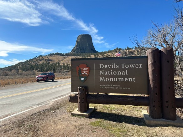
We’re covering new ground today as this is our first time exploring an NPS National Historic Trail. Based on the NPS definition of what denotes a National Historic Trail, we learn that a National Historic Trail is a “long-distance route that follows and commemorates a historic path of travel that changed the history and character of the U.S.” Today these routes offer opportunities to visit surviving sites, trail segments, and defining places of history as we learn about the diverse stories they tell. According to the NPS site, there are currently 19 trails that range from 16 miles long to a little over 5,000 miles long. For more information about all the trails, click on the link here.

Beginning in Mexico City and winding its way through Texas and up into Louisiana, the Camino Real de Los Tejas covers approximately 2,600 miles. This isn’t a “hikeable” trail by definition, rather it should be considered as a chance to follow the historical footsteps of the people who traveled across countries and through inhospitable lands to begin settling the areas we now recognize as Texas and Louisiana.

Because we’re writing this from our home base in San Antonio, it’s easy to talk about where the trail leads us from here, but before it got to San Antonio, the trail meandered up from Coahuila, Mexico, near the Rio Grande, to Laredo, Texas, in and around Goliad, Texas (where the Camino Real de Los Tejas museum is located), and up through Victoria and Cuero. From here, the trail veers back towards San Antonio, or continues on to Bryan, Texas. There are also documented starting points, once the border was crossed, in Eagle Pass up to San Antonio. From San Antonio, the road continued on through New Braunfels (which later became a German settlement), up to San Marcos, to Austin or towards Bastrop (home of the Lost Piney Woods). From there, the branches seemed to gather near Crockett and continue on towards Nacogdoches and on towards Louisiana. The Camino Real de Los Tejas split or combined according to the seasons. If the weather affected the planned route, the way could be rerouted to avoid flooded areas or other hazards along the way.
There are several missions along this corridor, some missions having been moved from other areas closer to the Gulf of Mexico, and rebuilt to follow the San Antonio River, going east towards Louisiana or west towards California. In this part of Texas, the most famous missions in and around this area are, arguably, the San Antonio Missions National Historical Park, a UNESCO World Heritage site. However, other missions pepper the way along the Camino Real, such as Mission Nuestra Señora del Espíritu Santo de Zúñiga in Goliad State Park.
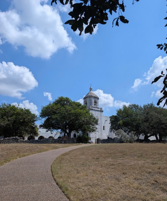
This amazing spot along the Camino Real showcases the work of the CCC (Civilian Conservation Corp) which was instrumental in building, conserving, and restoring a variety of buildings in and around Texas. While Mission Espiritu Santo was established in the mid-1700’s, it was the fourth mission with the same name and after several relocations, found its final home in the area known as La Bahía, which later became known as Goliad, Texas. As time passed and the mission was no longer needed, Franciscan Priests finally closed this mission in 1830.
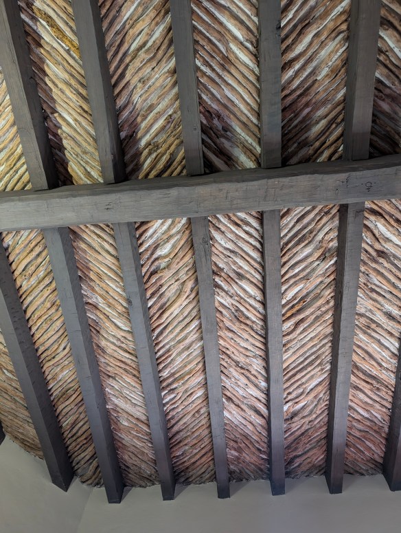
Between 1933-1942, the men of the CCC followed the plans to meticulously reconstruct the mission under the direction of a young architect by the name of Raiford Stripling. But before they would begin their project, they had to work on a “beginner” project in order to ensure that everyone understood the methods used to build the original mission in the 1700’s. In order to practice, they set about making a cottage for the park’s “superintendent to be”. In building this cottage, the men of the CCC could practice their brick making skills, along with learning to work with native materials, and making latilla ceilings (a traditional Southwestern design element consisting of peeled branches or small pieces of wood (latillas) laid between beams (vigas) to create a rustic, decorative ceiling). They learned how to hand carve large, ornate doors and forge iron hinges and once the cottage was finished, they understood what needed to be done to recreate the actual Mission de Espiritu Santo.
The Mission Nuestra Señora del Espíritu Santo de Zúñiga is the highlight of Goliad State Park and rightfully so. This mission, reconstructed on top of the its original 1749 foundation and wall remnants, is a testament to architecture and history as we make our way along the Camino Real de Los Tejas on the way to Louisiana.
If you’re interested in learning more about the Royal Road or following in the path of long ago Spanish settlers, look here for a FREE downloadable checklist of places to visit along the Camino Real de Los Tejas.
But there’s more to Goliad, Texas than meets the eye! We’re not done with our stop here just yet because in the midst of traveling this royal road through history, we also find ourselves in the heat of the battle for Texas independence! We’re going to look at, and talk about, flags you might not have known even existed! Stay with the Two Chicks for more adventures in Goliad, Texas!
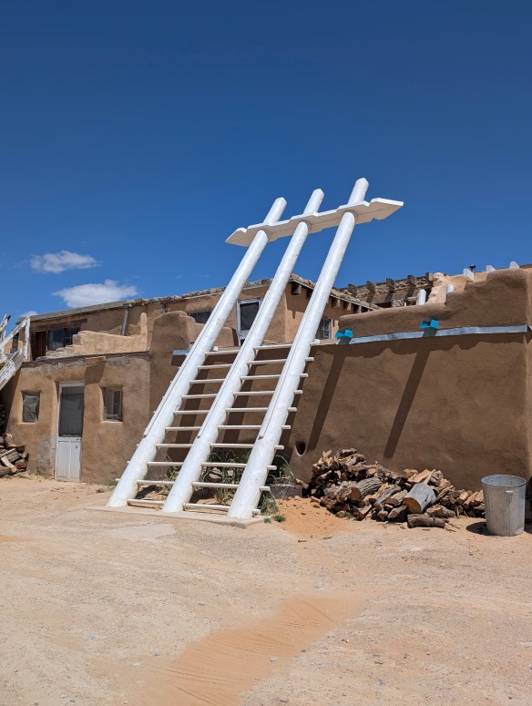
MILE MARKER: A staircase, carved from two logs, could be placed in tight spaces that might have otherwise only had room for a ladder. Known as “Escaleras de Madera” or Staircases of Wood, they were also sometimes referred to as “Witches Staircases” as folklore denotes the stairs were designed to prevent witches from climbing them.

HIKE IT!: There is a paved trail that runs through the park and connects the Presidio La Bahía to Goliad State Park and continues on towards downtown Goliad. Within the park, there is a trail that follows alongside the San Antonio River. It’s easy to park in the parking lot at the state park and walk the trail which is relatively flat and accessible. There are also hiking trails at the Medina Valley Natural Area. This area, just south of San Antonio, was part of the Camino Real de Los Tejas and there are some lovely trails to hike along the Medina River.