Redwood National Forest: Secrets of the Tallest Trees on Earth

Image courtesy of NPS

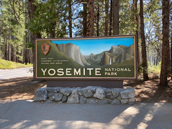
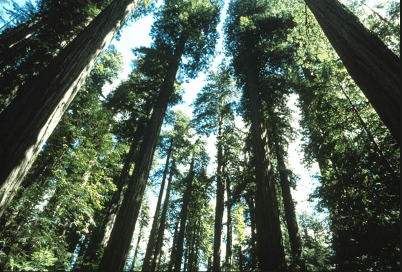
When people think of the Redwood National Forest, the first thing that comes to mind is the trees. Redwood National Forest is home to some of the tallest trees on earth, but the landscapes in and around the forest consist of more than just giant trees. Oak woodlands, rivers, prairies, and coastline make up the surrounding landscape. But we get it; you go for the trees. We all go for the trees…but there’s so much more!

Redwood National and State Parks is unique because the National Park Service (federal) and California State Parks (state) jointly manage the parks. Approximately 55% of the park is under federal management: the federal government, through the National Park Service (NPS), owns and manages a portion of the parkland, which was initially designated as Redwood National Park in 1968. The remaining 45% of the park is managed by the state of California, through California State Parks. California owns and manages the land in three separate state parks that are part of the larger, cooperatively managed unit: Del Norte Coast Redwoods State Park, Jedediah Smith Redwoods State Park, and Prairie Creek Redwoods State Park. In 1994, the NPS and California State Parks formed a cooperative management agreement to manage the parks as a single unit, maximizing resource protection.

Sea Star on Rock Photo courtesy of NPS

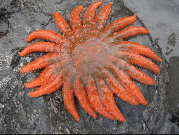
The abundance of ecological diversity in the Redwood Forest led to it being designated a UNESCO World Heritage Site in 1980. The diverse species of animals range from birds, land mammals, marine mammals, fish, and tide pool creatures such as sea stars and sea anemones. The Redwood Forest is also home to several threatened and endangered species such as the Northern Spotted Owl and the Steller Sea Lion. Redwood National and State Parks work hard to preserve, monitor, and safeguard fish and wildlife habitats to support recovery.

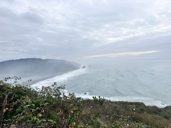
Redwood National Park is a total of 139,000 acres, or about 217 square miles, when combined with the three state parks (Jedediah Smith, Del Norte Coast, and Prairie Creek). Without the state parks, the national park itself is 131,983 acres, or 206 square miles, which includes about 40,000 acres of old-growth forest. The entire park extends for 35-60 miles along the northern California coastline.

Redwood National Forest Coastline Photo by S. Resendez

The Redwood National and State Park(s) is open year round but the Visitor’s Centers operate on a seasonal schedule. Check the website for information on hours and times. Cell service is limited and while GPS works, it often offers confusing directions. plan ahead by:

  • Carrying a physical map, especially if venturing into remote areas.
  • Using official park maps, available at visitor centers and on the park’s website.
  • Using road signs within the park rather than GPS apps, which may misdirect you.

It’s also a good idea to check conditions before heading out because heavy fog might prevent you from seeing some of the sights you’re planning to visit. Luckily, the NPS site has a page made just to let you know what current conditions are at the park at all times. Check that page right before you head out for alerts, road closures, and trail information.

MILE MARKER: Did you know the redwoods in California’s Redwood National and State Parks are not just the tallest trees on Earth — they’re weather-makers too? These ancient giants capture fog from the Pacific, absorbing moisture through their needles and creating their own microclimate. It’s a self-sustaining forest, where the trees literally drink from the clouds.

Hiking Trail in the Redwood Forest Photo by S. Resendez

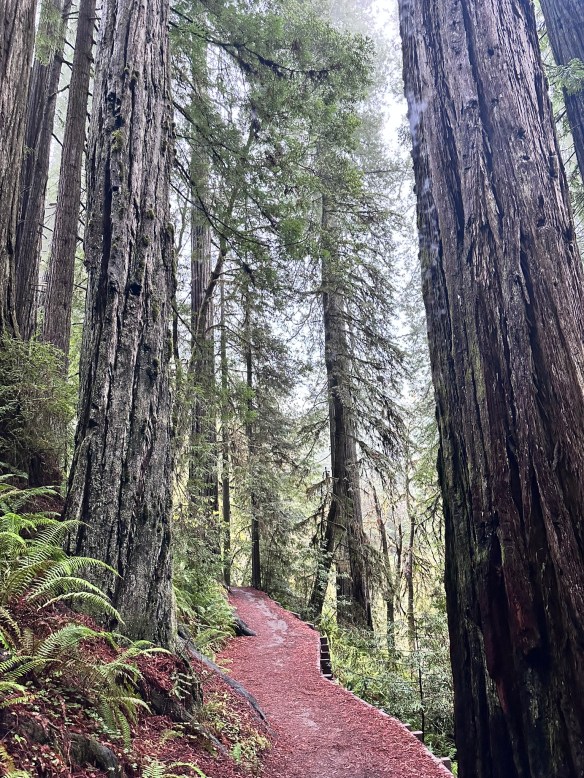
HIKE IT!: Once again, the National Park Service website for The Redwood National Forest and State Parks has done an excellent job helping you to plan your best hike. Their web page breaks down hikes by time and region. From short walks to all-day hikes, they’ve got you covered. Make sure you check out the current conditions page before you head out, then get your sticks and go!

Hiking in Yosemite National Park: Easy Trails and Epic Views

Photo by S. Resendez

In the mid-1800’s, California was the place to be. Gold had been discovered. The race was on to get the gold and nothing would stand in the way of the prospectors looking to get rich. As is usually the case, there were some obstacles in the way, namely people.

Bridal Veil Falls Photo by S. Resendez

The Indigenous people of Yosemite Valley called the valley “Ahwahnee” or “gaping mouth-like place”. The Ahwahnee lived in the area for thousands of years, developing a deep, reciprocal relationship with the land, but were eventually devastated by illness and displaced by settlers and park officials. In the end, the Mariposa Battalion, a Euro-American militia entered the area and drove the native Ahwahneechee people onto reservations,

As more people made their way into California, specifically Yosemite Valley, hotels, inns, and stagecoach companies began catering to the early tourists. In 1864, Yosemite was recognized by the federal government as someplace that should be protected. Abraham Lincoln signed the Yosemite Grant, placing Yosemite under the protection of the state of California.

President Teddy Roosevelt and John Muir standing on rock at Glacier Point, Yosemite, May 1903; Yosemite Falls and cliffs of Yosemite Valley in distance. Photo courtesy NPS [RL012904]

In 1903, President Theodore Roosevelt visited Yosemite and guided by naturalist John Muir, spent three nights camping in the Mariposa Grove and later, in a snowstorm near Sentinel Dome, then finally in a meadow near the base of Bridalveil Falls. This stay led Roosevelt to expand federal protection of Yosemite, and it inspired him to sign into existence 5 national parks, 18 national monuments, 55 national bird sanctuaries and wildlife refuges, and 150 national forests.

Yosemite National Park is open 24 hours per day, 365 days per year. The Hetch Hetchy area is only open from sunrise to sunset (except for permitted backpackers). There are other park entrances but check the website to see whether or not they are open. All day visitors must exit Hetch Hetchy by sunset. The road is also closed to all vehicles (including backpackers) from sunset to sunrise. Yosemite National Park covers nearly 1,200 square miles (3,100 square km) in the Sierra Nevada, with elevations ranging from about 2,000 feet (600 m) to 13,000 ft. The welcome center is located next to the Yosemite Village Parking and the Village Store in Yosemite Valley. Get help planning your visit and pick up free trail maps, junior ranger booklets, and more at the welcome center. Hours are 9:00 AM–5:00 PM and the Village is open year-round.

El Capitan Photo by S. Resendez

Things to do are numerous but if you’re visiting during the busy season, you need to make sure you plan ahead. Planning your visit will help to make sure you’re able to see everything you want to see while you’re there.

MILE MARKER: Did you know that some of the Buffalo Soldiers that were stationed at Fort Davis were stationed to park protection duties? After their frontier service, many Buffalo Soldiers were assigned to protect the newly formed national parks, including Yosemite. Between 1891 and 1913, soldiers from the 9th and 24th Cavalry, among others, served as the official administrators and park rangers in Yosemite.

HIKE IT!: There are a million things to do in Yosemite but hiking is the penultimate experience here. In and around Yosemite Valley, there are several day hikes rated easy to moderate that range from 0.5 miles all the way to 13 miles. There are also some shorter, more moderate hikes, that have elevation but if you plan ahead, you can check out the information and get yourself on a trail that suits your abilities. If you’re looking for trails outside of Yosemite Valley, check out Yosemite’s page all about the hiking trails. You’re sure to find something that suits your hiking style.

Photo by S. Resendez

El Camino de San Antonio Missions: How San Antonio Became Part of a Legendary Pilgrimage

Last week, we shared our visit to The World Heritage Center and introduced you to the Mission Trail. This is a Hike & Bike Trail that connects all the San Antonio Missions. This trail is an out and back trail that is approximately 14 miles long. After we finished up there, we made our way to the Padre Margil Pilgrimage Center.

Before we talk a little bit about the Pilgrimage Center, it is worth the time to learn about, and possibly introduce you to The Camino de Santiago, also known as The Way of St. James. The Camino is a pilgrimage that starts from various places, all over England and Europe, but every route leads the pilgrim to their final destination, the Church of St. James.

Until 2018, when the Camino de San Antonio Missions became a recognized part of El Camino de Santiago, there were no other formally recognized routes to the Camino outside of Europe. It is a great honor for San Antonio Missions to be formally recognized as part of the Camino!

The Way of St. James, has many starting points and these starting points are reflective of the route the Pilgrim takes as they make their way to their final destination. For example, the Camino Frances, or The French Way, which is the most common route, begins at the base of the Pyrenees Mountains in France and traverses across the northern part of Spain towards St. James. The Camino Portugués, or The Portuguese Way, begins in the southern part of Portugal and makes its way north to the church of St. James. And, The Camino Ingles, or the English Way, begins from one of two traditional starting points, either Ferrol or Coruña, and makes its way south to St. James Church. The English Way is named the English Way (even though both starting points are in Spain) for Pilgrims who began their pilgrimage in England and Ireland.

In order for your journey to count towards accreditation, you are required to have travelled at least the last 100 km on foot (or the last 200 km by bicycle), which is demonstrated by the “Credencial del Peregrino” which you have had stamped along the route travelled. The Credencial or Credential, is a sort of “passport” you receive upon starting your pilgrimage. While traveling along The Way, there are places known as albergas that are available for Pilgrims to spend the night as they journey towards St. James. Upon arrival at an alberga, you present your Credencial and receive a stamp to acknowledge that you stayed there on your way to St. James. At the end of your journey, you submit your Credencial as proof of your Pilgrimage and receive a Compostela, or accreditation, at the culmination of your journey.

El Camino de San Antonio Missions is a way to link your journey on the Camino de Santiago. Travel by foot on the Camino de San Antonio, traveling to all four Missions and the San Fernando Cathedral. Completing this journey counts as 30 km towards the Camino Ingles in Spain. Continue your Camino in Spain beginning in Ferrol and complete the remaining 70 km to complete the required 100 km towards your Compostela. From the official website: “If a pilgrim has already started a route on foot outside Spain along one of the routes recognized by the International Pilgrim’s Reception Office system, the required distance in Spain shall be no less than 70 kilometers.” Get more detailed information about the Pilgrimage and all the available routes at website of El Camino de Santiago.

For more details on the San Antonio portion of the Pilgrimage, visit the website for El Camino de San Antonio.

The Pilgrimage Center is a bright and welcoming, place with a small shop and a small cafe. There’s nothing fancy in the cafe but it’s a good place to grab a drink and a snack if you’ve been walking. There are tables outside in some shady areas to sit and relax for a bit. There’s not really a museum, per se, but there are some touch screens with some interesting information about a variety of subjects, including the Camino de San Antonio, the Camino de Santiago, the Riverwalk, and other areas of interest. There is also a display entitled “Hands in Prayer” showcasing the meaning and use of strings of beads from different religions.  There are places where children can do a “craft” of sorts creating ropes of beads. The building is a welcome place to sit and refresh on a hot day. The shop has some nice items in it. Buying a small souvenir helps to support the center so it’s all for a good cause. This is also where you will buy your Pilgrim Passport. For $10 you get your passport and a keychain. The fully stamped passport is what you will need to receive your Compostela upon completion.

The Padre Margil Pilgrimage Center is located at 263 Felisa St., behind Mission Concepción. It’s open M-Sa from 9a-5p.

MILE MARKER: Compostela means Field of Stars. It comes from the Latin “campus stellae” and is based on the stars of the Milky Way that, according to legend since the Middle Ages, had been outlined by the apostle St. James and followed by pilgrims to reach his tomb.

HIKE IT!: The Camino de San Antonio Missions is approximately 19-20 miles. The route does not have to be completed in one day and can be completed in sections. The route can be completed from north to south, or south to north. If you think you may ever travel to Spain to complete your Camino, register on the San Antonio website for your Compostela. Don’t forget, summer months can be brutally hot, so remember to bring plenty of water and sunscreen. See our downloadable checklist for ideas on what to bring for a city hike.

The San Antonio Missions National Historic Park and The World Heritage Center: A Complete Guide

On July 5, 2015, the five San Antonio Missions were designated the first UNESCO World Heritage site in Texas. The San Antonio Missions National Historical Park ensures that these treasures are preserved for future generations. Through guided tours, museum exhibits, and cultural events, the stories of the missions come alive, inviting visitors to reflect on the enduring legacies of cooperation, adaptation, and perseverance.

The San Antonio Missions tell the stories of the people who came into the Spanish missions to live in the 1700s. Acculturating and converting the Indigenous population in order to become Spanish citizens reverberates today in the southwest United States. Our history is part of who we were, who we are, and who we will be. The National Park Service invites you to discover American history in all its diversity at San Antonio Missions National Historical Park.

Other mission sites, such as those in Goliad and Nacogdoches, are maintained by state parks and local organizations, each contributing to the preservation of Texas’ rich history. Efforts to document and restore these sites ensure that the diverse narratives they hold are not lost to time.

The City of San Antonio World Heritage Office manages the World Heritage Center, Mission Marquee Plaza, and the Spanish Governor’s Palace. On February 7, 2025, the World Heritage Center opened its doors to the public. Set on the site of the former Mission San José farmland, The Center is a doorway, not only to the San Antonio Missions, but to the neighborhoods surrounding them. The Center provides visitor orientation, informs the community about the World Heritage Designation, and honors the legacies of the people connected to our World Heritage missions, in particular our mission descendants.

Upon arriving at The Center, the first thing you might notice, and truly appreciate (especially if you’re from San Antonio) are the grounds. The Center is set on the site of the former historic Mission San Jose farmland and the former Mission Drive-In Theater. They have retained the original facade of the old Mission Drive-In Theater. There is a large, grassy field in front of one of the old screens and the old concession stand is still there. The area is now referred to as Mission Plaza and also includes a public library and YMCA.

Mission Marquee Plaza, formerly known as the Mission Drive-In Theatre is open to the public and hosts a variety of free City of San Antonio events and various programs throughout the year.:

  • Farmers & Artisans Market: Every 1st & 3rd Saturday (March- Nov.)
  • Movie Nights: Every 1st and 3rd Saturday (May-Nov.) — Movies begin at dusk
  • Throwback Thursday Movie Nights: Every 3rd Thursday (May-Nov.)

For more details and information about Mission Marquee Plaza, please check their website.

World Heritage Center Veranda Photo by M. Gonzalez

Moving to The Center, there are beautiful, large, glass windows and an ornate, scrolling metal wall, also referred to as The Veranda. The Veranda was designed by local artist Adriana Garcia, and is also a Tricentennial Celebration Commission’s Legacy Gift to the citizens of San Antonio. The Plaza is easy to find with the San Jose Mission’s silhouette in the background.

The Center is a small museum with with interactive video boards, interpretive displays, and life-sized displays of regalia. It has enough information to keep visitors interested for at least 30 minutes or longer. Children might have some interest but there’s probably not enough there to keep a young child engaged. There are publications available to all visitors, most collectible is a very nice brochure highlighting the San Antonio River Walk. There is also a brochure featuring World Heritage Sites in the US. They will also, eventually, have a small gift shop.

Whether you’re a history enthusiast, a nature lover, or simply seeking a connection to the past, the Spanish Missions of San Antonio, Texas offer an unparalleled journey. Walk through the arched corridors, listen to the whispers of history in the mission chapels, and let the spirit of this remarkable heritage inspire you. Here, the past is not just remembered but celebrated, a testament to the resilience and creativity of those who came before.

Visit the San Antonio Missions! Choose one or make a full day of it.

The Alamo: The most recognizable of all the San Antonio Missions is The Alamo. Originally referred to as Mission San Antonio de Valero, the most recognizable part of the building was the chapel. The grounds continue to develop and grow as more and more history is discovered and as new information is brought to light.

Mission Concepcion: Mission Concepcion is considered to be the oldest, unrestored church in the United States. It is an active Catholic Church serving as a parish within the Archdiocese of San Antonio. There are several frescos still visible on the walls of the church, including the famous “Eye of God”. Mission Concepcion grounds also house the Padre Margill Pilgrimage Center.

Mission San Juan: Mission San Juan de Capistrano was originally founded in East Texas and moved to San Antonio in 1731. There is a short trail behind the mission, the Yanaguana Trail, that leads to the San Antonio river.

Mission Espada: Mission Espada is an active parish, meaning it still functions as a Catholic church. It is the oldest of all the San Antonio Missions and the first Mission to be founded in Texas in 1690. It was relocated from the Houston area in 1731.

The World Heritage Center is located at 3106 Roosevelt Ave., 78214. They are open from 10a to 5p on Tuesdays, Wednesdays, & Fridays. They are open from 10a to 8p on Thursdays, and from 10a to 5p on Saturdays & Sundays. They are closed on Mondays.


The San Antonio Missions National Historical Park is open daily from 9 AM–5 PM, except on Thanksgiving, Christmas, and New Year’s Day. The park’s outdoor grounds are open from sunrise to sunset. 

MILE MARKER: In 2024, Mission San José along with 18 other sites in 10 states have been added to the National Underground Railroad Network to Freedom today which recognizes places and programs with verifiable connections to the Underground Railroad and the resistance to enslavement through escape and flight.