Hiking in Yosemite National Park: Easy Trails and Epic Views

Photo by S. Resendez

In the mid-1800’s, California was the place to be. Gold had been discovered. The race was on to get the gold and nothing would stand in the way of the prospectors looking to get rich. As is usually the case, there were some obstacles in the way, namely people.

Bridal Veil Falls Photo by S. Resendez

The Indigenous people of Yosemite Valley called the valley “Ahwahnee” or “gaping mouth-like place”. The Ahwahnee lived in the area for thousands of years, developing a deep, reciprocal relationship with the land, but were eventually devastated by illness and displaced by settlers and park officials. In the end, the Mariposa Battalion, a Euro-American militia entered the area and drove the native Ahwahneechee people onto reservations,

As more people made their way into California, specifically Yosemite Valley, hotels, inns, and stagecoach companies began catering to the early tourists. In 1864, Yosemite was recognized by the federal government as someplace that should be protected. Abraham Lincoln signed the Yosemite Grant, placing Yosemite under the protection of the state of California.

President Teddy Roosevelt and John Muir standing on rock at Glacier Point, Yosemite, May 1903; Yosemite Falls and cliffs of Yosemite Valley in distance. Photo courtesy NPS [RL012904]

In 1903, President Theodore Roosevelt visited Yosemite and guided by naturalist John Muir, spent three nights camping in the Mariposa Grove and later, in a snowstorm near Sentinel Dome, then finally in a meadow near the base of Bridalveil Falls. This stay led Roosevelt to expand federal protection of Yosemite, and it inspired him to sign into existence 5 national parks, 18 national monuments, 55 national bird sanctuaries and wildlife refuges, and 150 national forests.

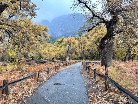
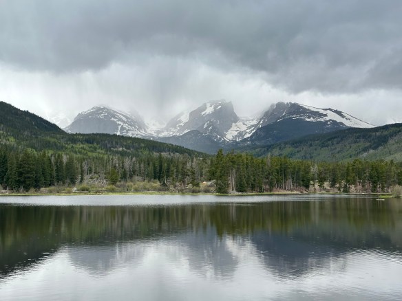
Yosemite National Park is open 24 hours per day, 365 days per year. The Hetch Hetchy area is only open from sunrise to sunset (except for permitted backpackers). There are other park entrances but check the website to see whether or not they are open. All day visitors must exit Hetch Hetchy by sunset. The road is also closed to all vehicles (including backpackers) from sunset to sunrise. Yosemite National Park covers nearly 1,200 square miles (3,100 square km) in the Sierra Nevada, with elevations ranging from about 2,000 feet (600 m) to 13,000 ft. The welcome center is located next to the Yosemite Village Parking and the Village Store in Yosemite Valley. Get help planning your visit and pick up free trail maps, junior ranger booklets, and more at the welcome center. Hours are 9:00 AM–5:00 PM and the Village is open year-round.

El Capitan Photo by S. Resendez

Things to do are numerous but if you’re visiting during the busy season, you need to make sure you plan ahead. Planning your visit will help to make sure you’re able to see everything you want to see while you’re there.

MILE MARKER: Did you know that some of the Buffalo Soldiers that were stationed at Fort Davis were stationed to park protection duties? After their frontier service, many Buffalo Soldiers were assigned to protect the newly formed national parks, including Yosemite. Between 1891 and 1913, soldiers from the 9th and 24th Cavalry, among others, served as the official administrators and park rangers in Yosemite.

HIKE IT!: There are a million things to do in Yosemite but hiking is the penultimate experience here. In and around Yosemite Valley, there are several day hikes rated easy to moderate that range from 0.5 miles all the way to 13 miles. There are also some shorter, more moderate hikes, that have elevation but if you plan ahead, you can check out the information and get yourself on a trail that suits your abilities. If you’re looking for trails outside of Yosemite Valley, check out Yosemite’s page all about the hiking trails. You’re sure to find something that suits your hiking style.

Photo by S. Resendez

“Flint, Frontier, and Falls: Pedernales State Park Through Time”

Photo by S. Resendez

There are signs that approximately 10,000-12,000 years ago, in the area we now recognize as the central Texas hill country, the Paleoindian people were utilizing the natural resources of the area to create tools for hunting megafauna such as bison and wooly mammoth. The grasslands of central Texas were the perfect environment for these animals. Add abundant water and flint, or as the Spaniards called it, pedernal, used to create those tools for hunting, and we can see why the area was such a draw for the indigenous people.

Fast forward to the 16th century, Spanish explorers and missionaries are making their foray inland towards central Texas. Lipan Apache are roaming the area and the Franciscans in charge of the missions in San Antonio are suggesting that a mission may need to be built in this part of Texas, as well. While that suggestion never comes to fruition, the influence of the Spaniards is cemented on the land. While in the area, the Spanish explorers begin to refer to the flowing water as the Pedernales River, due to the abundant amount of flint, or pedernal, in the riverbed.

After Texas became a state in 1845, small farming communities began to develop. and in the late 1800’s, the area in and around Pedernales Falls grew, but by the 1930’s, that same area began a decline. Lack of population growth, a depressed economy, and drought, probably helped to diminish and keep the local citizens to the bare minimum. The surrounding land was used for grazing until the original owner sold the land to Charles (C.A.) and Harriet Wheatley.

Photo by S. Resendez

The Wheatley’s named their new ranch, the Circle Bar Ranch and began improvement projects. They built a road that connected their ranch to the nearest county road and began building their home. They brought in purebred Hereford cattle and eventually, steer and goats. Although the Wheatley’s enjoyed hunting, they strongly believed that natural resources should be preserved and protected for the enjoyment of future generations. The Wheatley’s were prolific conservationists. Charles Wheatley helped to organize the National Wildlife Management Institute and was one of the founders of the Texas Fish and Game Commission. He was a friend of Governor Neff, who was responsible for creating the Texas State Parks system. Harriet Wheatley was also a lover of nature who enjoyed hunting and was active in the San Antonio Conservation Society, the Bexar County Girl Scouts, and the Blue Bird Auxiliary. She and Charles were both known to be expert fly fishermen and she even published a book entitled, Lady Angler: Fishing Hunting, and Camping in the Wilderness Areas of America.

© 2022 Larry D. Moore. Licensed under CC BY 4.0

In 1969, Harriet Wheatley sold the ranch to the state of Texas with her wish that “that it be conserved, and all of the wildlife be taken care of, and that it be enjoyed from generation to generation.” The park officially opened in 1971 as Pedernales Falls State Park. The park’s terrain typifies the Edwards Plateau, with woodlands, cedar brakes, grasslands, and lush riparian zones lining the Pedernales River.

The Pedernales Falls State Park is located at 2585 Park Road 6026, Johnson City, TX 78636. The park is open daily open daily and the office is open 8 a.m. to 4:30 p.m. The park’s phone number is (512) 389-8900.

Accessibility: Call ahead for specific information regarding building accessibility. They do have an all-terrain wheelchair available for use in the park. Contact the park to reserve it for your visit.

MILE MARKER: Beneath the falls and limestone shelves, the riverbed preserves fossilized tracks of ancient creatures. If you look closely in certain areas, you can spot impressions of prehistoric marine life that lived here when the Hill Country was covered by a shallow sea more than 100 million years ago.

HIKE IT!: Ten trails, from easy to challenging, are available for hiking, biking, and horseback riding. Trails vary in length from half mile to ten miles mean there are trails for every type of hiker! For more detailed information about the types of trails, check out the hiking trails page on the Pedernales State Park website.

Photo by S. Resendez

Rocky Mountain National Park: Trails, Wildlife, and Majestic Views

“The mountains are calling and I must go.” – John Muir 

11,000 years ago, humans began to venture into the untamed wilderness we now know as Rocky Mountain National Park. Replete with an abundance of wild animals, flora, fauna, and glacier-sculpted mountains, the Ute came to settle in the meadows and the valleys, eventually moving on in the 1700’s. With the Louisiana Purchase of 1803, the United States acquired the land that we know now as the Rocky Mountain National Park. In the late 1850’s, the gold rush in and around Pike’s Peak brought prospectors to the area. Hunters and trappers also began to discover the abundance of wildlife in the rugged area and despite the harsh winters, ranchers, hunters, miners, and homesteaders began to settle.

As tourism built, a conservation movement was already underway. Now renowned naturalists, John Muir, Gifford Pinchot, and Teddy Roosevelt, were instrumental in establishing the Estes Park Protective and Improvement Association. Enos Mills, a naturalist and nature guide began promoting, in earnest, the creation of a national park. After years of exhaustive lobbying, lecturing, and letter writing by Mr. Mills, President Woodrow Wilson signed the Rocky Mountain National Park Act in 1915, despite opposition from miners and loggers in the area.

During the depression of the 1930’s, the CCC (Civilian Conservation Corp) helped the National Park Service to build Trail Ridge Road. This was an integral part of the park because unlike other national parks at that time, there was no rail service to take tourists to the park. Rocky Mountain National Park was primarily an “auto park”. This meant that roads were a necessity for tourists to be able to experience all the beauty the park had to offer.

Rocky Mountain National Park hosts approximately 4 million visitors a year, with a record high of 4.7 million back in 2020.

There are 3 main entrances: 

Grand Lake Entrance if you wish to go clockwise on Trail Ridge Road.  

Beaver Meadows The entrance to get you to Bear Lake and you can also reach Trail Ridge Rd. 

Fall River Entrance if you wish to go counter-clockwise on Trail Ridge Road and a good place to see bighorn sheep.

As of the date this post was written, timed entry reservations are not needed in the spring and fall seasons. After May 23rd, you MUST make a timed entry reservation and if you wish to include a visit to Bear Lake, that must be stipulated with your timed entry reservation. Make sure you go to the Rocky Mountain National Park website and check out the Plan Your Visit section. Always make sure you’re looking ahead and planning your trip. Entrance fees can vary with your age and passes can be purchased ahead of time. Cash is NOT accepted so plan to use your credit card. There are fee-free entrance days but if you choose to go on those days, be aware that the park entrances may have extra long lines for entry. Everything you need to know is on the website so decide what time of year you’d like to visit, plan ahead, then go! If you live in and around the Rocky Mountain National Park and visit often, you might consider purchasing a transponder for your vehicle. Transponders are for park visitors who visit the park frequently, especially before 9a and after 2p, outside of the timed entry window. Check the park information page for more information about transponders.

There are approximately 355 miles of hiking trails throughout the park. Some good, simple hikes to do – especially when you are coming up to this altitude and need to take it easy.

  • Sprague Lake .7 miles (loop) 
  • Bear Lake .7 miles (loop) 
  • Alberta Falls 1.6 miles (in and out) 

There are also many more moderate, difficult, and longer trails, too.  Be sure to check out the Park newspaper for all the trail information and always check with the rangers on trail conditions before you head out, especially if you’re hiking in the spring and the fall, when weather can quickly take a turn.

If you’re not interested in hiking and just want to bask in the glory of the beautiful Rocky Mountains, take the Trail Ridge Road up to Alpine Ridge and the Alpine Visitor Center. Did you know that Rocky Mountain National Park has many aspects of the boreal forest?  While not in the continuous range of the geographic boreal forest, scientists have noted that many trees and animals in the Rocky Mountain National Park are the same as what you would find in the boreal forest that stretches from Alaska to New Foundland, and through Russia.

Feeling a little adventurous? While Trail Ridge Road is the highest, continuous, paved road in the nation, the Old Fall River Road is a scenic road that reminds you to slow down and enjoy the scenery. Old Fall River Road is an 11 mile long, one-way, gravel road. The speed limit is 15 mph and will take you, approximately, one hour to complete. There are several switchbacks and if driving up a road with no guardrails makes you antsy, this road may not be for you. But it is a one-way road so you will not encounter opposing traffic. Most of the people who take this road are driving it because they’re in no hurry. There are wider spots for you to pull over if someone does want to pass you. If you have the time, I would suggest taking Old Fall River Road up to Alpine Ridge and taking the Trail Ridge Road back down. Adventure awaits!

Rocky Mountain National Park is open year round, 24 hours a day, 365 days a year. It is located at 1000 US Hwy 36
Estes Park, CO 80517

The Information Office is open year-round: 8:00 a.m. – 4:00 p.m. daily in summer; 8:00 a.m. – 4:00 p.m. Mondays – Fridays and 8:00 a.m. – 12:00 p.m. Saturdays – Sundays in winter. Recorded Trail Ridge Road status: (970) 586-1222.

Information on accessible trails can be found here and all-terrain wheelchairs can be reserved at no cost to you.  Just call the Estes Park Mountain Shop at 970-586-6548.

MILE MARKER: There were so many women trailblazers that contributed to the development and conservation of this park, they could have a blog post of their own. Homesteaders, authors, teachers, and conservationists, these women were an integral part of making Rocky Mountain National Park the jewel it is today. To read more about them, go here to the history of the park and learn more about these female trailblazers!