

Imagine yourself in some open grasslands…the weather is humid and rainy. You can see that there’s a lush, beautiful forest nearby and in the river, there are large, expansive, trees growing in and around the river bottoms. The land is verdant and green. You’re actually standing in a flood plain. There are animals like wooly mammoth and giant bison roaming the area. This is the supercontinent Pangaea during the Late Triassic Epoch, over 225 million years ago. What we now recognize as the southwestern part of the United States.

Over millions of years, as the continents moved, the land tilted and uplifted, and the climate changed significantly, transforming the environment from a tropical basin to an arid plateau. The trees in that forest eventually fell and became buried in the biorich sediment where mineral-rich water replaced the tree’s organic structure with minerals, and turned them into petrified logs. The gradual uplifting of the land (starting about 60 million years ago) created stress that caused the brittle, crystal-filled logs to fracture like glass rods, creating the segmented appearance. Continual erosion from wind and water eventually exposed the fossils and sculpted the surrounding badlands and colorful Painted Desert formations, revealing the landscape we see today.
The Paleoindian people lived in, and around, the area of the petrified forest and as the climate and environment changed, began to settle the area as evidenced by the pithouses that were built into the land to mark the need for more permanent housing. By this time, the geographical area resembled what we recognize today as the Southwest. By the 1500’s, Spanish explorers began making inroads in search of routes along the Rio Grande and the Pacific Coast. After becoming a part of the U.S. territories in the 1800’s, the army continued to seek routes to the Pacific coastline and in doing so, came across what would eventually become the Petrified Forest National Park.

The Petrified Forest is located within the greater Painted Desert. A variety of animals call this area of the U.S. home, including amphibians such as salamanders and toads; birds; insects; mammals such as fox, coyote, deer, and rabbits; and reptiles like lizards, skinks, horned toads, and snakes. There are also several hundred species of plants and trees throughout the park. Research and dig sites are a constant in the Petrified Forest as scientists continue to learn and provide scientific information about the park to park visitors. This park is best known for its Triassic fossils.
Petrified Forest National Park is open year round except for Thanksgiving and Christmas. Painted Desert Visitor Center and Rainbow Forest Museum & Visitor Center hours are from 8am to 5pm and the Painted Desert Inn National Historic Landmark Hours are from 9am to 4pm. Note: Arizona does not observe Daylight Saving Time, remaining on Mountain Standard Time year-round. For example, in the summer months, during Daylight Saving Time, the time in Arizona and California is the same, with New Mexico and the Navajo Reservation one hour ahead. As usual, always make sure you check ahead in regards to weather and possible closures. This is a pet friendly park!!! Dogs (on leash) are allowed on the trails and there’s even a dog park available. Stop by one of the Visitor Centers and get a BARK Ranger certificate for your furry friend!
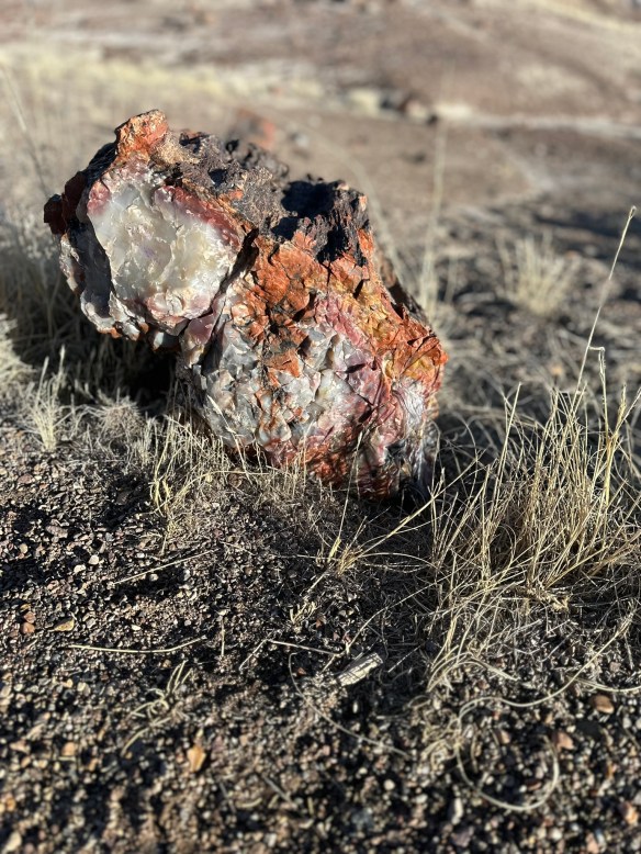
You can drive through the park in about an hour BUT there are plenty of short hikes that will allow you to see ancient villages, petroglyphs, giant logs, and petrified wood. This is the perfect park to see a lot with minimal physical investment.
MILE MARKER: Did you know Petrified Forest protects one of the richest Triassic fossil sites on Earth—not just fossilized trees, but early dinosaurs and evidence of some of the planet’s oldest wildfires? This park is far more alive than it looks!
HIKE IT!: There are several hiking trails of short to medium length available to hike in the Petrified Forest. The website’s trails page does a fantastic job of describing the trails and in giving you excellent insight into grades, cross slopes, and trial widths. Click on the link for the details.


