Land of Standing Stones: Discovering the Magic of Chiricahua National Monument

Photo by S. Resendez

We’re here again. We’re in a place settled long, long ago by people who migrated to North America thousands of years ago across the Bering land bridge or by sea. Their ancestral homeland was believed to be around modern-day Siberia/Mongolia, eventually settling across Alaska, northern Canada, and the American Southwest. Their migrations occurred in waves, with later groups moving south and east from an initial Alaskan settlement, adapting to diverse environments from subarctic forests to desert regions. These people are the Athabaskan people. We mentioned them in our episode about Canyon de Chelly.

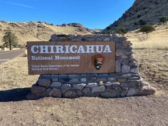
As these people made their way down to what we now refer to as the Southwestern United States (between 1400 and 1500), the Chiricahua eventually settled in what is now southeastern Arizona, southwestern New Mexico, and northern Mexico in the Sonoran and Chihuahuan Deserts. The Chiricahua people are named after the Chiricahua Mountains in southeast Arizona. The Apache Indians were only one of the bands of Chiricahua Indians that evolved into different clans.

As it was, and still seems to be, the way of the United States to take what belongs to someone else (for more current information, see “Greenland”) the Apache Wars of 1861 culminated, after 24 years, in the creation of a reservation for the Chiricahua people that allowed them to live in relative peace until the death of Cochise, when the reservation was abolished and the people were forced to move to another reservation.

After the Chiricahua people were relocated, settlers and ranchers moved into the area and in the 1930’s, the Civilian Conservation Corp (CCC) came into the region and were responsible for the construction of many of the roads, parking areas, and trails. Many of the trails were built for recreation but some of them were designed specifically to allow access for firefighters.The Sugarloaf Trail, for example, has the dual purpose of providing fire lookout access as well as recreational opportunities. The Natural Bridge Trail was constructed for the sole purpose of firefighter access into Picket Park.

Photo by S. Resendez

Bonita Canyon Highway offers a beautiful 8 mile drive to Massai Point, the culmination of a road that was constructed by the US Forest Service in 1932. The road is a narrow mountain road with low hanging trees and small parking areas. If you’re hauling a trailer, your trailer must be disconnected to drive up through Bonita Canyon. Chiricahua National Monument is a “Dark Sky” park, so be prepared for some intense stargazing!

Chiricahua National Monument is located at 13063 E Bonita Canyon Rd, Willcox, AZ. The park is open 24 hours a day. Trails stay open for sunrise, sunset, and night sky viewing. Be aware of wildlife and use extreme caution. There is no entrance fee or pass required to enter. The visitor center, on the right 3.5 miles after the entrance, is open from 8:30 am to 4:30 pm. It has an information desk, museum, park film, and gift shop. It provides free maps, junior ranger booklets, and information.

Photo by S. Resendez

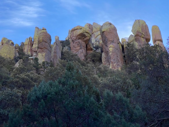
MILE MARKER: Chiricahua National Monument was formed by a single massive volcanic eruption about 27 million years ago. The Turkey Creek volcano released such an enormous ash cloud that the material hardened into rock, creating the towering hoodoos and balanced stones we see today. When you hike here, you’re walking through what was once a volcanic ash blanket—now sculpted into a stone forest by time and erosion.

HIKE IT!: Once again, the National Park’s website offers a great hiking page which breaks the hikes down into easy, moderate, and strenuous hikes. Five easy hikes about a mile or less will take you to some of the most scenic areas in the park! Don’t forget, though, there is elevation in this park so acclimate to the altitude by doing a short hike first!


Welcome to 2026!

We’ve got lots of good stuff in store for you in 2026!

More hiking! New trips! New interviews! If there is anything else you might like for us to review or any place you’d like for us to check out this year, leave a comment down below and we’ll do our best to get there.

If you’ve been enjoying our content, do us a favor and consider buying some merchandise from our Zazzle Store or dropping a little coin to buy us a coffee. We would really appreciate it.

Happy hiking. Now get out there and hike your own hike!

When East Met West: A Traveler’s Guide to Golden Spike National Historic Park

Photo by S. Resendez

America was moving west and it wasn’t an easy trek. As settlers began making their way into and across the United States, there was a push to move westward in the 1800’s. Gold had been discovered, Spaniards were making inroads and discovering land and an abundance of natural resources. Places like Fort Davis were providing a safe respite from the wild west but it was taking time for get from one end of the country to the other. Wagon routes and months-long sea voyages were slowing progress. Many leaders—businessmen, politicians, and military planners—began calling for a faster, safer way to connect the nation, a nation dreaming of speed and connection.

But the idea stalled for years because Congress couldn’t agree on where the route should run. Northern states pushed for a northern path; Southern states demanded a southern one. The political deadlock broke only after the Civil War began, when Southern representatives (who preferred a southern route) withdrew from Congress. Suddenly, the northern-backed plan had a clear path forward.

In 1862, President Abraham Lincoln signed the Pacific Railway Act, officially launching the transcontinental railroad. The government supported it with land grants and loans, while two companies—the Union Pacific (building west from Omaha) and the Central Pacific (building east from Sacramento)—took on the construction. Their lines met in 1869 at Promontory Summit, Utah, forever transforming travel, trade, and the American West.

 On May 10, 1869, officials from the Central Pacific Railroad and the Union Pacific Railroad met at PromontorySummit, in Box Elder County, Utah, to drive the final, ceremonial spikes, linking the eastern and western United States by rail. In 1965, the site of the last spike on the transcontinental railroad was designated a National Historic Site. In March of 2019, the park’s designation was changed from a historic site to a historic park, just in time to for the commemoration on May 10, 2019, as America celebrated the 150th anniversary of the completion of the First Transcontinental Railroad and recognizing the historic site as the Golden Spike National Historical Park.

Photo by S. Resendez

While connecting the railways was indeed a giant leap forward for the United States, it should be noted that these strides were made on the backs of several groups of people. Native Americans were already settled in the west and the construction of the railroad caused the people from 15 tribal nations to watch their homes and livelihood be destroyed with the advancement of the railroad. Irish immigrants, who came seeking work during potato famine in the mid-1800’s, were instrumental in helping build the railroad despite religious discrimination and.a language barrier. And Chinese immigrants, who were reluctantly hired after a critical shortage of labor was created due to gold strikes, were responsible for a great majority of the hardest labor that went into building the transcontinental railway. Chinese workers were often given tasked with working in the most dangerous conditions. Tunnels in the Sierra Nevada Mountains that had to be bored into solid granite for the railroad, rockslides, explosions, exposure, avalanches, and violent clashes claimed the lives of many of the Chinese workers. It is estimated that over one thousand Chinese laborers died building the CPRR. At the 1869 Golden Spike ceremony, not a single Chinese laborer was invited or mentioned, despite their indispensable role.

Central Pacific Railroad Jupiter
Photo courtesy NPS

Today, Golden Spike National Historical Park offers a variety of things to do during your visit. Commemorative events, seasonal events, nature, and hiking are all available at this park. There are approximately 55,000 visitors a year and the visitor’s center is open seasonally, at various hours. Please check the website for specific information before your visit. The physical address is 6200 North 22300 West, Promontory, Utah. It is approximately 30 miles west of Brigham City. The park is 2,735 acres of land surrounding a 15 mile stretch of the original Transcontinental Railroad. There is only one paved road coming in to the visitor’s center.

MILE MARKER: Did you know that the famous golden spike wasn’t hammered into place at all—it was gently tapped, lifted back out, and sent home, while the real work of joining the rails happened quietly behind the scenes.

HIKE IT!: There is a 1.5 mile trail called the Big Fill Loop Trail. It provides a beautiful view of the Promontory Mountains, the Great Salt Lake, and the Wasatch Front. Visitors can walk along the original grades of the Central Pacific and Union Pacific railroads and still see drill marks from the tools used to create the tracks.