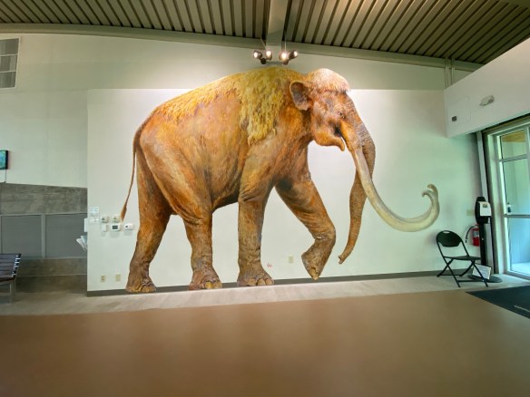
Imagine…you’re minding your own business, wandering around by the Bosque River, searching for fossils and arrowheads, when you come upon something sticking out of the ground and it looks like…a bone?!
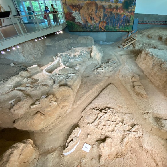
This is what happened back in 1978 to Paul Barron and Eddie Bufkin. Lucky for us that these two guys had a pretty good idea of what they had found and had the presence of mind to excavate it and take it over to Baylor University’s Strecker Museum for further examination. Museum staff identified the object as a femur bone from a Columbian Mammoth and quickly went about organizing a team to begin excavating. Between 1978 and 1990, the dig unearthed the remains of 16 Columbian mammoths. They also found what appeared to be a nursery herd that may have died together in a single natural event. Between 1990 and 1997, six additional mammoths were excavated as well as the remains of a Western camel, an alligator, a dwarf antelope, and a giant tortoise, among other animals.
Photo by S. Resendez
There is conjecture on how these animals died and even though it remains a mystery, there are theories that allude to several successive floods which may have trapped and eventually drowned the animals in rapidly rising flood waters.
Photo by S. Resendez
In 2015, President Barack Obama signed the executive order that established Waco Mammoth National Monument, making it a part of the National Park System. The public is welcome anytime during regular operating hours, 9:00 am to 5:00 pm Central Time. Start your visit at the Welcome Center located at 6220 Steinbeck Bend Drive. Guided tours are conducted every 30 minutes, so just show up and join the fun, no reservation needed! Tours last from 45 minutes to one hour. A small tour fee applies. Tour guides will lead you from the Welcome Center, down a 300 yard paved path to the Dig Shelter where mammoth fossils are in situ (still in their original position within the bone bed). During your tour, you will learn about the Ice Age, how the fossils were discovered, and why this site is one of the most important paleontological finds in North America,”
MILE MARKER: Waco Mammoth National Monument marks the largest known concentration of Columbian mammoths that died in a single event. When paleontologists first started excavating the site in Waco, they noticed something strange: many of the mammoth skeletons were facing the same direction. That detail helped scientists piece together what probably happened thousands of years ago. During a sudden Ice Age flood, the herd likely tried to move together against the rushing water, just as modern elephants protect their young during danger. The current pushed them downstream into soft sediment, where they became trapped in deep mud. In other words, the way the bones are positioned appears to have captured the final moments of the herd trying to escape the flood together.
HIKE IT!: While there aren’t many long trails at this site, there are some short hiking trails around the actual dig site. If you combine all the shorter trails into one, you would probably get a one mile trail so you can get some steps in and appreciate the area surrounding the dig site. If you go in the summer, make sure you still prepare for warm weather hiking! At a minimum, at least make sure to take some water and sunscreen. For more details about the hikes, check out this link. If you have time after your visit and you’re interested in doing some more hiking, take the short drive down N. MLK, Jr. Drive to Cameron Park. There are a myriad of hiking trails in this park, including one called Jacob’s Ladder which consists of 88 steep, concrete steps. It is located within a wooded area, and climbs approximately 50 to 80 feet in elevation.
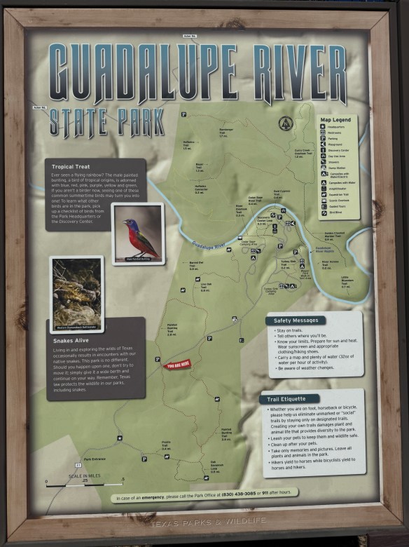
It’s a Hike & Feast!! That’s right, we’re headed for a hike at the Guadalupe River State Park, about 30 minutes northwest of San Antonio off Highway 46, west of 281 North.
This was the very first state park I ever visited when I first started camping. At the time of this first visit, I was a poor, case manager. Bachelor’s degree in hand, first professional job, still making peanuts. My housemate and I were looking for ways to have some fun that didn’t cost a lot of money. We decided to try our hand at camping so we splurged on a tent and somehow, I don’t really remember how, we found this park, made a reservation and spent a lovely weekend sleeping on the hard ground, grilling meats, hanging out at the river, and just generally, enjoying nature.
This isn’t my favorite state park but it does hold a special place in my heart because it was where I discovered camping. I’d been to Rocky Mountain National Park with my college roommate and her family before this camping trip, but they had a pop-up trailer and all I had to do was sit back and let my friend’s dad be in charge. The trip to Guadalupe River State Park was my first time setting up my own campsite, starting a campfire, and all the other camping experiences that came with it, including the midnight trips to the bathroom. But it was all good because that little bit of camping led to backpacking which led to hiking and here we are today! It’s a full circle for me.
Photo by M. Gonzalez
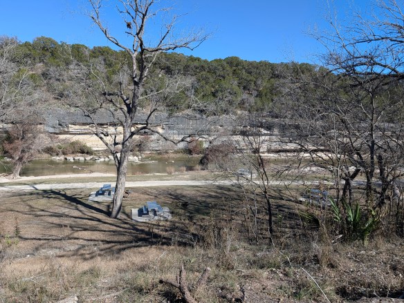
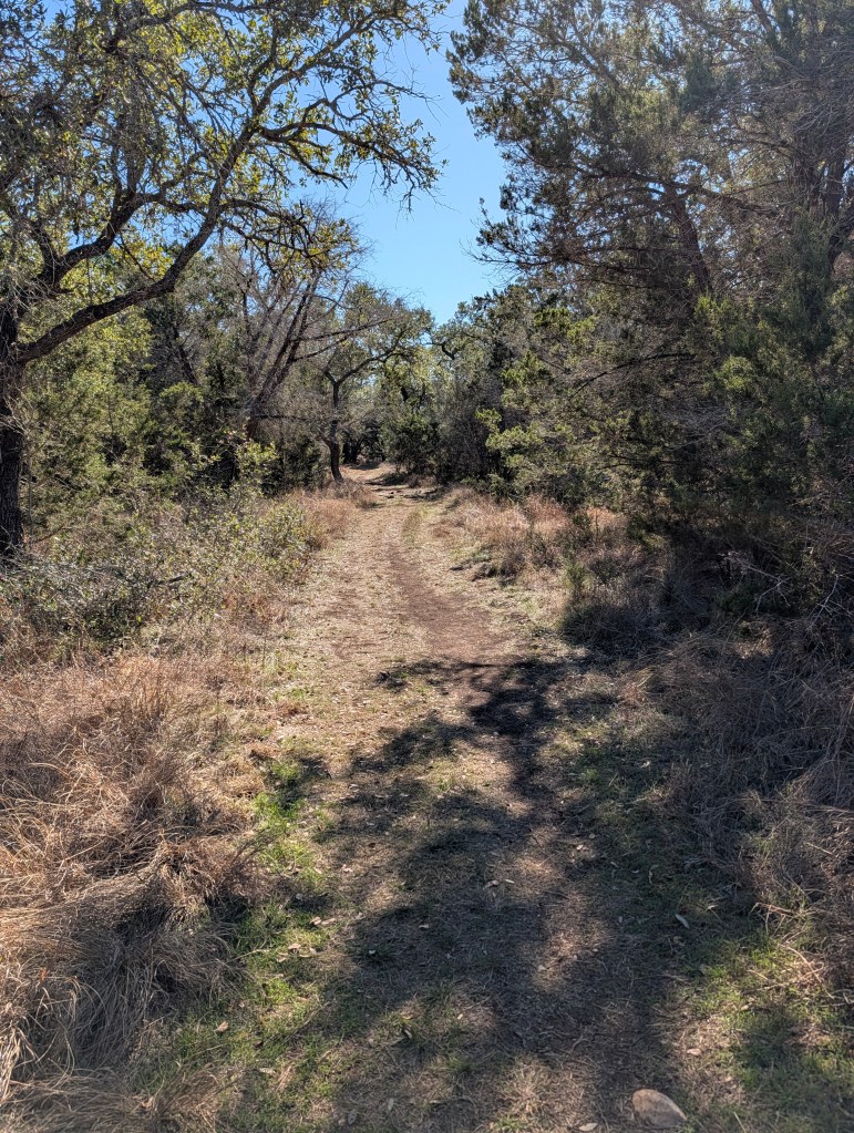
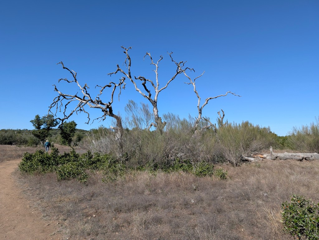
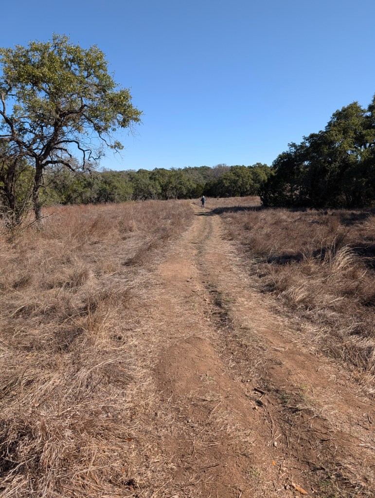
Guadalupe River State Park, as the name implies, sits smack dab on the Guadalupe River. The river here runs quiet and serene. The gentle flow makes it perfect for kids to get in and float down aways on a tube or raft, climb out, and do it all over again. The day use area is right on the river and you’d better believe it gets crowded in the summer. If you’re looking to camp here in the summer (as well as spring and fall if it’s warm enough), it’s going to be busy. It’s not the getaway you might be looking for if you’re looking for silence or quiet nature. But, if you’re looking for a place to hike some quiet, easy, and beautiful trails, you’ve come to the right place. Especially if you’re here in the fall and winter. Spring is also a magical time when the wildflowers are in bloom.
Photo by M. Gonzalez
Photo by M. Gonzalez
Photo by M. Gonzalez
Guadalupe River State Park is part of the area we’ve discussed in some of our other blogs and in our podcasts. Like Pedernales River State Park and our first Hike & Feast at Crownridge Canyon Natural Area, Guadalupe River State Park is an area comprised of limestone canyons that used to be a seabed. Dramatic canyon walls and rocky outcrops were formed when this region was covered by a shallow sea millions of years ago. If you look closely at the limestone layers, sometimes you can find fossiliferous limestone, better defined as fossils of seashells and organisms fossilized right into the limestone. Bonus if you’re a birder! This park sits at the crossroads of Hill Country and riparian ecosystems, making it an important stopover for migratory birds. Fall hikers often don’t realize they’re walking through habitat used by golden-cheeked warblers, painted buntings, and migrating raptors. Susan and I hiked the Painted Bunting Trail, named after the beautiful painted bunting bird (which we did not see while we were hiking, damn it).
This park has plenty of trails ranging from easy to challenging. Trail lengths range from 0.3 miles all the way to 3.1 miles. There are also river crossings if you’re looking to roll up your pants and get your feet wet. Terrain is varied and there are some trails that are short but steep, so choose wisely.
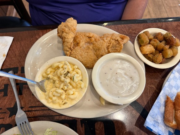
This is a great, little getaway right down the road from San Antonio. And there are plenty of places to feast after you finish up your hike. We made our way a few miles up the road to Spring Branch, Texas where we feasted on chicken fried steak at Antler Cafe. Delicious!
FEAST! Chicken Fried Steak at Antler Cafe in Spring Branch, Texas
MILE MARKER: Guadalupe River State Park protects one of the cleanest stretches of the Guadalupe River. Unlike the more heavily trafficked downstream sections (like New Braunfels), this stretch of the river is spring-fed and less developed, which helps keep the water unusually clear and ecologically healthy. It’s a quiet reason why the park feels so calm compared to other Guadalupe access points.
HIKE IT!: Make sure you check out the park’s website hiking page for links to their trail map but notice that there’s a secret hike on there! That’s right, there’s a secret hike at the connected Honey Creek State Natural Area. Access to this special area is allowed only by tour which is a 2 mile, ranger led tour, that only happens once a week. Click on the link to get to the Honey Creek website and sign up for that special hike there.
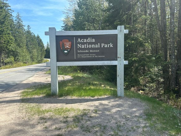
The trails in Acadia National Park tell a story carved by ancient glaciers and by the hands and hearts of the people who have called this place home. Long before it became a hiker’s paradise, Mount Desert Island was the ancestral homeland of the Wabanaki people, who paddled the rocky shores and named the mountains and waters that still define Acadia’s wild beauty. Later came the “rusticators” — artists, writers, and dreamers of the 19th century — who found inspiration in its rugged cliffs and helped spark a movement to protect it.
Before it became known as Acadia, this park had many names…Pemetic, Sieur de Monts, and Lafayette. The area in, and around, Arcadia, began colonization in the late 1700’s. By the early 1800’s, farming, foresting, fishing, and shipbuilding became the major occupations. Hundreds of acres of trees were deforested to make wood products. Farmers began growing crops like wheat, rye, corn, and potatoes. By the mid-1800’s, fishermen and sailors focused on creating a life on the sea. And word got around about the natural beauty of the area, so tourism also became a part of early life in Acadia.
Photo by S. Resendez
Charles W. Eliot, George B. Dorr, and John D. Rockefeller presented 5,000 acres to the American people in the form of a national monument, which was signed into effect by President Woodrow Wilson. At the time, the park was under the name, Sieur de Monts. More property was donated by wealthy patrons, many of them affluent women, and efforts continued to obtain full national park status. In 1919, President Wilson signed the act establishing Lafayette National Park and Dorr became the first park superintendent. In 1929, congress authorized the National Park Service to accept a donation of land on the Schoodic Peninsula and that was when the park’s current name, Acadia National Park, was adopted.
Photo by S. Resendez
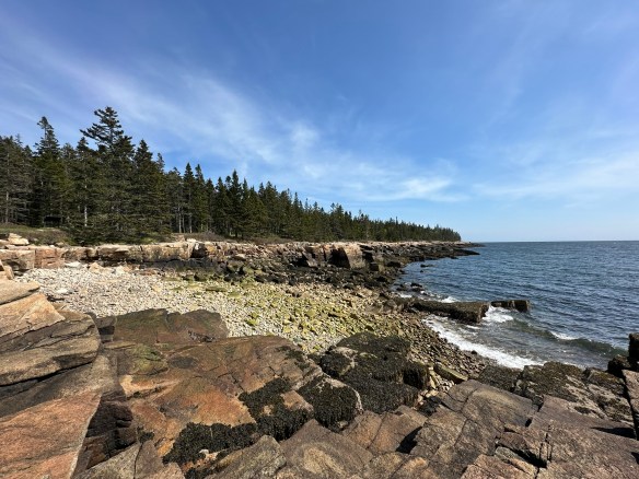
Acadia National Park preserves approximately 50,000 acres in Maine. Ecosystems contained within Acadia include mountains, shorelines, forests, lakes and ponds, steams and watersheds, marshes, swamps, and wetlands. It boasts. more than 1,100 plant species and diverse wildlife from microorganisms and larger animals. It is currently, as of this writing, the 10th most visited national park.
Acadia National Park is usually open 24 hours a day but check the website for specific information regarding operating hours for the visitor’s center. Summer is the busy season but it’s always good to plan in advance because you never know when things might change. Acadia is a huge park and while there are many areas that are accessible to people with disabilities, there are also many areas that are not accessible. The best way to check is to go directly to their accessibility page for specific information.
Photo by S. Resendez
MILE MARKER: Did you know that Acadia National Park was the first national park created entirely from private land donations? Also, Acadia’s famous carriage roads were built by John D. Rockefeller Jr., not for cars, but as a refuge from them. He even designed the roads and bridges to blend naturally into the landscape, using local granite and hand-carved details.
HIKE IT!: There are SO MANY hikes in Acadia, there’s not enough room to list them here. It’s a good thing that Acadia’s NPS website has a whole page that sorts all the hikes for you! Find your favorite hiking trail by location, by environment, by route, or by public transportation. Look here for links that will take you straight to the information you need to hike your hike.
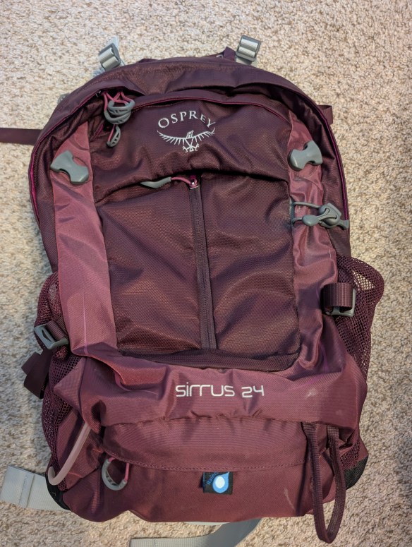
Have you ever wanted to know what other hikers carry in their hiking packs? This is your chance to take a quick peek into the backpacks of the Two Chicks.
We’ll talk a bit about what we carry and why we carry it. We hope you enjoy this podcast and we hope it inspires you to do some hiking!
Don’t forget to check out our Hiking Information page for lots of downloadable checklists you can use for your next hike. Also, what’s in your pack? Drop a quick comment down below and tell us what you carry and what’s the one thing you won’t leave behind when YOU go hiking.
Join us this week for a quick look at different types of bags you can use for different hiking situations. And while you’re planning your hike, don’t forget to visit our Hiking Information page for our FREE downloadable hiking checklists!
We’re not going to recommend any particular style or brand, we just want you to know about some of the options available to you as you consider your next hike. How long will you be hiking? Will the weather be hot or rainy? Will you be hiking into a particular destination or are you just planning to meander? Will you be in the middle of nowhere or will you be close to places where you can purchase extra water or snacks?
Once you consider all these things, then consider what king of bag you may need to hold all your gear. Do you just need something for your water, your snack bar, and your chapstick? Do you need to pack a rain jacket, a puffy jacket, food, and water? Do you just need water and a small first aid kit? This episode will help you choose the right bag for the right hike.
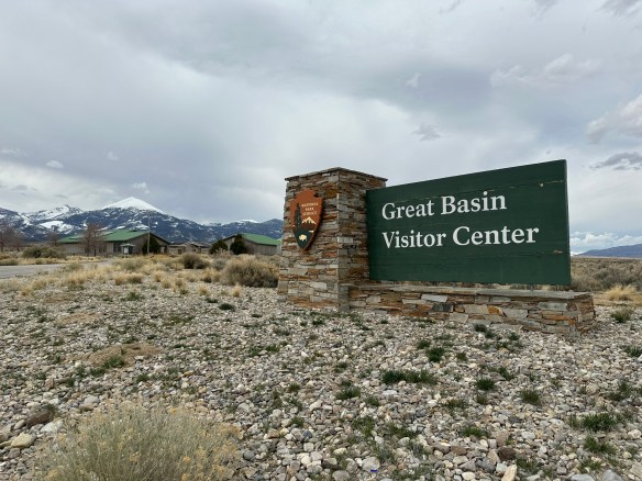
We recently took you to a place called Big Thicket National Preserve that highlighted a wealth of biodiversity in Texas. Today, we’re going to talk about another place that also encompasses a diverse sample of nature that will take you underground into caves, through the desert, hiking through pine trees, into mountains, and traversing through the stars! Today, we’ll be talking about Great Basin National Park in Nevada!
The first people documented living in the Great Basin area were what archeologists call the Paleo-Indians. For over 12,000 years, these people were thought to be big game hunters with no permanent houses because they were nomadic and followed the animal herds. The next group to occupy this area were referred to as the Great Basin Desert Archaic. This group were hunter-gatherers who also followed animal herds but collected native plants but also learned how to use grinding stones to process seeds. They used their crafts to trade with other peoples.
These groups eventually led to the Fremont and Shoshone cultures, with the Shoshone still living in the area today. In addition to the Shoshone, the Ute, the Paiute, the Goshute, and the Washoe also inhabited this region. Small family groups hunted and subsisted on the land and its natural resources. The people were early hunters and gatherers who eventually learned to farm and fish. Everything they needed to survive and thrive was available to them in the Great Basin.
Photo by S. Resendez
Trappers, miners, and military expeditions found their way to Great Basin area in the mid-1800’s. Immigrants may have passed through the area as they made their way to California for the gold rush. Ranching was established soon after the gold migration. Mining expeditions also discovered gold and silver which resulted in mining operations inside the Great Basin and just outside the region. Ranching was established in the late 1800’s and continues today.
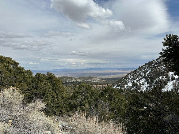
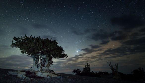
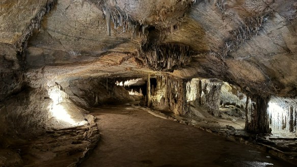
There are many things to do at Great Basin National Park. The ecosystem is diverse and plays host to 11 species of conifer trees, 73 species of mammals, 18 species of reptiles, 238 species of birds, 8 species of fish, and over 800 species of plants. The biodiversity ranges from desert valleys, mountain ranges, caves, a forest, an alpine environment, and even a glacier. And, if that weren’t enough, in 2016, Great Basin National Park was recognized as a a Gold Tier International Dark Sky Park by the International Dark Sky Association. This means the skies over Great Basin are some of the most pristine and clear night skies in the U.S. On a moonless, summer night, if the sky is clear, you may be able to see not just stars, but planets, satellites, meteors, the Milky Way, and the Andromeda Galaxy, all with the naked eye! Don’t forget, there’s also Lehman’s Cave to explore, hiking, and fishing…this park warrants a multi-day visit!
Mount Washington Bristlecone
Courtesy of NPS Great Basin National Park–Photo by Kelly Carroll
Accessibility: The park currently features two trails that are built to ADA standards and are accessible with a standard wheelchair. For information on all trails, go to their hiking page and for more specific information on ALL accessible areas in the park, go to the park’s accessibility page.
Great Basin National Park’s grounds are open 24 hours a day, year round to hiking, stargazing, and camping. The park’s Visitors Center is located just north of the town of Baker on the west side of NV Highway 487 and is open every day between the hours of 8a–5p. In the summer, the Great Basin Visitor Center is open daily. The Lehman Caves Visitors Center is located 5.5 miles up from the town of Baker, NV from 8a–5p. In the summer, Lehman Caves Visitor Center is open extended hours. Hours may change seasonally for both visitors centers, so make sure you check on their webpage before heading out. The Plan Your Visit page does a great job of letting you know what to expect during each season. It’s worth reading through it if you plan to visit outside of the summer months. Interested in stargazing and astronomy? The website’s Astronomy page highlights their ranger programs for all visitors and the associated rules.
Lehmans Cave–Photo by S. Resendez
MILE MARKER: Great Basin National Park has some of the most interesting, naturally occurring resources in the U.S. For example: Some of the bristleconepines here are over 4,000 years old. Also, there’s a hidden glacier here! Despite being in the Nevada desert, the park has a tiny glacier tucked into the shadow of Wheeler Peak, the southernmost glacier in the U.S.
HIKE IT!: There are numerous hiking trails in Great Basin. The hiking page on their website does a fantastic job of breaking down hikes by location and/or by ability. They also have a downloadable map site with all the trails topographical maps as well as advice about hiking in winter. It’s a great way to plan your hike and what you’ll need for it before you get out there.
Got questions? We might have some answers!! Tune in for a short chat about questions or comments some of you have mentioned either on our Facebook Page, YouTube, or Instagram.
This episode, we’ll be discussing…
What’s the difference between walking and hiking?
What is your favorite small park?
Would we ever consider doing guided hikes?
What’s the difference between an NPS Park Store and an affiliate store?
Can you take things from National Parks?
Who decided gold was the standard of wealth back in the gold rush days?
If you have any other questions or comments, feel free to write them below. If you let us know, we’ll hand out some more trail mix in a future podcast. Thanks for listening!
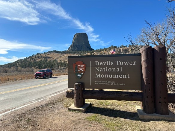
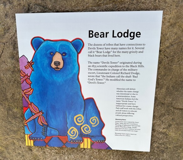
Many people will look at this towering section of striated stone and think to themselves that it looks familiar, even if they’ve never been there. Yes, this is the site made famous in the Steven Spielberg 1977 movie, Close Encounters of the Third Kind. But before it became a focal point of a movie about contact with extraterrestrials, it was famous in its own right. The Devils Tower National Monument, also known as Bear Lodge, was dedicated by President Theodore Roosevelt as America’s first national monument in 1906.
Photo by S. Resendez
There are a multitude of theories surmising how the tower came to be. In reality, all theories agree that the tower did not start out as a tower. In fact, the structure began beneath the earth’s surface and was created from magma that came to be in its current state via erosion. We will probably never know which theory regarding the actual creation is correct due to the fact that the erosion essentially eliminated the evidence to substantiate any theory.
Photo by S. Resendez
Despite questions surrounding its creation, the physical tower is imposing. Devils Tower is 1,267 feet (386 m) tall and sits above the Belle Fourche River. It is the world’s largest example of columnar jointing. It is considered a sacred place for over 20 Native American tribes and ceremonies are still held there. As you walk on the trails, you may come across cloths or small bundles attached to the trees. These are Native American prayer cloths and represent the spiritual connection some tribes have with the Tower. Do not touch, disturb or remove the prayer cloths. Also, it is considered culturally insensitive to photograph these prayer cloths.
Park roads and trails are open 24 hours/day. Visitor Center/Library summer hours are from 9a to 6p. Hours change by season so if you want to see the visitor center, make sure you verify on the website before going. The park usually sees around 500,000 visitors per year; over 80% of whom come between Memorial Day and Labor Day (late May to early September), so plan accordingly.
Parking is very limited. The park often experiences maximum parking capacity for several hours every day throughout the summer (usually between 10a-3p). There is a map and a suggestion to park outside the park and hike into the visitor’s center, if you don’t want to deal with the parking issue.
Accessibility: The Visitor Center is wheelchair accessible and can accommodate wheelchairs up to 35 inches in width. Accessible restrooms are available. While the trail loop is paved, steep grades mean the trail is not recommended for wheelchair users.
Photo by S. Resendez
MILE MARKER: The word for devil/evil spirit is Wakansica. It can be translated as “bad god” or “evil spirit”. The Lakota word for black bear is Wahanksica. It is possible that the name Devils Tower, which is called “Bear Lodge” in Lakota, came about due to a mistranslation of “Wahanksica” for “Wakansica”. It is also possible that Colonel Richard Irving Dodge, a man who publicly advocated for the genocide of Native Americans, ascribed the name Devils Tower to this sacred mountain merely to offend and disrespect indigenous tribes. To find out more about the movement to restore the original Native American name of Devils Tower back to Bear Lodge, click here.
HIKE IT!: There are several hiking trails in and around the Devils Tower. The most popular is the Tower Trail but there are plenty of other hiking trails for hikers of different levels to enjoy. The NPS website for Devils Tower does a great job of breaking down the hiking trails based on how much time you think you plan on spending at the park. Make sure you check it out and plan your hike ahead of time!
Got questions? We might have some answers!! Tune in for a short chat about questions or comments some of you have mentioned either on our Facebook Page, YouTube, or Instagram. If you have any other questions or comments, feel free to write them below. If you let us know, we’ll hand out some more trail mix in a future podcast. Thanks for listening!
Imagine yourself in the middle of a desert, surrounded by nothing but harsh cliffs, scrub brush, cactus, and sandy caliche. There is a dusty road stretching out from east to west and there is no sign of civilization as far as the eye can see.
Okay, this isn’t the actual road but you get the idea. (This is a road in the same general area, though.) Photo by M. Gonzalez
This is the Chihuahuan Desert. The largest desert in North America. It stretches from northern Mexico to the southwestern US, running through southwest Texas, New Mexico, and parts of Arizona. It covers approximately 200,000 square miles and while the average elevation is only 1000 feet above sea level, elevations can range from 3,500 to 5,000 feet.
In the mid-1800’s, if you wanted to travel from San Antonio, Texas to El Paso, Texas or further onto California to join the gold rush, this was the route you had to take. It was referred to as the Trans-Pecos Trail, specifically the San Antonio-El Paso road on the Chihuahua Trail.
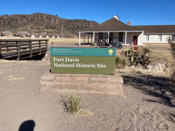
Park Entrance Photo by S. Resendez
In 1854, Fort Davis was established to create a point of protection for travelers, freighters, and mail carriers. The Eighth U.S. Infantry was stationed at Fort Davis until 1891. Fort Davis, named after Secretary of War, Jefferson Davis, was instrumental in protecting, defending, and developing the western frontier. The post was situated in a box canyon in the shadow of the Davis Mountains, (known then as the Limpia Mountains). With the onset of the Civil War and the secession of Texas, Fort Davis was abandoned and stayed deserted for five years.
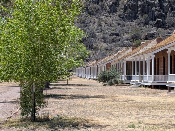
The original post was built quickly and was poorly constructed. After the civil war, in 1867, Fort Davis, once again, became an active post. New buildings were constructed, eventually adding a guardhouse, barracks, officer’s quarters, a temporary hospital, and storerooms. Construction went on through the 1880’s, eventually housing up to 400 soldiers.
Housing at Fort Davis Photo by M. Gonzalez
Commanches and Apaches continued to make the road hazardous travel for mail carriers and travelers, so soldiers spent the majority of their time patrolling the road and fighting off the Apache, as the Commanche had been defeated years earlier. The Apache, led by their leader, Victorio, were pushed into Mexico where, after eluding US troops for over a decade, they were finally captured and killed.
In June of 1891, Fort Davis was ordered to shut down and was abandoned, having outlived its usefulness. In 1961, the fort was authorized as a national historic site, a unit of the National Park Service.
Before we travel onto the Davis Mountains State Park, we would be remiss if we didn’t delve a tiny bit into what an integral part the Buffalo Soldiers played in the formation, maintenance, and safety of Fort Davis and the San Antonio-El Paso Road.
Following the Civil War, as Fort Davis was recommissioned, Troops from the Ninth U.S. Cavalry, the Buffalo Soldiers, were the first to report. They helped to reconstruct the fort, faced down conflicts with the Apache and the Comanche, and protected the mail, as well as travelers, on the San Antonio-El Paso road. The Buffalo Soldiers were integral in the day to day functions of Fort Davis. In addition to providing protection to travelers and escorting freight and mail, they repaired military telegraph lines and guarded water holes.
Even though the civil war was over, the Buffalo Soldiers still faced discrimination. Troops were segregated and rations and equipment were given to the white troops first, with the black troops receiving whatever was leftover. Despite all this, the Buffalo soldiers proved to be a force for keeping West Texas in check. They became known as the peacekeepers of the area and were highly revered by the Native Americans for their fierce fighting skills. It was the Native Americans who nicknamed these regiments, “Buffalo Soldiers”. The African-American soldiers accepted the name and adopted the Buffalo as a symbol of honor.
On a side note, in addition to keeping the peace in West Texas, active units of the Buffalo Soldiers served from 1866 until 1952. While remaining segregated, the Buffalo Soldiers served and fought in the Spanish-American War, protected the U.S. during the Mexican Revolution, World War I and World War II, as well as the Korean War.
Now, let’s make our way to the Davis Mountains State Park. It’s about a 10 minute drive from Fort Davis. Once you’re on the grounds, you will find yourself in an expansive state park of approximately 2,700 acres that reaches elevations of up to 6,000 feet! It may not seem like it, but this park is busy, especially beginning in the spring to the late summer. Camping is available but reservations are suggested, for camping AND day use, especially during their busy season.
Pullout view from Skyline Drive Photo by M. Gonzalez
There are many things to see and do at Davis Mountains State Park. You can go camping, hiking, backpacking, mountain biking, and if you have one, you can bring your horse and hit the trails! There’s a scenic drive that winds its way up the mountains for some spectacular views. If you’re there at night, or almost anywhere in this general area, star gazing is at its best. (The McDonald Observatory is nearby so you could book a star party with some friends if you really want to take advantage of the dark sky!)
In addition to all of the nature and the views, there are a couple of shops available, the smaller shop being at the park entrance office and the larger shop located at the Indian Lodge which is further into the park.
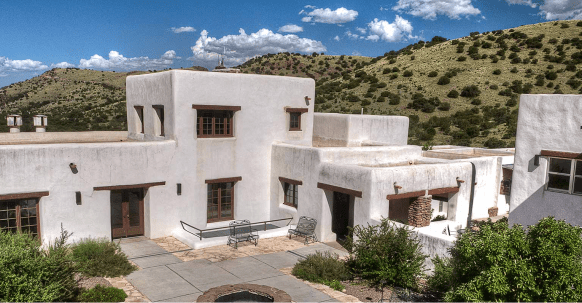
If you plan on spending several days in and around this area of west Texas, why not check to see if there are any rooms available at the The Indian Lodge? The Lodge has been recently renovated and would be a wonderful place to stay while you explore the area.
As you make your way to the top of Skyline Drive, take a minute to stop at the Interpretive Center. This short stop is worth your time if you have any interest in the park’s wildlife, geology, or history. And if you’re a birder, you’re really going to love stopping here because they have an indoor bird blind which allows you to sit in air conditioned comfort while you watch the birds fly in and out. There are also has GPS Units available for loan if you plan on hiking in the park. Please say hi to Charlie if you go by the Interpretive Center. He’s a wealth of information!
The top of Skyline Drive
Photo by M. Gonzalez
After your stop, continue towards the top of Skyline Drive, where you can park and take in the expansive views.
There is so much more to write about this park and its history but it’s just too much to cover. Take some time to visit their website. It’s got a wealth of information about everything the park has to offer. It also has alerts about things you may need to be aware of as you plan your trip. Make sure you check the website!
MILE MARKER: Cathay Williams was the first documented female buffalo soldier! She served from 1866-68. Since women were not allowed to serve then, Williams disguised herself as a man to enlist in the army. Read more about her history and more about the Buffalo Soldiers at the Bexar County Buffalo Soldiers Association.
HIKE IT!: There are several trails to choose from if you decide to hike while at Davis Mountains State Park. Check the website for details on length and difficulty. If you’re planning a visit to the Fort Davis National Historic Site, there’s a hiking path that connects both parks. It would be our recommendation, if you’re a less experienced hiker, especially if you’re hiking in higher elevations than you may be used to, that you study the details of this hike and make your decision based on your experience. While it is a relatively short hike (approximately 1 mile), you will be encountering an elevation drop on your way to Fort Davis and an elevation gain back to where you parked at the Davis Mountain State Park.
Remember, you’re in the mountains!! Most of these trails will incur elevation drops and elevation gains. You’re also in a desert, so hike wisely. Start your hikes early in the morning and take more water than you think you may need. Borrow a GPS unit from the Interpretive Center if it makes you feel more confident. Click here for an interactive map of the Davis Mountains State Park Trails. Be safe and have fun!