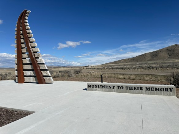
Stand in the quiet fields of Andersonville and it’s hard to imagine that the peaceful landscape was once the site of one of the most notorious prisons of the Civil War. Beneath the Georgia grass lies a powerful story of survival, suffering, and the resilience of thousands of men who endured unimaginable conditions here.
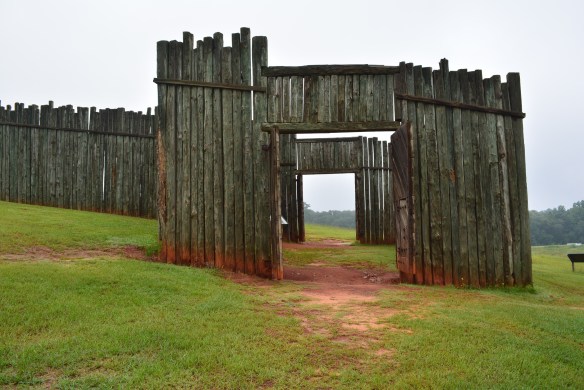
Andersonville National Historic Site preserves the grounds of Camp Sumter (not to be confused with Fort Sumter), known during the American Civil War as Andersonville Prison, one of the Confederacy’s largest and most infamous prisoner-of-war camps. Camp Sumter operated roughly from February 1864 until April 1865. Andersonville was intended to hold about 10,000 Union prisoners of war. Instead, as the war intensified, the population ballooned to more than 32,000 at one point. The prison stockade covered roughly 26 acres of open land enclosed by a 15-foot-high pine log wall. The prison was overcrowded and there were unsanitary conditions. There were no barracks inside and no real shelter. Prisoners were left to construct makeshift tents using scraps of cloth, blankets, and whatever materials they could salvage. Many had nothing at all. Of the approximately 45,000 Union prisoners who passed through Andersonville, nearly 13,000 perished from disease, starvation, and exposure.
Dysentary, scurvy, gangrene, and typhoid fever ran rampant in the overcrowded conditions. The prison’s only water source was a small stream that ran through the stockade. It quickly became polluted with human waste and runoff from Confederate camps located uphill. For prisoners already weakened by starvation, drinking that water was often a death sentence. Andersonville’s mortality rate, roughly 29%, made it one of the deadliest prisoner-of-war camps in American history.
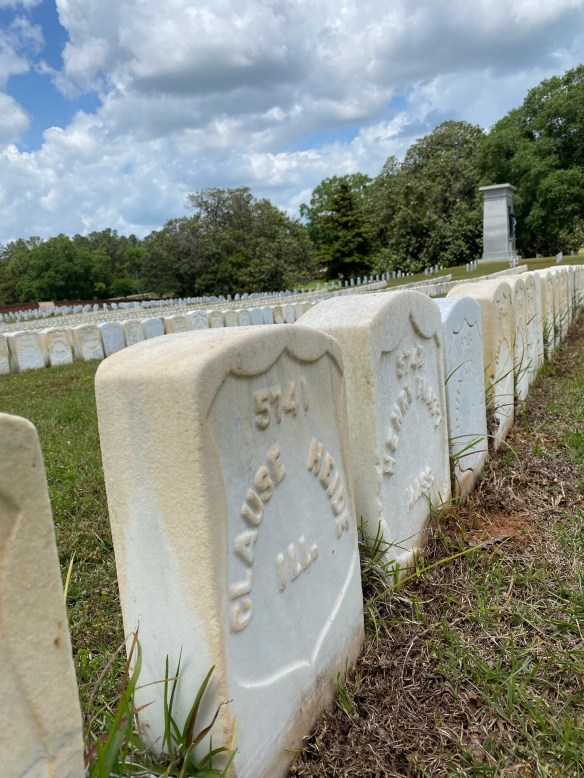
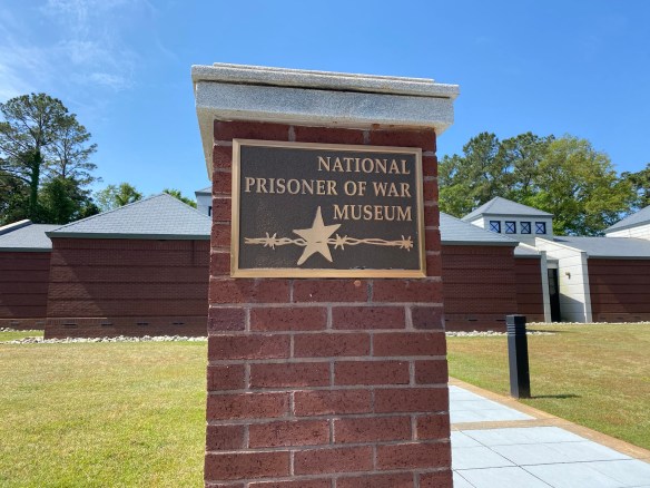
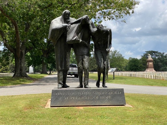
After the war, the burial grounds became Andersonville National Cemetery, established in July 1865, which today continues as an active National Cemetery interring veterans and their families.In recognition of its profound historic importance, Congress designated the site as a National Historic Site on October 16, 1970, and it became part of the National Park System. One of the most important aspects of the site today is the National Prisoner of War Museum, which opened in 1998. Andersonville is unique in the National Park System because it serves as a memorial to all American prisoners of war, not just those from the Civil War. This shifts the narrative from one tragic Civil War prison to a broader reflection on the experience of captivity in American history.
The National Prisoner of War Museum is located at 760 POW Road in Andersonville, Georgia. The park is open from 8 am to 5 pm and the National Prisoner of War Museum is open daily from 9:30 am to 4:30 pm. Park grounds, including the National Cemetery, are open daily from 8:00 AM to 5:00 PM. On Thanksgiving Day, Christmas Day, and New Year’s Day, the National Prisoner of War Museum and prison site are closed but Andersonville National Cemetery is open from 8:00 AM to 5:00 PM pending staff availability. As usual, it’s a good idea to check the website for updated information before you go.
Andersonville National Historic Site is comprised of three main components: the National Prisoner of War Museum, the historic Civil War prison site and Andersonville National Cemetery. Be aware that the Cemetery is active and a funeral may occur during your visit.
Today, Andersonville National Historic Site is quiet—grassy fields stretch under the Georgia sky, marked by monuments and the memories of those who suffered here. It’s hard to reconcile the peaceful landscape with the hardship once endured inside the prison walls. But that’s exactly why places like Andersonville matter. They remind us not only of the cruelty war can bring, but also of the resilience people show even in the darkest circumstances.
MILE MARKER: In 1865, Clara Barton, the founder of the American Red Cross, teamed up with a former Andersonville prisoner named Doronence Atwater. While imprisoned, Atwater had secretly kept a list of the names of men who died in the camp and where they were buried. He risked severe punishment if the Confederates discovered what he was doing. After the war, Barton and Atwater traveled to Andersonville with that list. Using it, they were able to identify and properly mark over 13,000 graves in what is now Andersonville National Cemetery. Because of their efforts, Andersonville became one of the first national cemeteries where most of the graves had names attached to them.
HIKE IT!: While there are no actual hiking trails, the park’s 514+ acres include open field landscapes, tree-lined edges, and quiet burial grounds that evoke both the starkness of the prison environment and the reflective mood appropriate for memorial space. The natural setting supports wildlife, walking paths, and contemplative spaces that contrast dramatically with the site’s brutal history, offering visitors a meaningful connection to place.