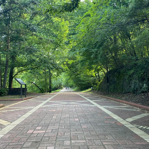
The trails in Acadia National Park tell a story carved by ancient glaciers and by the hands and hearts of the people who have called this place home. Long before it became a hiker’s paradise, Mount Desert Island was the ancestral homeland of the Wabanaki people, who paddled the rocky shores and named the mountains and waters that still define Acadia’s wild beauty. Later came the “rusticators” — artists, writers, and dreamers of the 19th century — who found inspiration in its rugged cliffs and helped spark a movement to protect it.
Before it became known as Acadia, this park had many names…Pemetic, Sieur de Monts, and Lafayette. The area in, and around, Arcadia, began colonization in the late 1700’s. By the early 1800’s, farming, foresting, fishing, and shipbuilding became the major occupations. Hundreds of acres of trees were deforested to make wood products. Farmers began growing crops like wheat, rye, corn, and potatoes. By the mid-1800’s, fishermen and sailors focused on creating a life on the sea. And word got around about the natural beauty of the area, so tourism also became a part of early life in Acadia.
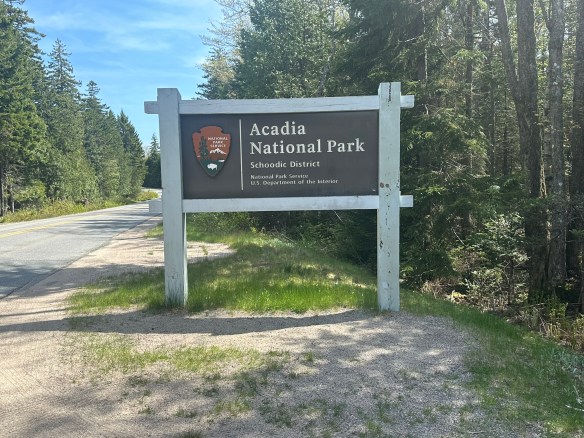
Photo by S. Resendez
Charles W. Eliot, George B. Dorr, and John D. Rockefeller presented 5,000 acres to the American people in the form of a national monument, which was signed into effect by President Woodrow Wilson. At the time, the park was under the name, Sieur de Monts. More property was donated by wealthy patrons, many of them affluent women, and efforts continued to obtain full national park status. In 1919, President Wilson signed the act establishing Lafayette National Park and Dorr became the first park superintendent. In 1929, congress authorized the National Park Service to accept a donation of land on the Schoodic Peninsula and that was when the park’s current name, Acadia National Park, was adopted.
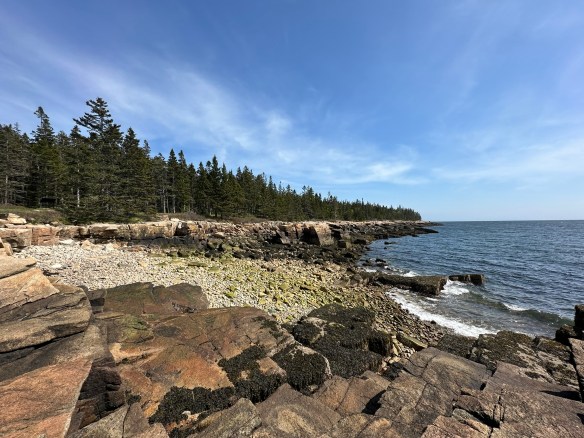
Photo by S. Resendez
Acadia National Park preserves approximately 50,000 acres in Maine. Ecosystems contained within Acadia include mountains, shorelines, forests, lakes and ponds, steams and watersheds, marshes, swamps, and wetlands. It boasts. more than 1,100 plant species and diverse wildlife from microorganisms and larger animals. It is currently, as of this writing, the 10th most visited national park.
Acadia National Park is usually open 24 hours a day but check the website for specific information regarding operating hours for the visitor’s center. Summer is the busy season but it’s always good to plan in advance because you never know when things might change. Acadia is a huge park and while there are many areas that are accessible to people with disabilities, there are also many areas that are not accessible. The best way to check is to go directly to their accessibility page for specific information.
Photo by S. Resendez
MILE MARKER: Did you know that Acadia National Park was the first national park created entirely from private land donations? Also, Acadia’s famous carriage roads were built by John D. Rockefeller Jr., not for cars, but as a refuge from them. He even designed the roads and bridges to blend naturally into the landscape, using local granite and hand-carved details.
HIKE IT!: There are SO MANY hikes in Acadia, there’s not enough room to list them here. It’s a good thing that Acadia’s NPS website has a whole page that sorts all the hikes for you! Find your favorite hiking trail by location, by environment, by route, or by public transportation. Look here for links that will take you straight to the information you need to hike your hike.
In the mid-1800’s, California was the place to be. Gold had been discovered. The race was on to get the gold and nothing would stand in the way of the prospectors looking to get rich. As is usually the case, there were some obstacles in the way, namely people.
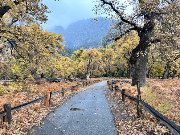
Bridal Veil Falls
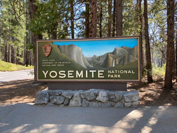
Photo by S. Resendez
The Indigenous people of Yosemite Valley called the valley “Ahwahnee” or “gaping mouth-like place”. The Ahwahnee lived in the area for thousands of years, developing a deep, reciprocal relationship with the land, but were eventually devastated by illness and displaced by settlers and park officials. In the end, the Mariposa Battalion, a Euro-American militia entered the area and drove the native Ahwahneechee people onto reservations,
As more people made their way into California, specifically Yosemite Valley, hotels, inns, and stagecoach companies began catering to the early tourists. In 1864, Yosemite was recognized by the federal government as someplace that should be protected. Abraham Lincoln signed the Yosemite Grant, placing Yosemite under the protection of the state of California.
President Teddy Roosevelt and John Muir standing on rock at Glacier Point, Yosemite, May 1903; Yosemite Falls and cliffs of Yosemite Valley in distance.
Photo courtesy NPS [RL012904]
In 1903, President Theodore Roosevelt visited Yosemite and guided by naturalist John Muir, spent three nights camping in the Mariposa Grove and later, in a snowstorm near Sentinel Dome, then finally in a meadow near the base of Bridalveil Falls. This stay led Roosevelt to expand federal protection of Yosemite, and it inspired him to sign into existence 5 national parks, 18 national monuments, 55 national bird sanctuaries and wildlife refuges, and 150 national forests.
Yosemite National Park is open 24 hours per day, 365 days per year. The Hetch Hetchy area is only open from sunrise to sunset (except for permitted backpackers). There are other park entrances but check the website to see whether or not they are open. All day visitors must exit Hetch Hetchy by sunset. The road is also closed to all vehicles (including backpackers) from sunset to sunrise. Yosemite National Park covers nearly 1,200 square miles (3,100 square km) in the Sierra Nevada, with elevations ranging from about 2,000 feet (600 m) to 13,000 ft. The welcome center is located next to the Yosemite Village Parking and the Village Store in Yosemite Valley. Get help planning your visit and pick up free trail maps, junior ranger booklets, and more at the welcome center. Hours are 9:00 AM–5:00 PM and the Village is open year-round.
El Capitan
Photo by S. Resendez
Things to do are numerous but if you’re visiting during the busy season, you need to make sure you plan ahead. Planning your visit will help to make sure you’re able to see everything you want to see while you’re there.
MILE MARKER: Did you know that some of the Buffalo Soldiers that were stationed at Fort Davis were stationed to park protection duties? After their frontier service, many Buffalo Soldiers were assigned to protect the newly formed national parks, including Yosemite. Between 1891 and 1913, soldiers from the 9th and 24th Cavalry, among others, served as the official administrators and park rangers in Yosemite.
HIKE IT!: There are a million things to do in Yosemite but hiking is the penultimate experience here. In and around Yosemite Valley, there are several day hikes rated easy to moderate that range from 0.5 miles all the way to 13 miles. There are also some shorter, more moderate hikes, that have elevation but if you plan ahead, you can check out the information and get yourself on a trail that suits your abilities. If you’re looking for trails outside of Yosemite Valley, check out Yosemite’s page all about the hiking trails. You’re sure to find something that suits your hiking style.
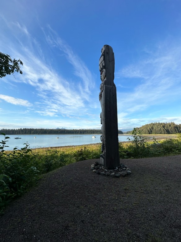
Glacier Bay National Park and Preserve is more than a stunning wilderness—it’s a living story of ice, culture, and resilience. Once completely covered by massive glaciers, this area is still reshaping itself, revealing dramatic fjords and thriving ecosystems. Home to Tlingit heritage sites, soaring mountains, and wildlife from bears to humpback whales, Glacier Bay invites you to explore its past while experiencing its raw, untamed beauty.
Photo by S. Resendez
The time when the gradual shifting of glaciers began is now referred to as “The Little Ice Age”. It lasted for approximately 550 years and in addition to the extreme cold, there were periods of extreme climate fluctuation that made it difficult for any human beings to survive and thrive. Food scarcity and famine, disease and unrest, plagued the native populations and for at least the last 100 years into the late 1800’s and early 1900’s, the Tlingit people were forced to gradually move off their ancestral lands.
But the shifting of the glaciers also brought out the mysteries of the land and suddenly, a new ecosystem was created which brought attention to the area in and around what we now call Glacier Bay. In 1925, when Glacier Bay became a National Monument, the land in and around Glacier Bay was the ancestral home to the four clans of the Huna (Hoonah) Łingít. In its attempt to preserve and conserve the natural beauty at Glacier Bay, the National Park Service (NPS) fostered new federal laws that severely impacted the lives of the indigenous people. Where they were once free to hunt, fish, and forage the land, new restrictions now curtailed, if not outright prohibited, the Huna Łingít’s ability to live freely on land that was once an integral part of their everyday lives.
Photo by S. Resendez
In December of 1980, President Jimmy Carter signed the Alaska National Interest Lands Conservation Act that created Glacier Bay National Park and Preserve. After becoming a national park, the National Park Service and Hoonah Indian Association, began working together to reestablish and reinvigorate traditional and cultural activities. There remains a concerted effort to collect and preserve oral history amongst the Hoonah. And on the shores of Bartlett Cove, a cooperative venture led to the first tribal house to honor the Glacier Bay since Łingít villages were destroyed by the moving glacier 250 years ago. The Huna Ancestor’s House is open to park visitors and provides opportunities to learn about Huna Łingít history, culture, and their ancestral way of life.
Accessibility: Bartlett Cove has a few short trails, a public dock, campground, Glacier Bay Lodge with the Park Visitor Center on the second level, and the Visitor Information Station. These pathsare not paved, and may have exposed roots and rocks. The Tlingit Trail provides a wheelchair accessible gravel path between the public dock parking area and the front of the Huna Tribal House. While navigable by many new wheelchairs, not all trails meet ADA standards. There is also a beautiful wooden boardwalk that provides access to a viewing deck overlooking a serene pond. This 1/2-mile section of the Forest Trail is accessible and easy to negotiate. For more detailed information about accessibility, visit the Glacier Bay National Park and Preserve website.
MILE MARKER: When Captain George Vancouver sailed by in 1794, he didn’t discover Glacier Bay as we know it — because it was completely covered by ice. A single glacier more than 100 miles long and 4,000 feet thick filled the entire bay. By the late 1800s, the ice had already retreated over 30 miles, revealing the stunning fjords and waterways we see today.
HIKE IT!:Several hiking trails are available to hike during your visit to Glacier Bay. You can view, or print, Bartlett Cove Trails Map for a simple visual of the shorter hiking trails. You can also visit the hiking page at the Glacier Bay NPS site. The best known hike at Glacier Bay would probably be the Forest Trail. It’s a 1 mile loop trail that’s rated as easy. The terrain is mostly flat and trail surface varies between dirt, gravel and boardwalk. There are benches and viewing platforms so factor in time to have a seat and enjoy nature. There is also a ranger led guided walk along this trail every afternoon.
View of the Shenandoah River from the Murphy-Chambers Farm Overlook.
Photo courtesy of NPS/Autumn Cook
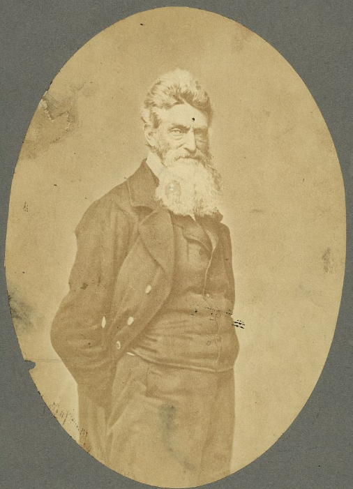
Near the area where the Potomac and Shenandoah rivers meet, a group of nineteen men, led by Captain John Brown, invaded the arsenal at Harpers Ferry. The group then took several of the residents of the surrounding neighborhood as prisoners, while emancipating several slaves, and held off United States troops, under the command of Colonel Robert E. Lee, for almost 30 hours, before finally being captured, wounded, or killed. Captain John Brown was captured, tried, convicted, and executed for high treason and inciting slaves to insurrection. While this endeavor appears to have been a failure, the actions of the Captain and the men who accompanied him helped to launch the United States into the Civil War.
Captain John Brown
Photo by S. Resendez
Because Harpers Ferry was chosen by George Washington to be the location of the 2nd national armory in the US at that time, Harpers Ferry was a prime spot for a faction to seize control. Between 1861 and 1865, the town of Harpers Ferry changed hands eight times. Strategically located at the confluence of two rivers and two railway lines, the arsenal at Harpers Ferry and its strategic location made it a hotbed of invasion and occupation that continued throughout the Civil War. In October of 1867, after the Civil War, Storer College was founded. It became the first higher education institution in West Virginia open to African Americans.
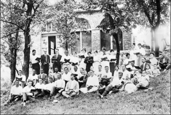
From 1909-1968, John Brown Fort stood on the site of Storer College on Camp Hill in Harpers Ferry. In this circa 1915 photograph, Storer College students, faculty members, and their families pose in front of the fort during an evening choral session. Year: 1915. Image Credit: Historic Photo Collection, Harpers Ferry NHP.
African American families continue to maintain their deep connections to the area in and around Harpers Ferry and today, more than 250 years after the first family settled the area, Jefferson County still boasts the longest established African American community in the state of Virginia.
In 1944, Harpers Ferry National Monument was authorized by Congress and in 1963, the park was renamed Harpers Ferry National Historical Park. Today, Harpers Ferry is not only a significant historical site, it also boasts a wide and varied ecosystem that encompasses a deciduous forest, flood plains, mountains, rivers, streams, wetlands, marshes, and swamps. “The park is home to approximately 14 amphibian,18 reptile, 36 mammal, 30 spider, 43 fish, 174 bird, and 276 insect species.”
Harpers Ferry National Historical Park is open year round with the exception of Thanksgiving Day, December 25, and January 1. The Visitor Center is located at 171 Shoreline Drive, Harpers Ferry, WV 25425 and is open daily from 9a to 5p. Shuttle buses run every day the park is open, every 10-15 minutes. Park museums/exhibits and restrooms in the historic Lower Town are open daily from 9 a to 5 p. Hours change seasonally so make sure you visit the website or call for the most up to date information.
Accessibility: The park has two wheelchairs available that may be borrowed by visitors upon request. The park’s shuttle buses are equipped for those with physical limitations. The buses kneel and have lifts to accommodate those who are unable to utilize the stairs. For more details on accessibility for physical, hearing loss, low vision/blindness, please check the website.
MILE MARKER: Harpers Ferry is an anchor point on the Lewis & Clark National Historical Trail. It served as the starting point for the Corps of Discovery’s journey westward on the Lewis & Clark Expedition in 1803.
HIKE IT!: There are several trails with varying levels of length and difficulty ranging from 1 mile to 6.5 miles long. Be sure to check out the hiking page of the Harpers Ferry NPS website for detailed information on the hikes and the Appalachian Trail!
Loudoun Heights Trail in the fall
Photo courtesy NPS / Volunteer Devin Taggart
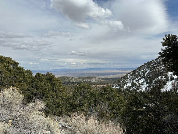
We recently took you to a place called Big Thicket National Preserve that highlighted a wealth of biodiversity in Texas. Today, we’re going to talk about another place that also encompasses a diverse sample of nature that will take you underground into caves, through the desert, hiking through pine trees, into mountains, and traversing through the stars! Today, we’ll be talking about Great Basin National Park in Nevada!
The first people documented living in the Great Basin area were what archeologists call the Paleo-Indians. For over 12,000 years, these people were thought to be big game hunters with no permanent houses because they were nomadic and followed the animal herds. The next group to occupy this area were referred to as the Great Basin Desert Archaic. This group were hunter-gatherers who also followed animal herds but collected native plants but also learned how to use grinding stones to process seeds. They used their crafts to trade with other peoples.
These groups eventually led to the Fremont and Shoshone cultures, with the Shoshone still living in the area today. In addition to the Shoshone, the Ute, the Paiute, the Goshute, and the Washoe also inhabited this region. Small family groups hunted and subsisted on the land and its natural resources. The people were early hunters and gatherers who eventually learned to farm and fish. Everything they needed to survive and thrive was available to them in the Great Basin.
Photo by S. Resendez
Trappers, miners, and military expeditions found their way to Great Basin area in the mid-1800’s. Immigrants may have passed through the area as they made their way to California for the gold rush. Ranching was established soon after the gold migration. Mining expeditions also discovered gold and silver which resulted in mining operations inside the Great Basin and just outside the region. Ranching was established in the late 1800’s and continues today.
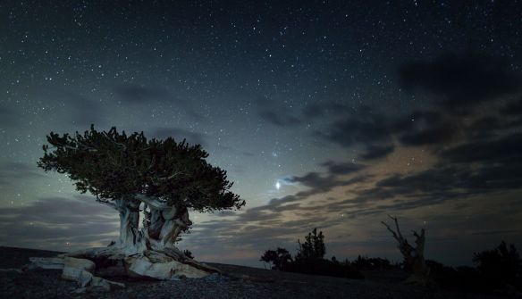
There are many things to do at Great Basin National Park. The ecosystem is diverse and plays host to 11 species of conifer trees, 73 species of mammals, 18 species of reptiles, 238 species of birds, 8 species of fish, and over 800 species of plants. The biodiversity ranges from desert valleys, mountain ranges, caves, a forest, an alpine environment, and even a glacier. And, if that weren’t enough, in 2016, Great Basin National Park was recognized as a a Gold Tier International Dark Sky Park by the International Dark Sky Association. This means the skies over Great Basin are some of the most pristine and clear night skies in the U.S. On a moonless, summer night, if the sky is clear, you may be able to see not just stars, but planets, satellites, meteors, the Milky Way, and the Andromeda Galaxy, all with the naked eye! Don’t forget, there’s also Lehman’s Cave to explore, hiking, and fishing…this park warrants a multi-day visit!
Mount Washington Bristlecone
Courtesy of NPS Great Basin National Park–Photo by Kelly Carroll
Accessibility: The park currently features two trails that are built to ADA standards and are accessible with a standard wheelchair. For information on all trails, go to their hiking page and for more specific information on ALL accessible areas in the park, go to the park’s accessibility page.
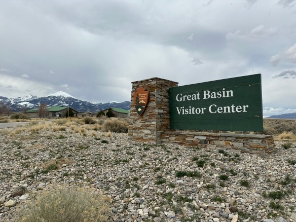
Great Basin National Park’s grounds are open 24 hours a day, year round to hiking, stargazing, and camping. The park’s Visitors Center is located just north of the town of Baker on the west side of NV Highway 487 and is open every day between the hours of 8a–5p. In the summer, the Great Basin Visitor Center is open daily. The Lehman Caves Visitors Center is located 5.5 miles up from the town of Baker, NV from 8a–5p. In the summer, Lehman Caves Visitor Center is open extended hours. Hours may change seasonally for both visitors centers, so make sure you check on their webpage before heading out. The Plan Your Visit page does a great job of letting you know what to expect during each season. It’s worth reading through it if you plan to visit outside of the summer months. Interested in stargazing and astronomy? The website’s Astronomy page highlights their ranger programs for all visitors and the associated rules.
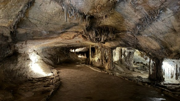
Lehmans Cave–Photo by S. Resendez
MILE MARKER: Great Basin National Park has some of the most interesting, naturally occurring resources in the U.S. For example: Some of the bristleconepines here are over 4,000 years old. Also, there’s a hidden glacier here! Despite being in the Nevada desert, the park has a tiny glacier tucked into the shadow of Wheeler Peak, the southernmost glacier in the U.S.
HIKE IT!: There are numerous hiking trails in Great Basin. The hiking page on their website does a fantastic job of breaking down hikes by location and/or by ability. They also have a downloadable map site with all the trails topographical maps as well as advice about hiking in winter. It’s a great way to plan your hike and what you’ll need for it before you get out there.
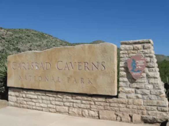
Carlsbad Caverns Entrance Sign
Photo courtesy of NPS
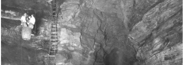
Imagine a time when, if you wanted to travel down into Carlsbad Caverns, instead of hiking or taking an elevator down, you had to load yourself up into a big, old, guano harvesting bucket and have people lower you down. Would you do it? At one time, lots of people did! People wanted to know what sort of world was beneath the surface of the earth. What lives down there? What does it look like? What is it like to be below the surface of the earth?!
Entering Carlsbad Caverns via guano mining bucket
Photo courtesy of NPS
There was enough intrigue and curiosity about these caverns that in October of 1923, President Calvin Coolidge put out a proclamation denoting Carlsbad Caverns a National Monument. What is interesting about that proclamation is that even while recognizing Carlsbad as something that needed to be preserved, its size and depth were still not fully known. The proclamation itself uses phrases like, “extraordinary proportions” and “vast chambers of unknown character and dimensions” and even notes that there was, at that time, one entrance but also included “such other entrances as may be found”. Despite the unknown aspect, everyone recognized that it was in our nation’s best interest to protect this cave. In May of 1930, Carlsbad Caverns was fully established as a National Park.
Since then, we have learned that Carlsbad Caverns encompasses over 300 limestone caves in what was discovered to be a fossil reef that was “laid down by by an inland sea about 265 million years ago”. Above ground, there were signs that the land in that area had been utilized by Indigenous people, probably Mescalero Apaches, as early as 1200-1400 years ago. Spanish explorers showed up in the mid-1500’s and laid claim to the area. Eventually, as the Spaniards left, settlers worked their way through the Guadalupe Mountains. As time passed, travelers stopped in and around the general area and began to build ranches and farms. In 1898, a 16 year old farmhand by the name of Jim White entered the cave for the first time. Jim White eventually became the main guide to reporters, photographers, geologists, and geographers who wanted to learn more about the caverns. After passing away at the age of 63, for his exploration, guide services, and promotion of sharing the caverns with the public, he was unofficially honored with the title of “Mr. Carlsbad Caverns”.
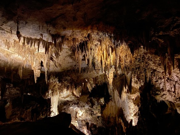
Stalactites and Stalagmites…they still confuse me.
Photo by S. Resendez
In 1925, the first trail into the cave was built, eliminating the need to be lowered in a guano bucket. In 1963, the bat flight amphitheater was built at the natural entrance and began allowing visitors to sit and watch the bats take flight.
Today, if you’d like to visit Carlsbad Caverns National Park, you will need to go to their official NPS website and look for information on how to make a timed reservation or call 877-444-6777. In addition to making your timed reservation, expect to pay your entrance fee and to bring your ID along with your timed pass when it’s time for your visit. Cavern entrance hours are from 9:30a to 2:30p with the last reservation time being 2:15p.
Bat Flight Amphitheater
Photo courtesy Carlsbad Caverns NPS / Peter Jones
If you’re only interested in watching the bat flight, you won’t need a reservation and there is no fee but seating at the amphitheater is first come, first serve, so get there early if you want to make sure you’ll have a place to sit. The bat flight program is held every evening from April through October. Bat flight takes place at the Bat Flight Amphitheater, which is located at the Natural Entrance to Carlsbad Cavern. The start time for the program changes as the summer progresses and sunset times change so make sure you check on the website before you head out. Bat flight programs may also be canceled due to inclimate weather, so again, check ahead of your visit! **Insider Tip** The best bat viewing months are August and September when baby bats born earlier in the summer begin flying with the colony. Also, migrating bats from colonies further north often join in the flights. Are you a morning person? Early risers (approx. 4-6 a.m.) can watch for the bats as they re-enter the cavern! Bat entrances often come with spectacular dives from heights of hundreds of feet. Remember: To protect the bats, electronic devices are not allowed at the Bat Flight Program and surrounding area. Electronic devices include cameras of any kind, laptop computers, cell phones, iPads, iPods, tablets, and MP3 players.
Bat Flight from inside Natural Entrance
Photo courtesy of Carlsbad Caverns NPS / Peter Jones
If you’ve never been to Carlsbad Caverns, the NPS website offers a webpage designed for first time visitors. Make sure you visit it for more detailed information about what to expect for your visit to the cave. Visitor hours are from 9a to 5p. Cave hours are from 9:30a to 2:30p. The last elevator coming OUT of the cavern is at 4:45p. If you decide you’d prefer to hike out, you must begin by 2:30 pm and plan to completeyour hike out by 3:30 pm.
Accessibility: The Natural Entrance Trail is not Americans with Disabilities Act (ADA) compliant due to its steep grade (15%–20%) and therefore not accessible with wheelchairs; however, the Big Room Trail is accessible by elevator once you enter the underground rest area. This is a “one mile trail that is wet from dripping water and can be slippery, bumpy, uneven, and difficult to navigate. It is not Americans with Disabilities Act approved and should only be attempted with assistance. Maps defining the wheelchair accessible areas can be obtained in the visitor center. Due to steep grades and narrowness of the trail, barriers, and signs have been installed to note the portions that are inaccessible in a wheelchair.” There is an accessibility guide brochure available at the Visitor Center with more detailed information.
MILE MARKER: Did you know that Carlsbad Caverns was part of an ancient fossilized reef in a long-gone inland sea?! Instead of fish, coral, and sea sponges, you now have towering stalagmites, stalactites, and weird cave formations made from limestone that was once alive with marine life. You’re literally walking through the skeleton of a prehistoric ocean!!
HIKE IT!: If you decide to venture into the caverns and choose to walk down using the Big Room route instead of taking the elevator, you will have hike approximately 1.25 miles. The walk is relatively flat and will take you approximately 1.5 hours to (average) to walk. There is a shorter route available which is about .6 mile and will take approximately 45 minutes (average) to complete. Only clear water is allowed in the cavern. Also, hiking sticks are not allowed unless medically necessary. If you’re interested in a surface hike, there are trails in and around the area. Check here for back country trail information prior to making your plans as some of these trails have been subject to repair and renovation after a flood in 2022.
Got questions? We might have some answers!! Tune in for a short chat about questions or comments some of you have mentioned either on our Facebook Page, YouTube, or Instagram.
This episode, we’ll be discussing…
What’s the difference between walking and hiking?
What is your favorite small park?
Would we ever consider doing guided hikes?
What’s the difference between an NPS Park Store and an affiliate store?
Can you take things from National Parks?
Who decided gold was the standard of wealth back in the gold rush days?
If you have any other questions or comments, feel free to write them below. If you let us know, we’ll hand out some more trail mix in a future podcast. Thanks for listening!
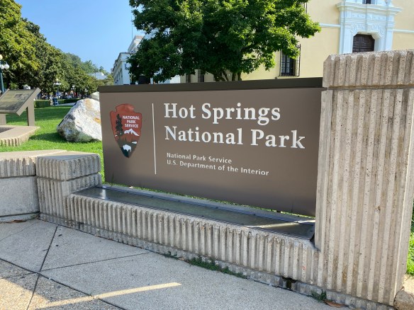
Ahhhhh…do you like it steamy?! If so, have we got a place for you!
Photo by S. Resendez
Indigenous people have been quarrying stone from this area of Arkansas for thousands of years. After an exploration expedition in 1804, sent by President Thomas Jefferson, the hot springs were discovered and shortly afterwards, Europeans arrived and began utilizing the geothermal springs. There was talk that the spring waters had healing abilities. A town grew in the area of the springs that later became known as Hot Springs. The resulting bathing industry was built around the geothermal springs coming from the Hot Springs Mountain. This later became known as the “American Spa”.
In 1832, President Andrew Jackson signed legislation to preserve “…four sections of land including said (hot) springs, reserved for the future disposal of the United States (which) shall not be entered, located, or appropriated, for any other purpose whatsoever.” This proclamation meant that Hot Springs National Park was actually the very first, and now the oldest, national park in the current national park sites. Unfortunately, there was no accompanying legislation that prohibited building or settling in or around the area, which meant that people continued to build around and over the springs.
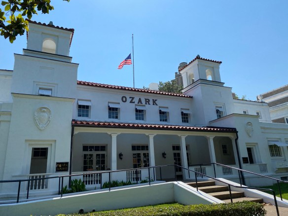
Ozark Bathhouse
Photo by S. Resendez
Victorian bath houses built between 1880-1888 were considered large and luxurious, but by the early 1900’s, they were eventually replaced with fire-resistant brick and stucco. This was a precaution due to a severe fire in 1878 which decimated south and central downtown Hot Springs. In contrast to the previous structures, these newly built bath houses featured marble walls, billiard rooms, and gymnasiums. The culmination of changes to Bathhouse Row was completed when the Lamar Bathhouse opened its doors for business in 1923. These bathhouses are all still standing today.
After the Civil War reconstruction era, African Americans found that they could work at the bath houses but they still could not receive services from the bathhouses so they built and maintained many of their own bath houses. African American bathhouse attendants were an integral part of the bathing industry in Hot Springs. They organized to protect their pay and professions from exploitation. And in the early 1900’s, African American residents built the first bathhouse used exclusively by African Americans. For a more in depth look at how African Americans impacted the bathing industry at Hot Springs, visit the NPS link about Bathhouse Attendants at Hot Springs National Park.
The Grand Promenade
Photo by S. Resendez
Take a short walk along the Grand Promenade. This walk runs behind the eight bathhouse buildings that were built between the years 1892-1923. Most of these buildings are open to the public with Fordyce functioning as the park’s visitor center. They can be accessed from Central Avenue. The Fordyce Bathhouse is open every day from 9:00-5:00pm, with the exception of Thanksgiving Day, Christmas Day, and New Years Day.
Today, there are only two bath houses where you are permitted to soak in the springs: the Buckstaff and the Quapaw. There are no entrance fees for the park but because this park encircles a city, you will probably have to pay for parking somewhere in the general area. This is one of the national parks that allows pets! Pets are welcome in the park and on the trails but not in the federal buildings. There is a cell phone tour available for Bathhouse Row so you can stop and listen along the way. If you decide to visit in the summer months, be prepared for the heat! Drink lots of water and wear a hat!
Accessibility: The Fordyce Visitor Center, Gulpha Gorge Campground, other park buildings, and all park bathrooms have functional ramps and are accessible to all persons. Bathhouse Row is paved and has a four to five foot wide walkway that creates a circular loop around the block. There are benches with backs along the Grand Promenade if you need to sit down and rest. There are two wheelchairs available to loan free of charge for use in the Fordyce Bathhouse Visitor Center and Museum. There are tactile exhibits along with self-guided tour books in braille as well as audio descriptions some exhibits and the park films. ASL interpreters are available for guided tours, but you must submit a request two weeks in advance. There are two accessible trails in the park. The Grand Promenade is a half-mile (one-way), fully paved trail with ramp access off Fountain Street and another behind the Fordyce Bathhouse. Whittington Park Trail is a 1.2 mile gravel trail that is a flat but unpaved loop.
MILE MARKER: The water in the hot springs is over 4000 years old! The thermal water that bubbles up in the park today fell as rain over 4,000 years ago. It percolates deep underground, gets heated by the earth’s geothermal energy, and reemerges through the Hot Springs Fault. So when you step into those bathhouses, you’re literally soaking in ancient rainwater!
HIKE IT!: There are over 20 miles of hiking trails in and around the Hot Springs National Park! Levels vary but there are plenty of options for anyone looking to get out of the city and into nature. Paper trail maps can be obtained at the Fordyce Bathhouse and Visitor Center and digital maps with real-time GPS location are available by downloading the service-wide NPS App. Make sure you check at the visitor center before starting your hike just in case there have been any updates or closures.
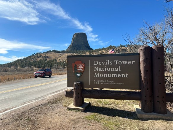
Many people will look at this towering section of striated stone and think to themselves that it looks familiar, even if they’ve never been there. Yes, this is the site made famous in the Steven Spielberg 1977 movie, Close Encounters of the Third Kind. But before it became a focal point of a movie about contact with extraterrestrials, it was famous in its own right. The Devils Tower National Monument, also known as Bear Lodge, was dedicated by President Theodore Roosevelt as America’s first national monument in 1906.
Photo by S. Resendez
There are a multitude of theories surmising how the tower came to be. In reality, all theories agree that the tower did not start out as a tower. In fact, the structure began beneath the earth’s surface and was created from magma that came to be in its current state via erosion. We will probably never know which theory regarding the actual creation is correct due to the fact that the erosion essentially eliminated the evidence to substantiate any theory.
Photo by S. Resendez
Despite questions surrounding its creation, the physical tower is imposing. Devils Tower is 1,267 feet (386 m) tall and sits above the Belle Fourche River. It is the world’s largest example of columnar jointing. It is considered a sacred place for over 20 Native American tribes and ceremonies are still held there. As you walk on the trails, you may come across cloths or small bundles attached to the trees. These are Native American prayer cloths and represent the spiritual connection some tribes have with the Tower. Do not touch, disturb or remove the prayer cloths. Also, it is considered culturally insensitive to photograph these prayer cloths.
Park roads and trails are open 24 hours/day. Visitor Center/Library summer hours are from 9a to 6p. Hours change by season so if you want to see the visitor center, make sure you verify on the website before going. The park usually sees around 500,000 visitors per year; over 80% of whom come between Memorial Day and Labor Day (late May to early September), so plan accordingly.
Parking is very limited. The park often experiences maximum parking capacity for several hours every day throughout the summer (usually between 10a-3p). There is a map and a suggestion to park outside the park and hike into the visitor’s center, if you don’t want to deal with the parking issue.
Accessibility: The Visitor Center is wheelchair accessible and can accommodate wheelchairs up to 35 inches in width. Accessible restrooms are available. While the trail loop is paved, steep grades mean the trail is not recommended for wheelchair users.
Photo by S. Resendez
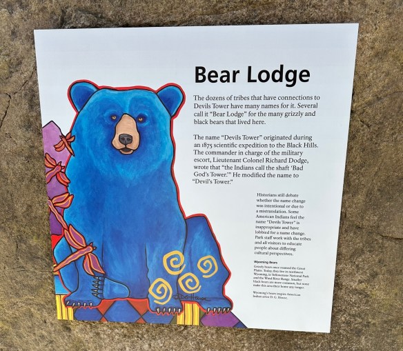
MILE MARKER: The word for devil/evil spirit is Wakansica. It can be translated as “bad god” or “evil spirit”. The Lakota word for black bear is Wahanksica. It is possible that the name Devils Tower, which is called “Bear Lodge” in Lakota, came about due to a mistranslation of “Wahanksica” for “Wakansica”. It is also possible that Colonel Richard Irving Dodge, a man who publicly advocated for the genocide of Native Americans, ascribed the name Devils Tower to this sacred mountain merely to offend and disrespect indigenous tribes. To find out more about the movement to restore the original Native American name of Devils Tower back to Bear Lodge, click here.
HIKE IT!: There are several hiking trails in and around the Devils Tower. The most popular is the Tower Trail but there are plenty of other hiking trails for hikers of different levels to enjoy. The NPS website for Devils Tower does a great job of breaking down the hiking trails based on how much time you think you plan on spending at the park. Make sure you check it out and plan your hike ahead of time!
Got questions? We might have some answers!! Tune in for a short chat about questions or comments some of you have mentioned either on our Facebook Page, YouTube, or Instagram. If you have any other questions or comments, feel free to write them below. If you let us know, we’ll hand out some more trail mix in a future podcast. Thanks for listening!