Through Fields of Fire and Footpaths: Gettysburg National Military Park

Photo by S. Resendez

Gettysburg is where the nation turned and where a battlefield became sacred ground. Gettysburg National Military Park preserves the site of the Battle of Gettysburg (July 1–3, 1863), the bloodiest battle ever fought on American soil and a turning point in the Civil War. More than 51,000 soldiers were killed, wounded, captured, or declared missing in just three days. The battle ensued across rolling farmland, rocky hills, orchards, and small town streets. The battle erupted almost accidentally when Confederate troops encountered Union cavalry near the town of Gettysburg, Pennsylvania. What began as a scouting expedition quickly escalated into a massive three-day engagement involving over 165,000 soldiers.

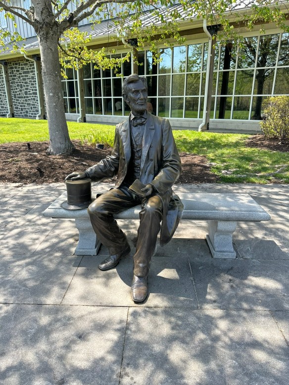
After the battle, local citizens worked to recover bodies and care for the wounded. A Soldiers’ National Cemetery was created for Union dead. It was here that President Abraham Lincoln delivered the Gettysburg Address in November 1863 — redefining the war as a struggle not just for union, but for equality and democracy.

Photo by S. Resendez

The Battle of Gettysburg is important for several reasons:

  • It Stopped the Confederate Invasion of the North–General Robert E. Lee hoped to win a major victory on Northern soil, potentially forcing peace negotiations. Instead, his army suffered devastating losses and had to retreat back to Virginia.
  • It Shifted Momentum Toward the Union–After Gettysburg, the Confederacy never again launched a full-scale invasion of the North. The Union gained confidence and strategic advantage.
  • It Redefined the Meaning of the War–Lincoln’s Gettysburg Address framed the war as a fight for equality and democratic ideals — not simply preservation of the Union.
  • It Became a Symbol of Sacrifice and Unity–Gettysburg represents the cost of division and the power of reconciliation — something visitors still feel walking the fields today.
Stone wall on Cemetery Ridge
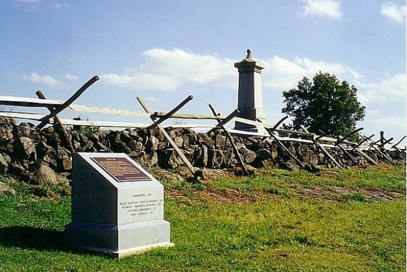
Photo courtesy of NPS

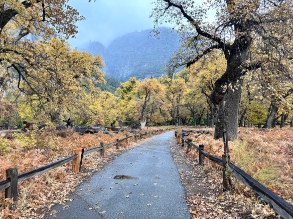
Today, the park protects over 6,000 acres, with more than 1,300 monuments, markers, and memorials, making it one of the most monument-dense historic landscapes in the world. Visitors can hike the same ridgelines and walk the same fields where Union and Confederate soldiers fought, often within feet of original stone walls, farm buildings, and cannon placements. It serves as a perfect junction for hikers and history lovers alike, it’s a rare place where the outdoors and American identity intersect.

Park hours for Gettysburg National Military Park are from sunrise to sunset. The battlefield and roads are open thirty minutes before sunrise to thirty minutes after sunset. Visitors can plan their visit and obtain a listing of sunrise and sunset times by day in Gettysburg, PA here. Visitor Center hours change by season so make sure you check the website for more detailed information.

MILE MARKER: Did you know Gettysburg almost became an amusement park?
In the late 1800s and early 1900s, parts of the battlefield were treated more like a tourist playground than sacred ground. There were trolley lines, picnic groves, dance pavilions, and even proposals for roller coasters and a Ferris wheel near key battle sites. Visitors could ride out to the battlefield for leisure outings, not reflection. It wasn’t until preservation groups and the federal government stepped in that large sections of the land were protected and restored to their historic appearance.

HIKE IT!: There are no hiking trails in the park but that doesn’t mean you won’t be getting your steps in. Places in the park like Gettysburg National Cemetery or taking a Gettysburg Battle Walk will make sure you get your exercise. Just check the weather and plan accordingly.

Hiking the Edge of Alaska: Kenai Fjords National Park

Photo by S. Resendez

Mountains, ice, ocean, and glaciers…have I left anything out?

Kenai Fjord National Park is located in south-central Alaska on the southeast coast of the Kenai Peninsula, primarily accessed from the town of Seward. It is situated about 130 miles (2.5-hour drive) south of Anchorage and is known as the place “where mountains, ice, and ocean meet,” featuring the massive Harding Icefield and coastal glaciers. It is one of the few Alaska national parks accessible by road and ies south of the Kenai National Wildlife Refuge and north of the Gulf of Alaska.

This part of Alaska has long been populated by the Sugpiaq (also known as Alutiiq) whom are often referred to as the “people of the seal.” They have lived in, and around, the Kenai Fjord area for over 7,800 years. They learned to rely on the ocean for food, clothing, and materials, using seal gut for waterproof parkas and harvesting such resources as mussels, clams, algae, and crustaceans. While these cultures and others subsisted on harvesting, gathering, preparing, and sharing wild foods, subsistence hunting is no longer allowed within the borders of the park because it is a national park and not a national preserve. However, subsistence practices are still allowed on corporation-owned lands within the park and its adjacent waters. The Sugpiaq/Alutiiq people still maintain a close relationship with the land and remain an integral part of the area.

There are three main areas of the park that provide opportunities to see the park through varied lenses:

  • Exit Glacier: The Exit Glacier area is the only part of the park accessible by road. This area also offers an opportunity to take a short, accessible, one mile loop hike that takes you to a panoramic vista of Exit Glacier spilling down from the Harding Icefield.
  • The Coastal Fjords:  Several local companies offer opportunities to see the park’s coastline, tidewater glaciers, and marine mammals up close. If you’d prefer to do it yourself, kayaking is also an option.
  • The Harding Icefield: This is the star of the show. During the last ice age, the immense pressure of glaciers from the icefield scoured the coastal mountains, carving deep, steep-walled valleys.
    As the climate warmed and the glaciers retreated, the ocean filled these U-shaped valleys, creating the characteristic steep-walled fjords. The combination of retreating ice and rising sea levels transformed the landscape, leaving behind a coastline where mountains drop directly into the ocean, sometimes descending 600 to 1,000 feet below sea level. If you’re the strenuous type, you can take a full day to hike the strenuous 8 mile round trip trail. Mountaineering here is also an option if you’re a mountaineer with several outfitters and guides to assist in the planning. Probably the best way to view the Harding Icefield would be from the sky, with flightseeing overflights. More information for those flights can be found at the Seward Chamber of Commerce.

Kenai Fjords National Park is open year round. The primary months to visit are June, July, and August. There are reduced services in the area during the months of May and September. The Visitor Centers are open from Memorial Day weekend (last weekend of May) through Labor Day (first Monday of September) unless otherwise noted.

Being at Kenai Fjord National Park is about moving through a landscape shaped by ice, animals, and generations of people who learned to live with both. Whether you go for the trails, the scenery, the wildlife, or the cultural echoes of this rugged coastline, Kenai Fjords teaches us to move slowly and enjoy creation.

MILE MARKER: Would you believe that the Harding Icefield contains remnants of the vast Pleistoscene ice sheets that once covered much of Alaska?! The Pleistocene Ice Age occurred from approximately 2.58 million to 11,700 years ago.

HIKE IT!: There are only two maintained trails in Kenai Fjords National Park. They are the connected Exit Glacier Trails and Harding Icefield Trail. The trailhead for both starts just beyond the parking lot at the end of Exit Glacier Road. Make sure you check out the local conditions as you plan your trip to the park.

Land of Standing Stones: Discovering the Magic of Chiricahua National Monument

Photo by S. Resendez

We’re here again. We’re in a place settled long, long ago by people who migrated to North America thousands of years ago across the Bering land bridge or by sea. Their ancestral homeland was believed to be around modern-day Siberia/Mongolia, eventually settling across Alaska, northern Canada, and the American Southwest. Their migrations occurred in waves, with later groups moving south and east from an initial Alaskan settlement, adapting to diverse environments from subarctic forests to desert regions. These people are the Athabaskan people. We mentioned them in our episode about Canyon de Chelly.

As these people made their way down to what we now refer to as the Southwestern United States (between 1400 and 1500), the Chiricahua eventually settled in what is now southeastern Arizona, southwestern New Mexico, and northern Mexico in the Sonoran and Chihuahuan Deserts. The Chiricahua people are named after the Chiricahua Mountains in southeast Arizona. The Apache Indians were only one of the bands of Chiricahua Indians that evolved into different clans.

As it was, and still seems to be, the way of the United States to take what belongs to someone else (for more current information, see “Greenland”) the Apache Wars of 1861 culminated, after 24 years, in the creation of a reservation for the Chiricahua people that allowed them to live in relative peace until the death of Cochise, when the reservation was abolished and the people were forced to move to another reservation.

After the Chiricahua people were relocated, settlers and ranchers moved into the area and in the 1930’s, the Civilian Conservation Corp (CCC) came into the region and were responsible for the construction of many of the roads, parking areas, and trails. Many of the trails were built for recreation but some of them were designed specifically to allow access for firefighters.The Sugarloaf Trail, for example, has the dual purpose of providing fire lookout access as well as recreational opportunities. The Natural Bridge Trail was constructed for the sole purpose of firefighter access into Picket Park.

Photo by S. Resendez

Bonita Canyon Highway offers a beautiful 8 mile drive to Massai Point, the culmination of a road that was constructed by the US Forest Service in 1932. The road is a narrow mountain road with low hanging trees and small parking areas. If you’re hauling a trailer, your trailer must be disconnected to drive up through Bonita Canyon. Chiricahua National Monument is a “Dark Sky” park, so be prepared for some intense stargazing!

Chiricahua National Monument is located at 13063 E Bonita Canyon Rd, Willcox, AZ. The park is open 24 hours a day. Trails stay open for sunrise, sunset, and night sky viewing. Be aware of wildlife and use extreme caution. There is no entrance fee or pass required to enter. The visitor center, on the right 3.5 miles after the entrance, is open from 8:30 am to 4:30 pm. It has an information desk, museum, park film, and gift shop. It provides free maps, junior ranger booklets, and information.

Photo by S. Resendez

MILE MARKER: Chiricahua National Monument was formed by a single massive volcanic eruption about 27 million years ago. The Turkey Creek volcano released such an enormous ash cloud that the material hardened into rock, creating the towering hoodoos and balanced stones we see today. When you hike here, you’re walking through what was once a volcanic ash blanket—now sculpted into a stone forest by time and erosion.

HIKE IT!: Once again, the National Park’s website offers a great hiking page which breaks the hikes down into easy, moderate, and strenuous hikes. Five easy hikes about a mile or less will take you to some of the most scenic areas in the park! Don’t forget, though, there is elevation in this park so acclimate to the altitude by doing a short hike first!


Welcome to 2026!

We’ve got lots of good stuff in store for you in 2026!

More hiking! New trips! New interviews! If there is anything else you might like for us to review or any place you’d like for us to check out this year, leave a comment down below and we’ll do our best to get there.

If you’ve been enjoying our content, do us a favor and consider buying some merchandise from our Zazzle Store or dropping a little coin to buy us a coffee. We would really appreciate it.

Happy hiking. Now get out there and hike your own hike!

Wander the Petrified Wild at Petrified Forest National Park

Photo by S. Resendez

Imagine yourself in some open grasslands…the weather is humid and rainy. You can see that there’s a lush, beautiful forest nearby and in the river, there are large, expansive, trees growing in and around the river bottoms. The land is verdant and green. You’re actually standing in a flood plain. There are animals like wooly mammoth and giant bison roaming the area. This is the supercontinent Pangaea during the Late Triassic Epoch, over 225 million years ago. What we now recognize as the southwestern part of the United States.

Photo by S. Resendez

Over millions of years, as the continents moved, the land tilted and uplifted, and the climate changed significantly, transforming the environment from a tropical basin to an arid plateau. The trees in that forest eventually fell and became buried in the biorich sediment where mineral-rich water replaced the tree’s organic structure with minerals, and turned them into petrified logs. The gradual uplifting of the land (starting about 60 million years ago) created stress that caused the brittle, crystal-filled logs to fracture like glass rods, creating the segmented appearance. Continual erosion from wind and water eventually exposed the fossils and sculpted the surrounding badlands and colorful Painted Desert formations, revealing the landscape we see today.

The Paleoindian people lived in, and around, the area of the petrified forest and as the climate and environment changed, began to settle the area as evidenced by the pithouses that were built into the land to mark the need for more permanent housing. By this time, the geographical area resembled what we recognize today as the Southwest. By the 1500’s, Spanish explorers began making inroads in search of routes along the Rio Grande and the Pacific Coast. After becoming a part of the U.S. territories in the 1800’s, the army continued to seek routes to the Pacific coastline and in doing so, came across what would eventually become the Petrified Forest National Park.

The Petrified Forest is located within the greater Painted Desert. A variety of animals call this area of the U.S. home, including amphibians such as salamanders and toads; birds; insects; mammals such as fox, coyote, deer, and rabbits; and reptiles like lizards, skinks, horned toads, and snakes. There are also several hundred species of plants and trees throughout the park. Research and dig sites are a constant in the Petrified Forest as scientists continue to learn and provide scientific information about the park to park visitors. This park is best known for its Triassic fossils.

Petrified Forest National Park is open year round except for Thanksgiving and Christmas. Painted Desert Visitor Center and Rainbow Forest Museum & Visitor Center hours are from 8am to 5pm and the Painted Desert Inn National Historic Landmark Hours are from 9am to 4pm. Note: Arizona does not observe Daylight Saving Time, remaining on Mountain Standard Time year-round. For example, in the summer months, during Daylight Saving Time, the time in Arizona and California is the same, with New Mexico and the Navajo Reservation one hour ahead. As usual, always make sure you check ahead in regards to weather and possible closures. This is a pet friendly park!!! Dogs (on leash) are allowed on the trails and there’s even a dog park available. Stop by one of the Visitor Centers and get a BARK Ranger certificate for your furry friend!

Photo by S. Resendez

You can drive through the park in about an hour BUT there are plenty of short hikes that will allow you to see ancient villages, petroglyphs, giant logs, and petrified wood. This is the perfect park to see a lot with minimal physical investment.

MILE MARKER: Did you know Petrified Forest protects one of the richest Triassic fossil sites on Earth—not just fossilized trees, but early dinosaurs and evidence of some of the planet’s oldest wildfires? This park is far more alive than it looks!

HIKE IT!: There are several hiking trails of short to medium length available to hike in the Petrified Forest. The website’s trails page does a fantastic job of describing the trails and in giving you excellent insight into grades, cross slopes, and trial widths. Click on the link for the details.


Exploring the Cibolo Center for Conservation

Photo by S. Resendez

On our podcast, we’ve talked before about how the average person can make a difference in how our lands are cared for and conserved. You traveled with us to the Chihuahuan Desert Nature Center and saw how research, education, and conservation work cohesively. Now, let’s visit another beautiful area off Cibolo Creek in Boerne, Texas, that shows what a handful of people and a small city can do when they work together to preserve and conserve.

Photo by S. Resendez


In 1988, Carolyn Chipman Evans, her husband, Brent Evans, along with several friends, began advocating to restore and conserve a segment of Cibolo Creek. Gaining the support of the city of Boerne, the group brought the need for the conservation of their part of Cibolo Creek to the public and began a movement to create what eventually became the Cibolo Center for Conservation. With the purchase of the neighboring Herff Farm in 2007, and the creation of the Nest Nature School, the Center offers the local and surrounding community the opportunity to educate, hike, and garden. The Center provides a space for special events and exhibits, as well as a weekly farmer’s market. They serve more than 70,000 children, adults, and families a year.

Photo by S. Resendez

Cibolo Center for Conservation offers a plethora of outdoor learning programs for children, as well as opportunities for 18+ interns, educators, and adult education workshops for adults. Read all about it here.

Whether you’re visiting for the scenery, the wildlife, or a quiet escape into nature, Cibolo Creek Nature Center is a place that invites you to slow down and discover something new. Cibolo Creek Nature Center is located at 140 City Park Rd, Boerne, TX. Their visitor center hours are M–F from 9 am to 4:30 pm and the trail hours are from 8am to dusk, 7 days a week.

Photo by S. Resendez

MILE MARKER: Many visitors don’t realize that Cibolo Creek Nature Center is more than just a beautiful place, it’s a site rich with history and biodiversity. Archaeologists have found evidence of human life here dating back over 10,000 years, and the preserve protects four distinct ecosystems within just a few miles of trail. From the shady creekside to the open prairie, every step offers a glimpse into the natural and cultural story of the Texas Hill Country.

HIKE IT!: The main trail in the park is the Prairie, Creekside, and Woodlands Trail Loop. There is a map at the center that shows how each section of the hike traverses through distinct ecological areas. There are several other trails and many of them can be combined to create a longer hiking experience if that’s what you’re seeking.

Hiking in Yosemite National Park: Easy Trails and Epic Views

Photo by S. Resendez

In the mid-1800’s, California was the place to be. Gold had been discovered. The race was on to get the gold and nothing would stand in the way of the prospectors looking to get rich. As is usually the case, there were some obstacles in the way, namely people.

Bridal Veil Falls Photo by S. Resendez

The Indigenous people of Yosemite Valley called the valley “Ahwahnee” or “gaping mouth-like place”. The Ahwahnee lived in the area for thousands of years, developing a deep, reciprocal relationship with the land, but were eventually devastated by illness and displaced by settlers and park officials. In the end, the Mariposa Battalion, a Euro-American militia entered the area and drove the native Ahwahneechee people onto reservations,

As more people made their way into California, specifically Yosemite Valley, hotels, inns, and stagecoach companies began catering to the early tourists. In 1864, Yosemite was recognized by the federal government as someplace that should be protected. Abraham Lincoln signed the Yosemite Grant, placing Yosemite under the protection of the state of California.

President Teddy Roosevelt and John Muir standing on rock at Glacier Point, Yosemite, May 1903; Yosemite Falls and cliffs of Yosemite Valley in distance. Photo courtesy NPS [RL012904]

In 1903, President Theodore Roosevelt visited Yosemite and guided by naturalist John Muir, spent three nights camping in the Mariposa Grove and later, in a snowstorm near Sentinel Dome, then finally in a meadow near the base of Bridalveil Falls. This stay led Roosevelt to expand federal protection of Yosemite, and it inspired him to sign into existence 5 national parks, 18 national monuments, 55 national bird sanctuaries and wildlife refuges, and 150 national forests.

Yosemite National Park is open 24 hours per day, 365 days per year. The Hetch Hetchy area is only open from sunrise to sunset (except for permitted backpackers). There are other park entrances but check the website to see whether or not they are open. All day visitors must exit Hetch Hetchy by sunset. The road is also closed to all vehicles (including backpackers) from sunset to sunrise. Yosemite National Park covers nearly 1,200 square miles (3,100 square km) in the Sierra Nevada, with elevations ranging from about 2,000 feet (600 m) to 13,000 ft. The welcome center is located next to the Yosemite Village Parking and the Village Store in Yosemite Valley. Get help planning your visit and pick up free trail maps, junior ranger booklets, and more at the welcome center. Hours are 9:00 AM–5:00 PM and the Village is open year-round.

El Capitan Photo by S. Resendez

Things to do are numerous but if you’re visiting during the busy season, you need to make sure you plan ahead. Planning your visit will help to make sure you’re able to see everything you want to see while you’re there.

MILE MARKER: Did you know that some of the Buffalo Soldiers that were stationed at Fort Davis were stationed to park protection duties? After their frontier service, many Buffalo Soldiers were assigned to protect the newly formed national parks, including Yosemite. Between 1891 and 1913, soldiers from the 9th and 24th Cavalry, among others, served as the official administrators and park rangers in Yosemite.

HIKE IT!: There are a million things to do in Yosemite but hiking is the penultimate experience here. In and around Yosemite Valley, there are several day hikes rated easy to moderate that range from 0.5 miles all the way to 13 miles. There are also some shorter, more moderate hikes, that have elevation but if you plan ahead, you can check out the information and get yourself on a trail that suits your abilities. If you’re looking for trails outside of Yosemite Valley, check out Yosemite’s page all about the hiking trails. You’re sure to find something that suits your hiking style.

Photo by S. Resendez

Reintroducing Ourselves: Meet the Two Chicks!

Thanks for joining us at Two Chicks with Hiking Sticks. We’ve been picking up new subscribers on YT so we thought it would be a good time to take a moment to reintroduce ourselves. Our goal with our all of our content, podcast and blog, is to entertain and educate about the outdoors through experiences that will empower us to explore the rich intersections of culture, history, and the natural world.

Chihuahuan Desert Photo by M. Gonzalez

We also think we’re at a good age to encourage other people who have had a long time urge to get into the outdoors and do some hiking but have always felt that perhaps they couldn’t hike long hikes, or maybe they’re recovering from an injury and aren’t sure they’re ready to hike. Or maybe they’re just afraid to get started. If any of those statements sound familiar, you’re in the right place!

We firmly believe that hiking is for everyone! Being outdoors is good for all of us. It’s important to touch grass now and then. To know that if things get too hectic in our daily lives, a walk or hike amongst the greenery can help us all to breathe. Being outside helps bring our blood pressure down. It brings down our stress levels. It helps us to focus. It grounds us.

Sweetwater Wetlands Park Photo by M. Gonzalez

You don’t have to hike miles and miles to gain the benefits of hiking and being outdoors. Research published in 2019 in the Journal of Positive Psychology provides evidence that subjects who spent just five minutes in a natural environment showed significant increases in positive emotions compared to participants who sat in a windowless room.

It’s not only how long a single outing is, but also how often you get out. Shorter, repeated exposures (interval exposure) can bring benefits. Even 10 minute exposures, if repeated over time, show positive effects. And here’s something interesting…these same studies also show that very long durations (hours) don’t always yield proportionally greater benefits, depending on the setting and how strenuous the activity is. This means that short intervals outside can yield the same, if not better, results than long, extended activity!

Comanche Lookout Park Photo by M. Gonzalez
  • If you go for a hike (or spend time in nature) just once, even 10-15 minutes will likely give you a mental boost: better mood, lower stress.
  • More frequent shorter outings may be as or more helpful than infrequent long ones.
  • Hiking regularly (say, one or more hikes/week) is better than one long hike then many days indoors.

We take you to visit city, state, and national parks. We talk about the culture and the history surrounding them, then we talk about the hikes. And, we have some laughs as we do it. So, what are you waiting for? Grab your hiking sticks, join the Two Chicks, and go “Hike Your Own Hike!”

Glacier Bay National Park & Preserve: Where Glaciers, Culture, and Wildlife Collide

Photo by S. Resendez

Glacier Bay National Park and Preserve is more than a stunning wilderness—it’s a living story of ice, culture, and resilience. Once completely covered by massive glaciers, this area is still reshaping itself, revealing dramatic fjords and thriving ecosystems. Home to Tlingit heritage sites, soaring mountains, and wildlife from bears to humpback whales, Glacier Bay invites you to explore its past while experiencing its raw, untamed beauty.

Photo by S. Resendez

The time when the gradual shifting of glaciers began is now referred to as “The Little Ice Age”. It lasted for approximately 550 years and in addition to the extreme cold, there were periods of extreme climate fluctuation that made it difficult for any human beings to survive and thrive. Food scarcity and famine, disease and unrest, plagued the native populations and for at least the last 100 years into the late 1800’s and early 1900’s, the Tlingit people were forced to gradually move off their ancestral lands.

But the shifting of the glaciers also brought out the mysteries of the land and suddenly, a new ecosystem was created which brought attention to the area in and around what we now call Glacier Bay. In 1925, when Glacier Bay became a National Monument, the land in and around Glacier Bay was the ancestral home to the four clans of the Huna (Hoonah) Łingít. In its attempt to preserve and conserve the natural beauty at Glacier Bay, the National Park Service (NPS) fostered new federal laws that severely impacted the lives of the indigenous people. Where they were once free to hunt, fish, and forage the land, new restrictions now curtailed, if not outright prohibited, the Huna Łingít’s ability to live freely on land that was once an integral part of their everyday lives.

Photo by S. Resendez

In December of 1980, President Jimmy Carter signed the Alaska National Interest Lands Conservation Act that created Glacier Bay National Park and Preserve. After becoming a national park, the National Park Service and Hoonah Indian Association, began working together to reestablish and reinvigorate traditional and cultural activities. There remains a concerted effort to collect and preserve oral history amongst the Hoonah. And on the shores of Bartlett Cove, a cooperative venture led to the first tribal house to honor the Glacier Bay since Łingít villages were destroyed by the moving glacier 250 years ago. The Huna Ancestor’s House is open to park visitors and provides opportunities to learn about Huna Łingít history, culture, and their ancestral way of life.

Accessibility: Bartlett Cove has a few short trails, a public dock, campground, Glacier Bay Lodge with the Park Visitor Center on the second level, and the Visitor Information Station. These paths are not paved, and may have exposed roots and rocks. The Tlingit Trail provides a wheelchair accessible gravel path between the public dock parking area and the front of the Huna Tribal House. While navigable by many new wheelchairs, not all trails meet ADA standards. There is also a beautiful wooden boardwalk that provides access to a viewing deck overlooking a serene pond. This 1/2-mile section of the Forest Trail is accessible and easy to negotiate. For more detailed information about accessibility, visit the Glacier Bay National Park and Preserve website.

MILE MARKER: When Captain George Vancouver sailed by in 1794, he didn’t discover Glacier Bay as we know it — because it was completely covered by ice. A single glacier more than 100 miles long and 4,000 feet thick filled the entire bay. By the late 1800s, the ice had already retreated over 30 miles, revealing the stunning fjords and waterways we see today.

HIKE IT!:Several hiking trails are available to hike during your visit to Glacier Bay. You can view, or print, Bartlett Cove Trails Map for a simple visual of the shorter hiking trails. You can also visit the hiking page at the Glacier Bay NPS site. The best known hike at Glacier Bay would probably be the Forest Trail. It’s a 1 mile loop trail that’s rated as easy. The terrain is mostly flat and trail surface varies between dirt, gravel and boardwalk. There are benches and viewing platforms so factor in time to have a seat and enjoy nature. There is also a ranger led guided walk along this trail every afternoon.

Hiking Forest Trail GBNP Photo by S. Resendez

Flint, Frontier, and Falls: Pedernales State Park Through Time

Photo by S. Resendez

There are signs that approximately 10,000-12,000 years ago, in the area we now recognize as the central Texas hill country, the Paleoindian people were utilizing the natural resources of the area to create tools for hunting megafauna such as bison and wooly mammoth. The grasslands of central Texas were the perfect environment for these animals. Add abundant water and flint, or as the Spaniards called it, pedernal, used to create those tools for hunting, and we can see why the area was such a draw for the indigenous people.

Fast forward to the 16th century, Spanish explorers and missionaries are making their foray inland towards central Texas. Lipan Apache are roaming the area and the Franciscans in charge of the missions in San Antonio are suggesting that a mission may need to be built in this part of Texas, as well. While that suggestion never comes to fruition, the influence of the Spaniards is cemented on the land. While in the area, the Spanish explorers begin to refer to the flowing water as the Pedernales River, due to the abundant amount of flint, or pedernal, in the riverbed.

After Texas became a state in 1845, small farming communities began to develop. and in the late 1800’s, the area in and around Pedernales Falls grew, but by the 1930’s, that same area began a decline. Lack of population growth, a depressed economy, and drought, probably helped to diminish and keep the local citizens to the bare minimum. The surrounding land was used for grazing until the original owner sold the land to Charles (C.A.) and Harriet Wheatley.

Photo by S. Resendez

The Wheatley’s named their new ranch, the Circle Bar Ranch and began improvement projects. They built a road that connected their ranch to the nearest county road and began building their home. They brought in purebred Hereford cattle and eventually, steer and goats. Although the Wheatley’s enjoyed hunting, they strongly believed that natural resources should be preserved and protected for the enjoyment of future generations. The Wheatley’s were prolific conservationists. Charles Wheatley helped to organize the National Wildlife Management Institute and was one of the founders of the Texas Fish and Game Commission. He was a friend of Governor Neff, who was responsible for creating the Texas State Parks system. Harriet Wheatley was also a lover of nature who enjoyed hunting and was active in the San Antonio Conservation Society, the Bexar County Girl Scouts, and the Blue Bird Auxiliary. She and Charles were both known to be expert fly fishermen and she even published a book entitled, Lady Angler: Fishing Hunting, and Camping in the Wilderness Areas of America.

© 2022 Larry D. Moore. Licensed under CC BY 4.0

In 1969, Harriet Wheatley sold the ranch to the state of Texas with her wish that “that it be conserved, and all of the wildlife be taken care of, and that it be enjoyed from generation to generation.” The park officially opened in 1971 as Pedernales Falls State Park. The park’s terrain typifies the Edwards Plateau, with woodlands, cedar brakes, grasslands, and lush riparian zones lining the Pedernales River.

The Pedernales Falls State Park is located at 2585 Park Road 6026, Johnson City, TX 78636. The park is open daily open daily and the office is open 8 a.m. to 4:30 p.m. The park’s phone number is (512) 389-8900.

Accessibility: Call ahead for specific information regarding building accessibility. They do have an all-terrain wheelchair available for use in the park. Contact the park to reserve it for your visit.

MILE MARKER: Beneath the falls and limestone shelves, the riverbed preserves fossilized tracks of ancient creatures. If you look closely in certain areas, you can spot impressions of prehistoric marine life that lived here when the Hill Country was covered by a shallow sea more than 100 million years ago.

HIKE IT!: Ten trails, from easy to challenging, are available for hiking, biking, and horseback riding. Trails vary in length from half mile to ten miles mean there are trails for every type of hiker! For more detailed information about the types of trails, check out the hiking trails page on the Pedernales State Park website.

Photo by S. Resendez