Have you ever wanted to know what other hikers carry in their hiking packs? This is your chance to take a quick peek into the backpacks of the Two Chicks.
We’ll talk a bit about what we carry and why we carry it. We hope you enjoy this podcast and we hope it inspires you to do some hiking!
Don’t forget to check out our Hiking Information page for lots of downloadable checklists you can use for your next hike. Also, what’s in your pack? Drop a quick comment down below and tell us what you carry and what’s the one thing you won’t leave behind when YOU go hiking.
View of the Shenandoah River from the Murphy-Chambers Farm Overlook.
Photo courtesy of NPS/Autumn Cook
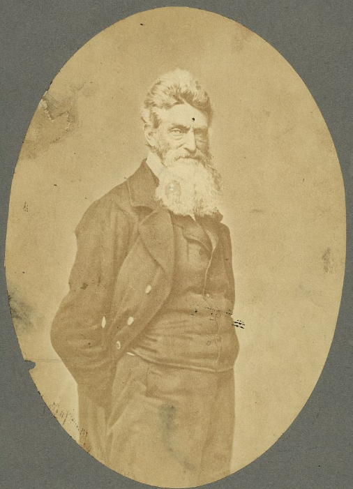
Near the area where the Potomac and Shenandoah rivers meet, a group of nineteen men, led by Captain John Brown, invaded the arsenal at Harpers Ferry. The group then took several of the residents of the surrounding neighborhood as prisoners, while emancipating several slaves, and held off United States troops, under the command of Colonel Robert E. Lee, for almost 30 hours, before finally being captured, wounded, or killed. Captain John Brown was captured, tried, convicted, and executed for high treason and inciting slaves to insurrection. While this endeavor appears to have been a failure, the actions of the Captain and the men who accompanied him helped to launch the United States into the Civil War.
Captain John Brown
Photo by S. Resendez
Because Harpers Ferry was chosen by George Washington to be the location of the 2nd national armory in the US at that time, Harpers Ferry was a prime spot for a faction to seize control. Between 1861 and 1865, the town of Harpers Ferry changed hands eight times. Strategically located at the confluence of two rivers and two railway lines, the arsenal at Harpers Ferry and its strategic location made it a hotbed of invasion and occupation that continued throughout the Civil War. In October of 1867, after the Civil War, Storer College was founded. It became the first higher education institution in West Virginia open to African Americans.
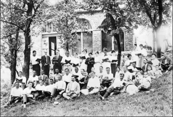
From 1909-1968, John Brown Fort stood on the site of Storer College on Camp Hill in Harpers Ferry. In this circa 1915 photograph, Storer College students, faculty members, and their families pose in front of the fort during an evening choral session. Year: 1915. Image Credit: Historic Photo Collection, Harpers Ferry NHP.
African American families continue to maintain their deep connections to the area in and around Harpers Ferry and today, more than 250 years after the first family settled the area, Jefferson County still boasts the longest established African American community in the state of Virginia.
In 1944, Harpers Ferry National Monument was authorized by Congress and in 1963, the park was renamed Harpers Ferry National Historical Park. Today, Harpers Ferry is not only a significant historical site, it also boasts a wide and varied ecosystem that encompasses a deciduous forest, flood plains, mountains, rivers, streams, wetlands, marshes, and swamps. “The park is home to approximately 14 amphibian,18 reptile, 36 mammal, 30 spider, 43 fish, 174 bird, and 276 insect species.”
Harpers Ferry National Historical Park is open year round with the exception of Thanksgiving Day, December 25, and January 1. The Visitor Center is located at 171 Shoreline Drive, Harpers Ferry, WV 25425 and is open daily from 9a to 5p. Shuttle buses run every day the park is open, every 10-15 minutes. Park museums/exhibits and restrooms in the historic Lower Town are open daily from 9 a to 5 p. Hours change seasonally so make sure you visit the website or call for the most up to date information.
Accessibility: The park has two wheelchairs available that may be borrowed by visitors upon request. The park’s shuttle buses are equipped for those with physical limitations. The buses kneel and have lifts to accommodate those who are unable to utilize the stairs. For more details on accessibility for physical, hearing loss, low vision/blindness, please check the website.
MILE MARKER: Harpers Ferry is an anchor point on the Lewis & Clark National Historical Trail. It served as the starting point for the Corps of Discovery’s journey westward on the Lewis & Clark Expedition in 1803.
HIKE IT!: There are several trails with varying levels of length and difficulty ranging from 1 mile to 6.5 miles long. Be sure to check out the hiking page of the Harpers Ferry NPS website for detailed information on the hikes and the Appalachian Trail!
Loudoun Heights Trail in the fall
Photo courtesy NPS / Volunteer Devin Taggart
We’re covering new ground today as this is our first time exploring an NPS National Historic Trail. Based on the NPS definition of what denotes a National Historic Trail, we learn that a National Historic Trail is a “long-distance route that follows and commemorates a historic path of travel that changed the history and character of the U.S.” Today these routes offer opportunities to visit surviving sites, trail segments, and defining places of history as we learn about the diverse stories they tell. According to the NPS site, there are currently 19 trails that range from 16 miles long to a little over 5,000 miles long. For more information about all the trails, click on the link here.
Map courtesy of NPS
Beginning in Mexico City and winding its way through Texas and up into Louisiana, the Camino Real de Los Tejas covers approximately 2,600 miles. This isn’t a “hikeable” trail by definition, rather it should be considered as a chance to follow the historical footsteps of the people who traveled across countries and through inhospitable lands to begin settling the areas we now recognize as Texas and Louisiana.
Spanish Missions in Texas
Photo by M. Gonzalez
Because we’re writing this from our home base in San Antonio, it’s easy to talk about where the trail leads us from here, but before it got to San Antonio, the trail meandered up from Coahuila, Mexico, near the Rio Grande, to Laredo, Texas, in and around Goliad, Texas (where the Camino Real de Los Tejas museum is located), and up through Victoria and Cuero. From here, the trail veers back towards San Antonio, or continues on to Bryan, Texas. There are also documented starting points, once the border was crossed, in Eagle Pass up to San Antonio. From San Antonio, the road continued on through New Braunfels (which later became a German settlement), up to San Marcos, to Austin or towards Bastrop (home of the Lost Piney Woods). From there, the branches seemed to gather near Crockett and continue on towards Nacogdoches and on towards Louisiana. The Camino Real de Los Tejas split or combined according to the seasons. If the weather affected the planned route, the way could be rerouted to avoid flooded areas or other hazards along the way.
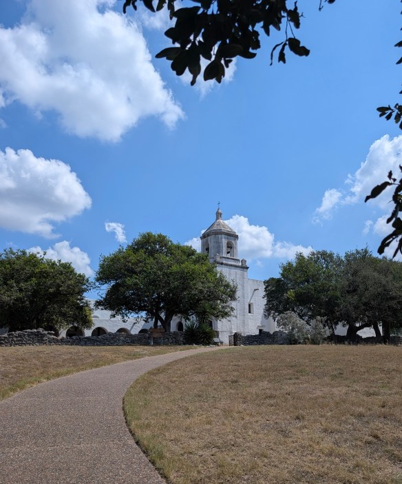
There are several missions along this corridor, some missions having been moved from other areas closer to the Gulf of Mexico, and rebuilt to follow the San Antonio River, going east towards Louisiana or west towards California. In this part of Texas, the most famous missions in and around this area are, arguably, the San Antonio Missions National Historical Park, a UNESCO World Heritage site. However, other missions pepper the way along the Camino Real, such as Mission Nuestra Señora del Espíritu Santo de Zúñiga in Goliad State Park.
Mission Nuestra Señora del Espíritu Santo de Zúñiga
Photo by M. Gonzalez
This amazing spot along the Camino Real showcases the work of the CCC (Civilian Conservation Corp) which was instrumental in building, conserving, and restoring a variety of buildings in and around Texas. While Mission Espiritu Santo was established in the mid-1700’s, it was the fourth mission with the same name and after several relocations, found its final home in the area known as La Bahía, which later became known as Goliad, Texas. As time passed and the mission was no longer needed, Franciscan Priests finally closed this mission in 1830.
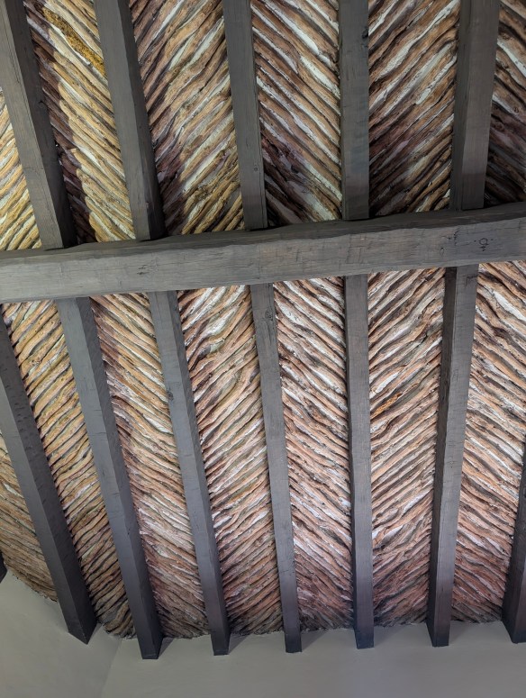
Between 1933-1942, the men of the CCC followed the plans to meticulously reconstruct the mission under the direction of a young architect by the name of Raiford Stripling. But before they would begin their project, they had to work on a “beginner” project in order to ensure that everyone understood the methods used to build the original mission in the 1700’s. In order to practice, they set about making a cottage for the park’s “superintendent to be”. In building this cottage, the men of the CCC could practice their brick making skills, along with learning to work with native materials, and making latilla ceilings (a traditional Southwestern design element consisting of peeled branches or small pieces of wood (latillas) laid between beams (vigas) to create a rustic, decorative ceiling). They learned how to hand carve large, ornate doors and forge iron hinges and once the cottage was finished, they understood what needed to be done to recreate the actual Mission de Espiritu Santo.
Latillas and Vigas
Photo by M. Gonzalez
The Mission Nuestra Señora del Espíritu Santo de Zúñiga is the highlight of Goliad State Park and rightfully so. This mission, reconstructed on top of the its original 1749 foundation and wall remnants, is a testament to architecture and history as we make our way along the Camino Real de Los Tejas on the way to Louisiana.
If you’re interested in learning more about the Royal Road or following in the path of long ago Spanish settlers, look here for a FREE downloadable checklist of places to visit along the Camino Real de Los Tejas.
But there’s more to Goliad, Texas than meets the eye! We’re not done with our stop here just yet because in the midst of traveling this royal road through history, we also find ourselves in the heat of the battle for Texas independence! We’re going to look at, and talk about, flags you might not have known even existed! Stay with the Two Chicks for more adventures in Goliad, Texas!
MILE MARKER: A staircase, carved from two logs, could be placed in tight spaces that might have otherwise only had room for a ladder. Known as “Escaleras de Madera” or Staircases of Wood, they were also sometimes referred to as “Witches Staircases” as folklore denotes the stairs were designed to prevent witches from climbing them.
Escalera de Madera
Photo by M. Gonzalez
HIKE IT!: There is a paved trail that runs through the park and connects the Presidio La Bahía to Goliad State Park and continues on towards downtown Goliad. Within the park, there is a trail that follows alongside the San Antonio River. It’s easy to park in the parking lot at the state park and walk the trail which is relatively flat and accessible. There are also hiking trails at the Medina Valley Natural Area. This area, just south of San Antonio, was part of the Camino Real de Los Tejas and there are some lovely trails to hike along the Medina River.
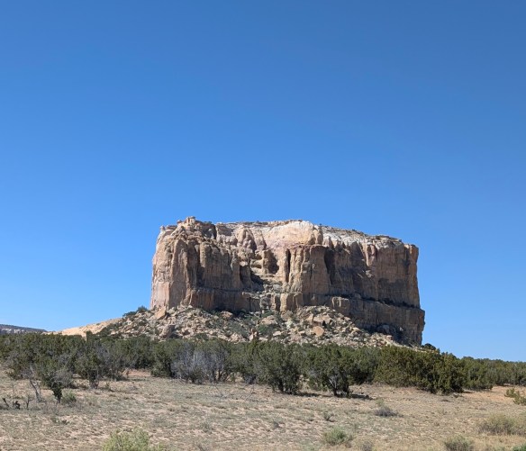
Deep in the high desert of New Mexico, there sits a 367 foot high, sandstone mesa known as Acoma Rock. This is home to Acoma Sky City Pueblo. The ancient Puebloan tribes began to inhabit this mesa, and the surrounding area, as far back as 1150 AD. It is believed that the Puebloans originally inhabited the desert area in and around the mesa until eventually, they found a way to get to the top of the mesa by building crude steps, including hand holds and toe holds, which allowed people to climb up the side of the mesa. Once there, they more than likely realized that its high, isolated location made it virtually impossible to penetrate.
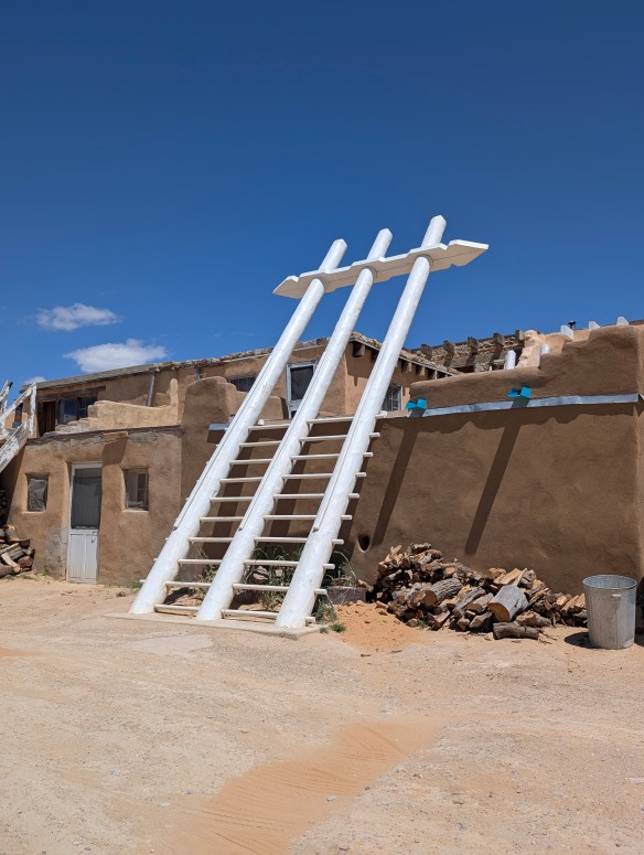
The ancient Puebloans were potters, artisans and architects. The pueblo was a village of roughly 500 three or four stories tall adobe houses. Dwellings were built on the mesa, not unlike those in Mesa Verde, except that the dwellings were not built into cliffs, but on them. People entered buildings via ladders placed through holes in the roof. If materials had to be brought up from the desert or surrounding area, people had to carry everything to construct the buildings up the cliffs on their backs.
Ladder to other worlds
Photo by M. Gonzalez
During the times when the Spanish began their explorations and making their presence known, the Acoma people were able to generally refrain from contact due to their location atop the mesa. When the Spaniards finally made their way to the top of the mesa where the dwellings were located, initial contact was friendly, but over time, as Spanish demands for food and supplies increased, tensions rose. The Acoma people retaliated and months later, the Spanish responded in force, killing over 1500 people. Many survivors were mutilated and forced into slavery and eventually surrendered the pueblo to the Spanish. This lead to the rebuilding of the pueblo under Spanish rule.
San Estévan del Rey Mission Church of Acoma
Photo by M. Gonzalez
Missionaries began their efforts to convert the people to Catholicism and to force them to give up their way of life. The Mission San Estevan del Rey church was built on the mesa in an effort to move the religious agenda forward. The church itself is an amazing structure, especially when you see it for what it is…a place where the people of Acoma could create a flux between Catholicism and their own culture. This is how the church is utilized today. The ceremonies of the people of Acoma are practiced inside the church and the church stands as a testament to the tenacity of the Acoma people and their culture. It is a large, beautiful building consisting of materials that had to be carried up the cliffs on the backs of the enslaved people forced to build it. The roof is held in place by 40-foot long Ponderosa pine vigas, or roof beams, originally hewn in the San Mateo Mountains, 30 miles away. The vigas were carried in by the enslaved people and were not allowed to touch the ground throughout the journey back to the mesa. There is a simple cemetery in front of the church and all the earth used to create that cemetery also had to be brought up the side of the mesa.
Acoma Pueblo
Photo by M. Gonzalez
Acoma was designated a National Historic Landmark in 1960. In 1970, it was placed on the National Register of Historic Places and in 2007, the San Estévan del Rey Mission Church was designated a National Trust Historic Site. It is the only Native American site with that designation. The pueblo consists of approximately 250 dwellings that have held to tradition and currently have no electricity, sewer, or running water. The pueblo is largely uninhabited but there are some families who choose to live there year round. The pueblo is usually filled to capacity during feasts, dances, and community gatherings.
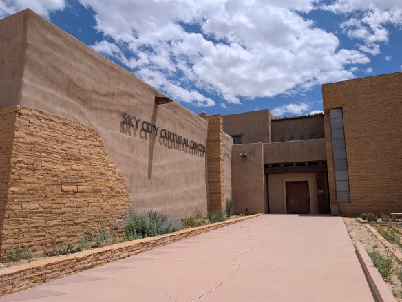
Cultural Center
Photo by M. Gonzalez
Sky City Cultural Center is located approximately 50 miles west on I-40, then another 12 miles on State Route 23. Signs are easily visible once you exit the interstate. The cultural center is open Monday and Tuesday 9am- 4pm and Wednesday- Sunday 9am- 5pm. Monday & Tuesday tour times are 10:30am, 12:30pm, and 2:30pm. Wednesday- Sunday tours start every hour starting at 9:30am to 3:30pm. There are annual closures, and sometimes there are unannounced cultural events that require closure. Weather issues may affect tour times. You can check the website for more details or all 800-747-0181 between 9am to 5pm for specific questions prior to your visit. The price for a tour is approximately $30 at the time of this posting so it may have changed depending on when you’re reading this post. Entry fee includes your photo permit. Your photo permit allows you to take pictures of the pueblo except for inside the Church, within the cemetery courtyard, and during feast days. Permission must be obtained prior to photographing tribal members or their artwork.
Use of tripods, GoPros, video cameras, digital video cameras, binoculars and audio recording devices is prohibited. Commercial use of a photograph depicting Acoma imagery for personal gain (profit) is prohibited. For more information on guidelines, click here.
MILE MARKER: “Acoma is on the Zuni-Acoma Trail, an ancient footpath connecting the old Zuni and Acoma Pueblos. Once used by both native peoples and Spanish explorers, the seven and a half mile-long trail is enjoyed by hikers through New Mexico’s beautiful lava beds. The Zuni-Acoma Trail is part of the El Malpais National Monument, which the National Park Service manages.”~Information courtesy of NPS
Hiking down the mesa
Photo by M. Gonzalez
HIKE IT!: There aren’t any specific trails on the mesa itself, but the guided tour takes about an hour and a half and I logged about one and half miles by the time the tour was finished. If you want to add a bit more adventure to your day, you will be given the option, towards the end of the tour, to take the steps down the side of the cliff and walk back to the Cultural Center. If you’re going there in the summer, be prepared for intense heat. Water and restrooms are only available at the visitor center so bring a hat, wear some sunscreen, and bring some water. Walking sticks help because the terrain in the pueblo is uneven.
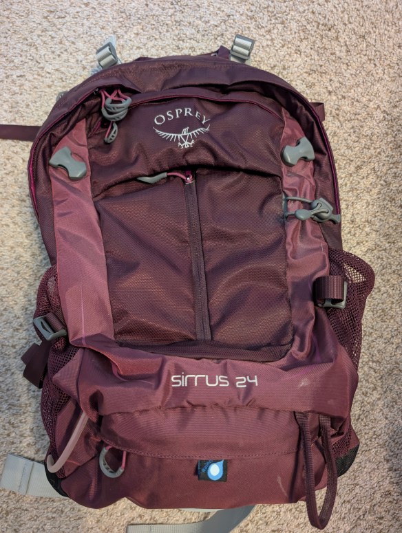
Join us this week for a quick look at different types of bags you can use for different hiking situations. And while you’re planning your hike, don’t forget to visit our Hiking Information page for our FREE downloadable hiking checklists!
We’re not going to recommend any particular style or brand, we just want you to know about some of the options available to you as you consider your next hike. How long will you be hiking? Will the weather be hot or rainy? Will you be hiking into a particular destination or are you just planning to meander? Will you be in the middle of nowhere or will you be close to places where you can purchase extra water or snacks?
Once you consider all these things, then consider what king of bag you may need to hold all your gear. Do you just need something for your water, your snack bar, and your chapstick? Do you need to pack a rain jacket, a puffy jacket, food, and water? Do you just need water and a small first aid kit? This episode will help you choose the right bag for the right hike.
**QUICK UPDATE for all who were asking. If you’re looking for a t-shirt, you pick the design then Zazzle allows you to choose your t-shirt style, quality, size, and fit. So you basically pick the fit, size, and material quality. If you have any other questions, there is a way to leave messages on Zazzle or you can always drop a comment here. Thanks!**
We really appreciate your support over these last few months. We’ve had comments from several of you asking about merchandise and we heard you!
The Two Chicks with Hiking Sticks storefront is now open and we’d love it if you would consider supporting our endeavor to inform and educate about our cultural, historical, and natural world by buying a t-shirt or sticker or pin to help spread the word.
If you see something you like on the storefront but would like it more personalized, send a direct message and we’ll do our best to accommodate your request! Thank you!
We recently took you to a place called Big Thicket National Preserve that highlighted a wealth of biodiversity in Texas. Today, we’re going to talk about another place that also encompasses a diverse sample of nature that will take you underground into caves, through the desert, hiking through pine trees, into mountains, and traversing through the stars! Today, we’ll be talking about Great Basin National Park in Nevada!
The first people documented living in the Great Basin area were what archeologists call the Paleo-Indians. For over 12,000 years, these people were thought to be big game hunters with no permanent houses because they were nomadic and followed the animal herds. The next group to occupy this area were referred to as the Great Basin Desert Archaic. This group were hunter-gatherers who also followed animal herds but collected native plants but also learned how to use grinding stones to process seeds. They used their crafts to trade with other peoples.
These groups eventually led to the Fremont and Shoshone cultures, with the Shoshone still living in the area today. In addition to the Shoshone, the Ute, the Paiute, the Goshute, and the Washoe also inhabited this region. Small family groups hunted and subsisted on the land and its natural resources. The people were early hunters and gatherers who eventually learned to farm and fish. Everything they needed to survive and thrive was available to them in the Great Basin.
Photo by S. Resendez
Trappers, miners, and military expeditions found their way to Great Basin area in the mid-1800’s. Immigrants may have passed through the area as they made their way to California for the gold rush. Ranching was established soon after the gold migration. Mining expeditions also discovered gold and silver which resulted in mining operations inside the Great Basin and just outside the region. Ranching was established in the late 1800’s and continues today.
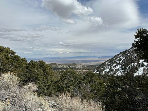
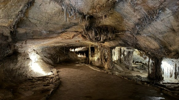
There are many things to do at Great Basin National Park. The ecosystem is diverse and plays host to 11 species of conifer trees, 73 species of mammals, 18 species of reptiles, 238 species of birds, 8 species of fish, and over 800 species of plants. The biodiversity ranges from desert valleys, mountain ranges, caves, a forest, an alpine environment, and even a glacier. And, if that weren’t enough, in 2016, Great Basin National Park was recognized as a a Gold Tier International Dark Sky Park by the International Dark Sky Association. This means the skies over Great Basin are some of the most pristine and clear night skies in the U.S. On a moonless, summer night, if the sky is clear, you may be able to see not just stars, but planets, satellites, meteors, the Milky Way, and the Andromeda Galaxy, all with the naked eye! Don’t forget, there’s also Lehman’s Cave to explore, hiking, and fishing…this park warrants a multi-day visit!
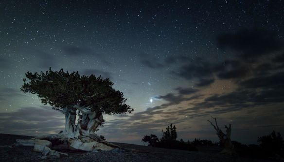
Mount Washington Bristlecone
Courtesy of NPS Great Basin National Park–Photo by Kelly Carroll
Accessibility: The park currently features two trails that are built to ADA standards and are accessible with a standard wheelchair. For information on all trails, go to their hiking page and for more specific information on ALL accessible areas in the park, go to the park’s accessibility page.
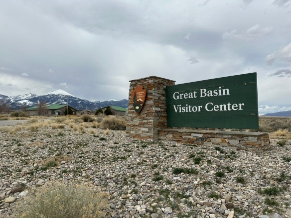
Great Basin National Park’s grounds are open 24 hours a day, year round to hiking, stargazing, and camping. The park’s Visitors Center is located just north of the town of Baker on the west side of NV Highway 487 and is open every day between the hours of 8a–5p. In the summer, the Great Basin Visitor Center is open daily. The Lehman Caves Visitors Center is located 5.5 miles up from the town of Baker, NV from 8a–5p. In the summer, Lehman Caves Visitor Center is open extended hours. Hours may change seasonally for both visitors centers, so make sure you check on their webpage before heading out. The Plan Your Visit page does a great job of letting you know what to expect during each season. It’s worth reading through it if you plan to visit outside of the summer months. Interested in stargazing and astronomy? The website’s Astronomy page highlights their ranger programs for all visitors and the associated rules.
Lehmans Cave–Photo by S. Resendez
MILE MARKER: Great Basin National Park has some of the most interesting, naturally occurring resources in the U.S. For example: Some of the bristleconepines here are over 4,000 years old. Also, there’s a hidden glacier here! Despite being in the Nevada desert, the park has a tiny glacier tucked into the shadow of Wheeler Peak, the southernmost glacier in the U.S.
HIKE IT!: There are numerous hiking trails in Great Basin. The hiking page on their website does a fantastic job of breaking down hikes by location and/or by ability. They also have a downloadable map site with all the trails topographical maps as well as advice about hiking in winter. It’s a great way to plan your hike and what you’ll need for it before you get out there.
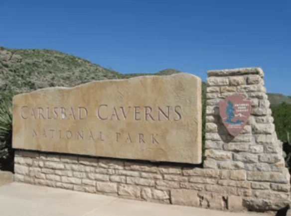
Carlsbad Caverns Entrance Sign
Photo courtesy of NPS
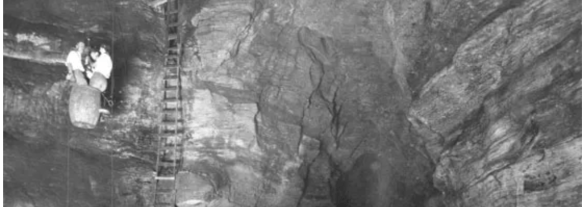
Imagine a time when, if you wanted to travel down into Carlsbad Caverns, instead of hiking or taking an elevator down, you had to load yourself up into a big, old, guano harvesting bucket and have people lower you down. Would you do it? At one time, lots of people did! People wanted to know what sort of world was beneath the surface of the earth. What lives down there? What does it look like? What is it like to be below the surface of the earth?!
Entering Carlsbad Caverns via guano mining bucket
Photo courtesy of NPS
There was enough intrigue and curiosity about these caverns that in October of 1923, President Calvin Coolidge put out a proclamation denoting Carlsbad Caverns a National Monument. What is interesting about that proclamation is that even while recognizing Carlsbad as something that needed to be preserved, its size and depth were still not fully known. The proclamation itself uses phrases like, “extraordinary proportions” and “vast chambers of unknown character and dimensions” and even notes that there was, at that time, one entrance but also included “such other entrances as may be found”. Despite the unknown aspect, everyone recognized that it was in our nation’s best interest to protect this cave. In May of 1930, Carlsbad Caverns was fully established as a National Park.
Since then, we have learned that Carlsbad Caverns encompasses over 300 limestone caves in what was discovered to be a fossil reef that was “laid down by by an inland sea about 265 million years ago”. Above ground, there were signs that the land in that area had been utilized by Indigenous people, probably Mescalero Apaches, as early as 1200-1400 years ago. Spanish explorers showed up in the mid-1500’s and laid claim to the area. Eventually, as the Spaniards left, settlers worked their way through the Guadalupe Mountains. As time passed, travelers stopped in and around the general area and began to build ranches and farms. In 1898, a 16 year old farmhand by the name of Jim White entered the cave for the first time. Jim White eventually became the main guide to reporters, photographers, geologists, and geographers who wanted to learn more about the caverns. After passing away at the age of 63, for his exploration, guide services, and promotion of sharing the caverns with the public, he was unofficially honored with the title of “Mr. Carlsbad Caverns”.
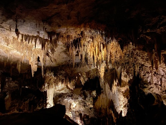
Stalactites and Stalagmites…they still confuse me.
Photo by S. Resendez
In 1925, the first trail into the cave was built, eliminating the need to be lowered in a guano bucket. In 1963, the bat flight amphitheater was built at the natural entrance and began allowing visitors to sit and watch the bats take flight.
Today, if you’d like to visit Carlsbad Caverns National Park, you will need to go to their official NPS website and look for information on how to make a timed reservation or call 877-444-6777. In addition to making your timed reservation, expect to pay your entrance fee and to bring your ID along with your timed pass when it’s time for your visit. Cavern entrance hours are from 9:30a to 2:30p with the last reservation time being 2:15p.
Bat Flight Amphitheater
Photo courtesy Carlsbad Caverns NPS / Peter Jones
If you’re only interested in watching the bat flight, you won’t need a reservation and there is no fee but seating at the amphitheater is first come, first serve, so get there early if you want to make sure you’ll have a place to sit. The bat flight program is held every evening from April through October. Bat flight takes place at the Bat Flight Amphitheater, which is located at the Natural Entrance to Carlsbad Cavern. The start time for the program changes as the summer progresses and sunset times change so make sure you check on the website before you head out. Bat flight programs may also be canceled due to inclimate weather, so again, check ahead of your visit! **Insider Tip** The best bat viewing months are August and September when baby bats born earlier in the summer begin flying with the colony. Also, migrating bats from colonies further north often join in the flights. Are you a morning person? Early risers (approx. 4-6 a.m.) can watch for the bats as they re-enter the cavern! Bat entrances often come with spectacular dives from heights of hundreds of feet. Remember: To protect the bats, electronic devices are not allowed at the Bat Flight Program and surrounding area. Electronic devices include cameras of any kind, laptop computers, cell phones, iPads, iPods, tablets, and MP3 players.
Bat Flight from inside Natural Entrance
Photo courtesy of Carlsbad Caverns NPS / Peter Jones
If you’ve never been to Carlsbad Caverns, the NPS website offers a webpage designed for first time visitors. Make sure you visit it for more detailed information about what to expect for your visit to the cave. Visitor hours are from 9a to 5p. Cave hours are from 9:30a to 2:30p. The last elevator coming OUT of the cavern is at 4:45p. If you decide you’d prefer to hike out, you must begin by 2:30 pm and plan to completeyour hike out by 3:30 pm.
Accessibility: The Natural Entrance Trail is not Americans with Disabilities Act (ADA) compliant due to its steep grade (15%–20%) and therefore not accessible with wheelchairs; however, the Big Room Trail is accessible by elevator once you enter the underground rest area. This is a “one mile trail that is wet from dripping water and can be slippery, bumpy, uneven, and difficult to navigate. It is not Americans with Disabilities Act approved and should only be attempted with assistance. Maps defining the wheelchair accessible areas can be obtained in the visitor center. Due to steep grades and narrowness of the trail, barriers, and signs have been installed to note the portions that are inaccessible in a wheelchair.” There is an accessibility guide brochure available at the Visitor Center with more detailed information.
MILE MARKER: Did you know that Carlsbad Caverns was part of an ancient fossilized reef in a long-gone inland sea?! Instead of fish, coral, and sea sponges, you now have towering stalagmites, stalactites, and weird cave formations made from limestone that was once alive with marine life. You’re literally walking through the skeleton of a prehistoric ocean!!
HIKE IT!: If you decide to venture into the caverns and choose to walk down using the Big Room route instead of taking the elevator, you will have hike approximately 1.25 miles. The walk is relatively flat and will take you approximately 1.5 hours to (average) to walk. There is a shorter route available which is about .6 mile and will take approximately 45 minutes (average) to complete. Only clear water is allowed in the cavern. Also, hiking sticks are not allowed unless medically necessary. If you’re interested in a surface hike, there are trails in and around the area. Check here for back country trail information prior to making your plans as some of these trails have been subject to repair and renovation after a flood in 2022.
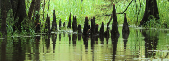
Cypress Knees National Park Service, Big Thicket National Preserve, Photo by Scott Sharaga
Big Thicket National Preserve was established in October of 1974 and was the first of the National Preserves in the United States. Big Thicket encompasses an area of approximately 113,000 acres and works its way through several counties and at least 6 waterways.
The Big Thicket is located near Beaumont, Texas and is considered part of the Piney Woods of East Texas. With a diverse range of plants and animals, it is often referred to as “America’s Ark” for its mind-blowing biodiversity. The Big Thicket serves as host for over 1,300 plant species, including 4 types of carnivorous plants! There are alligators, bobcats, armadillos, and over 300 bird species. As a matter of fact, Big Thicket is very popular during the bird migratory season. Swamps, pine forests, and sandhills comprise multiple ecosystems in one park. There are rare orchids and pitcher plants thriving in its boggy areas and 40 miles of hiking trails through diverse habitats across 9 diverse ecosystems.
Pine Savannah National Park Service, Big Thicket National Preserve, Photo by Scott Sharaga
Here are the nine distinct ecological systems within the Big Thicket:
Pine Forests–Includes the longleaf pine and loblolly pine. Often maintained by controlled burns to mimic natural wildfires.
Hardwood Forests–Includes oak, hickory, sweetgum, and beech trees. Great for birdwatching and spotting woodland wildlife.
Swamps–Saturated lowlands with bald cypress and water tupelo. Many of these support hanging mosses and aquatic plants.
Baygalls–Waterlogged areas fed by groundwater, often at the base of slopes. Characterized by sweetbay, blackgum, and magnolia trees. This system houses rare amphibians, orchids, and carnivorous plants.
Sandhills–Dry, sandy ridges with scrub oaks and grasses.
Savannahs–These are open grassy areas dotted with scattered trees and maintained by fire. This area serves as home to pitcher plants and wildflowers. It also serves as a transitional zone between the forest and prairie.
Floodplains and Bottom Lands–Found along the Neches River and other waterways.
Bogs–Acidic wetlands with peaty soils. This area is famous for its carnivorous plants: pitcher plants, sundews, and bladderworts.
Riparian Corridors–Edges of streams and creeks, vital for aquatic and semi-aquatic species.
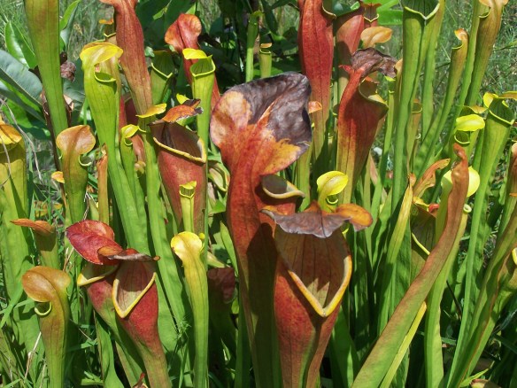
Pitcher Plants
National Park Service, Big Thicket National Preserve, Photo by Chuck Hunt
As you can see, there is something for every type of hiker in the Big Thicket!
The Big Thicket Visitor Center is open 9:00 am to 5:00 pm, central time, 7 days a week. It is closed on Thanksgiving, December 25, and January 1. The roads, trails, and waterways of the preserve are open 24 hours. To spend a night in the preserve, you’ll need a free backcountry camping permit from the visitor center. Are you a hunter or trapper? Remember, Big Thicket’s hunting season runs from early October to the end of February. Hog trapping season runs from early February until the start of hunting season in October. Permits for hunting and trapping are available at the visitor center.
Big Thicket offers opportunities for camping, hiking, swimming, hunting, trapping, fishing, and paddling! Make sure you check in with the Visitor’s Center for the latest information on the preserve and any updates you may need to know before you head out.
Rainbow SwampNational Park Service, Big Thicket National Preserve, Photo by Scott Shiraga
Accessibility: The Visitor Center is wheelchair accessible as are bookstore, exhibits, and theater. The park film is open-captioned and audio described. Assistive Listening Devices (ALDs) are available at the front desk. For people with sensory issues, sensory kits are also available at the front desk. Also, Sundew Trail Inner Loop and the Pitcher Plant Trail are wheelchair accessible, as well as picnic tables and restrooms within the preserve.
MILE MARKER: Big Thicket was the first U.S. national preserve created specifically to protect a biological (not scenic or geological) resource.
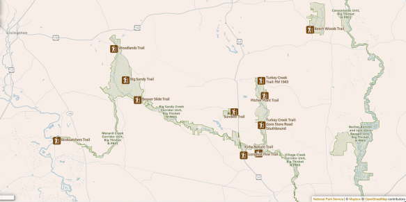
HIKE IT!: Big Thicket National Preserve has over 30 miles of hiking trails. From short loops to long backcountry trails, hiking is one of the best ways to explore the preserve. And if you’re really interested in getting to know Big Thicket, check out our FREE downloadable Big Thicket Ecosystem Scavenger Hunt! checklist. This checklist can help you make your way through all the ecosystems and guide you on what to look for in each area.
Big Thicket Trails Map
Courtesy of National Park Service
Got questions? We might have some answers!! Tune in for a short chat about questions or comments some of you have mentioned either on our Facebook Page, YouTube, or Instagram.
This episode, we’ll be discussing…
What’s the difference between walking and hiking?
What is your favorite small park?
Would we ever consider doing guided hikes?
What’s the difference between an NPS Park Store and an affiliate store?
Can you take things from National Parks?
Who decided gold was the standard of wealth back in the gold rush days?
If you have any other questions or comments, feel free to write them below. If you let us know, we’ll hand out some more trail mix in a future podcast. Thanks for listening!