“Flint, Frontier, and Falls: Pedernales State Park Through Time”

Photo by S. Resendez

There are signs that approximately 10,000-12,000 years ago, in the area we now recognize as the central Texas hill country, the Paleoindian people were utilizing the natural resources of the area to create tools for hunting megafauna such as bison and wooly mammoth. The grasslands of central Texas were the perfect environment for these animals. Add abundant water and flint, or as the Spaniards called it, pedernal, used to create those tools for hunting, and we can see why the area was such a draw for the indigenous people.

Fast forward to the 16th century, Spanish explorers and missionaries are making their foray inland towards central Texas. Lipan Apache are roaming the area and the Franciscans in charge of the missions in San Antonio are suggesting that a mission may need to be built in this part of Texas, as well. While that suggestion never comes to fruition, the influence of the Spaniards is cemented on the land. While in the area, the Spanish explorers begin to refer to the flowing water as the Pedernales River, due to the abundant amount of flint, or pedernal, in the riverbed.

After Texas became a state in 1845, small farming communities began to develop. and in the late 1800’s, the area in and around Pedernales Falls grew, but by the 1930’s, that same area began a decline. Lack of population growth, a depressed economy, and drought, probably helped to diminish and keep the local citizens to the bare minimum. The surrounding land was used for grazing until the original owner sold the land to Charles (C.A.) and Harriet Wheatley.

Photo by S. Resendez

The Wheatley’s named their new ranch, the Circle Bar Ranch and began improvement projects. They built a road that connected their ranch to the nearest county road and began building their home. They brought in purebred Hereford cattle and eventually, steer and goats. Although the Wheatley’s enjoyed hunting, they strongly believed that natural resources should be preserved and protected for the enjoyment of future generations. The Wheatley’s were prolific conservationists. Charles Wheatley helped to organize the National Wildlife Management Institute and was one of the founders of the Texas Fish and Game Commission. He was a friend of Governor Neff, who was responsible for creating the Texas State Parks system. Harriet Wheatley was also a lover of nature who enjoyed hunting and was active in the San Antonio Conservation Society, the Bexar County Girl Scouts, and the Blue Bird Auxiliary. She and Charles were both known to be expert fly fishermen and she even published a book entitled, Lady Angler: Fishing Hunting, and Camping in the Wilderness Areas of America.

© 2022 Larry D. Moore. Licensed under CC BY 4.0

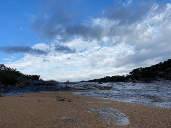
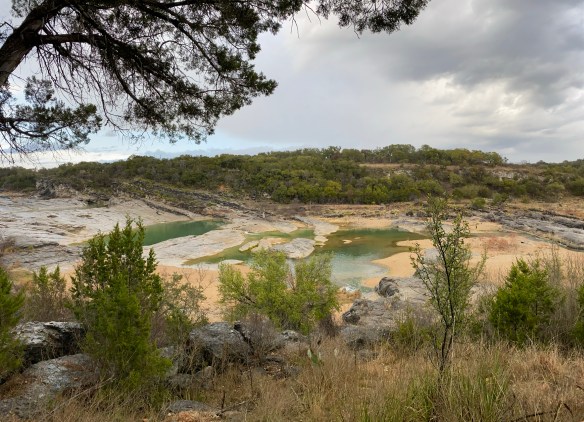
In 1969, Harriet Wheatley sold the ranch to the state of Texas with her wish that “that it be conserved, and all of the wildlife be taken care of, and that it be enjoyed from generation to generation.” The park officially opened in 1971 as Pedernales Falls State Park. The park’s terrain typifies the Edwards Plateau, with woodlands, cedar brakes, grasslands, and lush riparian zones lining the Pedernales River.

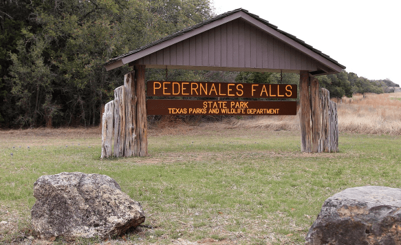
The Pedernales Falls State Park is located at 2585 Park Road 6026, Johnson City, TX 78636. The park is open daily open daily and the office is open 8 a.m. to 4:30 p.m. The park’s phone number is (512) 389-8900.

Accessibility: Call ahead for specific information regarding building accessibility. They do have an all-terrain wheelchair available for use in the park. Contact the park to reserve it for your visit.

MILE MARKER: Beneath the falls and limestone shelves, the riverbed preserves fossilized tracks of ancient creatures. If you look closely in certain areas, you can spot impressions of prehistoric marine life that lived here when the Hill Country was covered by a shallow sea more than 100 million years ago.

HIKE IT!: Ten trails, from easy to challenging, are available for hiking, biking, and horseback riding. Trails vary in length from half mile to ten miles mean there are trails for every type of hiker! For more detailed information about the types of trails, check out the hiking trails page on the Pedernales State Park website.

Photo by S. Resendez

West Texas Gems: Balmorhea and the Chihuahuan Desert Nature Center

There are signs that in around 1849, Mescalero Apache watered their horses at the Mescalero Springs. Later, Mexican farmers dug canals by hand to irrigate their crops, which they later sold to people who lived in Fort Davis. The farmers called these springs the San Solomon Springs. In 1927, the springs were dredged and a canal was built to better utilize the flow of the water. Records show that the springs around Balmorhea have been in use for almost 11,000 years.

San Solomon Springs Motor Courts
Photo by S. Resendez

In 1934, the State Board of Texas acquired approximately 46 acres around the San Solomon Springs. The Civilian Conservation Corp (CCC) arrived at the springs in July 1934 and began work on building what would later become Balmorhea State Park. The CCC created the 1.3 acre pool around the springs. They also built the concession building, the bath houses, and the motel court using native limestone and hand hewn adobe bricks.

Balmorhea Swimming Pool Photo by S. Resendez

The San Solomon Springs is the largest in a series of 6 springs located in the Chihuahuan desert. The Balmorhea State Park Swimming Pool is the world’s largest spring-fed pool and often referred to as the crown jewel of the Texas State Parks System. The springs originally emptied into what is known as a ciénga or desert wetland. Construction of the swimming pool, back in 1934, resulted in the destruction of the natural springs which were rebuilt and fashioned into two man-made ciéngas.

Ciénega Photo by M. Gonzalez

There is an overlook by the RV section of the park for visitors to look for wildlife like deer, javelina, squirrels, turtles, lizards and dragonflies, which also utilize the springs. San Solomon Springs also serves as a stop for resident and migratory birds and is home to several rare and endangered species of snails and fish. San Solomon Springs is the largest spring in the Balmorhea area, and the habitat at Balmorhea State Park is very important for the con­ser­vation of these species.

Balmorhea State Park is located at 9207 TX-17, Toyahvale, TX 79786. Daily entrance fee for adults is $7 and free for children 12 and under. Park hours are from 8a to 7:30p or sunset (whichever comes first) and office hours are from 8a-5p. They often reach capacity and highly recommend reservations for both camping and day use. You can reserve passes online or by calling the customer service center before you visit. Check the park’s Facebook page for updates. Read their FAQ page for more detailed information about park and pool rules. Make sure you plan your visit before going!

Chihuahuan Desert Nature Center Entrance
Photo by S. Resendez

About 41 miles south and just outside of Fort Davis, Texas, sits the Chihuahuan Desert Nature Center. The Chihuahuan Desert Research Institute (CDRI) is a nonprofit organization that was established in 1973 and housed in Alpine, Texas. Its principal founders were science professors at Sul Ross State University, a university that the institute continues to work closely with today. Today, the CDRI is the Chihuahuan Desert Nature Center and is located on 507 acres in the foothills of the Davis Mountains.

Susan intently studying the locations of the mines! Photo by M. Gonzalez

The Nature Center is open year round. If you’re interested in exhibits about geology, history, and culture of the Chihuahuan desert, there is a mining exhibit detailing desert mining and the geological changes that have occurred in the Trans-Pecos of Texas over the last 2 billion years! A bird blind is available for birders, and there’s a cactus museum which houses over 200 species, sub-species, and varieties of cacti and succulents.

If you don’t feel like hiking, there are botanical gardens which encompass a wildscape garden, a self-guided stroll through a Trans Pecos Natives garden, a pollinator garden trail, and a native grasses exhibit.

Check the website for Chihuahuan Desert Nature Center before heading out. The Center is located off of Hwy 118, 4 miles SE of Fort Davis at 43869 St. Hwy. 118, Their hours are Monday-Saturday, 9a-5p.

MILE MARKER: Would you believe that cactus can be found as far north as Canada?! Some species have evolved to withstand cold temperatures and dry conditions. Southern prairies and certain regions by the Great Lakes, provide habitats with enough sun, well-drained soil, and suitable temperatures for cacti to thrive.

HIKE IT!: There are lots of great hiking trails at the Chihuahuan Desert Nature Center. There are 5 trails ranging from .25 mile (scenic loop inside the botanical garden) to a 2.5 mile loop, which is considered a strenuous hike. Remember, you are hiking at an elevation of approximately 5,000 feet! Consider the weather and your own physical abilities. While the trails are mostly earthen, they may be uneven so take your hiking sticks, sunscreen, a good hat to cover your head and face, and plenty of water. After all, you’re desert hiking!

Trail Map for CDNC Photo courtesy of Chihuahuan Desert Nature Center